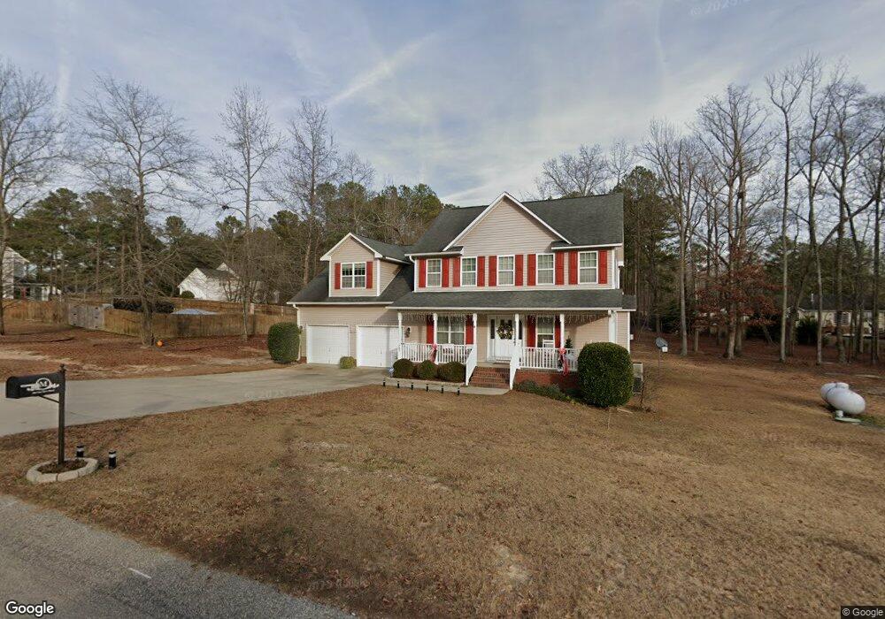
285 Fair Barn Rd Sanford, NC 27332
Estimated Value: $375,000 - $405,000
4
Beds
3
Baths
2,876
Sq Ft
$137/Sq Ft
Est. Value
About This Home
This home is located at 285 Fair Barn Rd, Sanford, NC 27332 and is currently estimated at $392,933, approximately $136 per square foot. 285 Fair Barn Rd is a home located in Harnett County with nearby schools including Benhaven Elementary School, Highland Middle School, and Western Harnett High School.
Ownership History
Date
Name
Owned For
Owner Type
Purchase Details
Closed on
May 7, 2009
Sold by
New Century Homes Llc
Bought by
Mashburn James A and Mashburn Rita G
Current Estimated Value
Home Financials for this Owner
Home Financials are based on the most recent Mortgage that was taken out on this home.
Original Mortgage
$247,100
Outstanding Balance
$156,207
Interest Rate
4.86%
Mortgage Type
VA
Estimated Equity
$236,726
Create a Home Valuation Report for This Property
The Home Valuation Report is an in-depth analysis detailing your home's value as well as a comparison with similar homes in the area
Home Values in the Area
Average Home Value in this Area
Purchase History
| Date | Buyer | Sale Price | Title Company |
|---|---|---|---|
| Mashburn James A | $242,000 | -- |
Source: Public Records
Mortgage History
| Date | Status | Borrower | Loan Amount |
|---|---|---|---|
| Open | Mashburn James A | $247,100 |
Source: Public Records
Tax History Compared to Growth
Tax History
| Year | Tax Paid | Tax Assessment Tax Assessment Total Assessment is a certain percentage of the fair market value that is determined by local assessors to be the total taxable value of land and additions on the property. | Land | Improvement |
|---|---|---|---|---|
| 2025 | $2,373 | $321,734 | $0 | $0 |
| 2024 | $2,373 | $321,734 | $0 | $0 |
| 2023 | $2,373 | $321,734 | $0 | $0 |
| 2022 | $2,106 | $321,734 | $0 | $0 |
| 2021 | $2,106 | $234,970 | $0 | $0 |
| 2020 | $2,082 | $234,970 | $0 | $0 |
| 2019 | $2,067 | $234,970 | $0 | $0 |
| 2018 | $2,044 | $234,970 | $0 | $0 |
| 2017 | $2,044 | $234,970 | $0 | $0 |
| 2016 | $2,117 | $243,630 | $0 | $0 |
| 2015 | $2,117 | $243,630 | $0 | $0 |
| 2014 | $2,117 | $243,630 | $0 | $0 |
Source: Public Records
Map
Nearby Homes
- 92 Carter Dr
- 24 Carter Dr
- 2846 Barbecue Church Rd
- 655 Bullard Rd
- 667 Bullard Rd
- 691 Bullard Rd
- 711 Bullard Rd
- 731 Bullard Rd
- 113 Rocking Horse Ln
- 48 Appleton Way
- 41 Andrea Ct
- 56 Briarwood Place
- 2 Christopher Dr
- 739 Nicole Dr
- 115 Gates Way
- 164 Gray Pine Way
- 104 Gates Way
- The Landen Plan at Briarwood Bluff
- The Coleman Plan at Briarwood Bluff
- The Telfair Plan at Briarwood Bluff
- 255 Fair Barn Rd
- 255 Fair Barn (L62) Rd
- 316 Fair Barn (L64) Rd
- 282 Fair Barn (L65) Rd
- 282 Fair Barn Rd
- 266 Fair Barn Rd
- 316 Fair Barn Rd
- 27 Wellstone Dr
- 205 Fair Barn Rd
- 1115 Hoover Rd
- 1149 Hoover Rd
- 47 Wellstone (L60) Dr
- 242 Fair Barn Rd
- 1199 Hoover Rd
- 200 Fair Barn Rd
- 1160 Hoover Rd
- 54 Wellstone Dr
- 54 Wellstone (L81) Dr
- 158 Fair Barn Rd
- 1015 Hoover Rd
