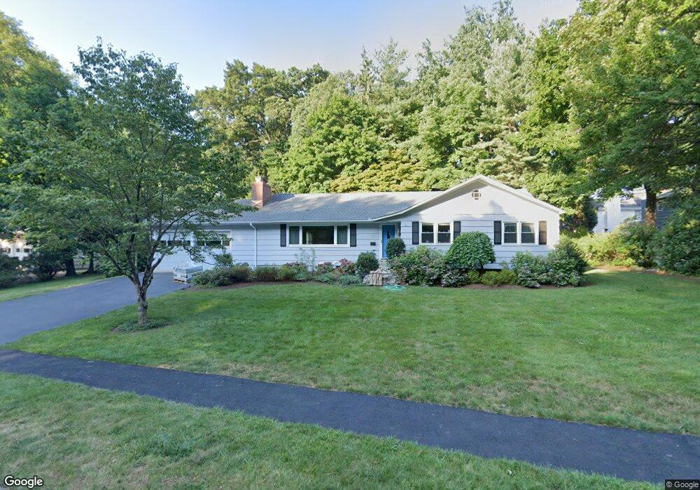
285 Melville Ave Fairfield, CT 06825
Tunxis Hill NeighborhoodEstimated Value: $763,339 - $1,027,000
3
Beds
3
Baths
2,052
Sq Ft
$446/Sq Ft
Est. Value
About This Home
This home is located at 285 Melville Ave, Fairfield, CT 06825 and is currently estimated at $914,835, approximately $445 per square foot. 285 Melville Ave is a home located in Fairfield County with nearby schools including Mckinley Elementary School, Tomlinson Middle School, and Fairfield Warde High School.
Ownership History
Date
Name
Owned For
Owner Type
Purchase Details
Closed on
Jul 5, 2001
Sold by
Mcguirk John and Mcguirk Ann M
Bought by
Nigro Rosemary A
Current Estimated Value
Home Financials for this Owner
Home Financials are based on the most recent Mortgage that was taken out on this home.
Original Mortgage
$275,000
Interest Rate
7.21%
Create a Home Valuation Report for This Property
The Home Valuation Report is an in-depth analysis detailing your home's value as well as a comparison with similar homes in the area
Home Values in the Area
Average Home Value in this Area
Purchase History
| Date | Buyer | Sale Price | Title Company |
|---|---|---|---|
| Nigro Rosemary A | $412,900 | -- | |
| Nigro Rosemary A | $412,900 | -- |
Source: Public Records
Mortgage History
| Date | Status | Borrower | Loan Amount |
|---|---|---|---|
| Open | Nigro Rosemary A | $265,000 | |
| Closed | Nigro Rosemary A | $277,000 | |
| Closed | Nigro Rosemary A | $275,000 |
Source: Public Records
Tax History Compared to Growth
Tax History
| Year | Tax Paid | Tax Assessment Tax Assessment Total Assessment is a certain percentage of the fair market value that is determined by local assessors to be the total taxable value of land and additions on the property. | Land | Improvement |
|---|---|---|---|---|
| 2025 | $9,489 | $334,250 | $226,940 | $107,310 |
| 2024 | $9,326 | $334,250 | $226,940 | $107,310 |
| 2023 | $9,195 | $334,250 | $226,940 | $107,310 |
| 2022 | $9,105 | $334,250 | $226,940 | $107,310 |
| 2021 | $11,629 | $334,250 | $226,940 | $107,310 |
| 2020 | $11,629 | $293,020 | $189,210 | $103,810 |
| 2019 | $7,659 | $285,880 | $189,210 | $96,670 |
| 2018 | $11,232 | $285,880 | $189,210 | $96,670 |
| 2017 | $10,219 | $285,880 | $189,210 | $96,670 |
| 2016 | $7,276 | $285,880 | $189,210 | $96,670 |
| 2015 | $6,723 | $271,180 | $190,190 | $80,990 |
| 2014 | $6,617 | $271,180 | $190,190 | $80,990 |
Source: Public Records
Map
Nearby Homes
- 42 Fairway Green
- 90 White Oak Rd
- 279 Knapps Hwy
- 709 Tunxis Hill Rd
- 155 Moody Ave
- 183 Vesper St
- 197 Vesper St
- 376 Knapps Hwy
- 605 Brooklawn Ave
- 62 Soundview Ave
- 2660 North Ave Unit 217
- 101 Soundview Ave
- 80 Cartright St Unit 8J
- 80 Cartright St Unit 2F
- 80 Cartright St Unit GC
- 80 Cartright St Unit 8B
- 80 Cartright St Unit GFA
- 860 Briarwood Ave
- 2612 North Ave Unit E2
- 67 Campfield Dr