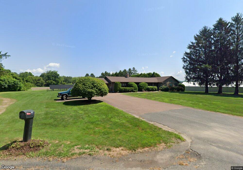
286 River Rd Sunderland, MA 01375
Estimated Value: $582,000 - $641,000
4
Beds
4
Baths
2,420
Sq Ft
$255/Sq Ft
Est. Value
About This Home
This home is located at 286 River Rd, Sunderland, MA 01375 and is currently estimated at $617,784, approximately $255 per square foot. 286 River Rd is a home located in Franklin County with nearby schools including Sunderland Elementary School and Frontier Regional School.
Create a Home Valuation Report for This Property
The Home Valuation Report is an in-depth analysis detailing your home's value as well as a comparison with similar homes in the area
Home Values in the Area
Average Home Value in this Area
Tax History Compared to Growth
Tax History
| Year | Tax Paid | Tax Assessment Tax Assessment Total Assessment is a certain percentage of the fair market value that is determined by local assessors to be the total taxable value of land and additions on the property. | Land | Improvement |
|---|---|---|---|---|
| 2025 | $62 | $476,700 | $142,500 | $334,200 |
| 2024 | $6,264 | $476,700 | $142,500 | $334,200 |
| 2023 | $5,743 | $448,700 | $129,300 | $319,400 |
| 2022 | $5,826 | $396,300 | $111,000 | $285,300 |
| 2021 | $5,504 | $355,300 | $102,700 | $252,600 |
| 2020 | $1,349 | $355,300 | $102,700 | $252,600 |
| 2019 | $91 | $342,700 | $99,700 | $243,000 |
| 2018 | $91 | $335,800 | $96,200 | $239,600 |
| 2017 | $88 | $331,200 | $96,200 | $235,000 |
| 2016 | $4,845 | $330,500 | $93,900 | $236,600 |
| 2015 | $4,687 | $327,500 | $90,900 | $236,600 |
| 2014 | $4,578 | $327,500 | $90,900 | $236,600 |
Source: Public Records
Map
Nearby Homes
- 146 Old Amherst Rd
- 110 Old Amherst Rd
- 15 S Plain Rd
- 3 Depot Rd
- Lot C Mountain Rd
- Lot A Mountain Rd
- Lot B Mountain Rd
- 238 N Main St
- 15 Crestview Dr
- 32 Swamp Rd
- 40 Eastern Ave
- 24 Graves St
- 0 North St Unit 73407299
- 24 Elm St
- 320 West St
- 134 Montague Rd
- 13 Capt Lathrop Dr
- 7 Roosevelt St
- 73 Depot Rd
- 151 Pantry Rd