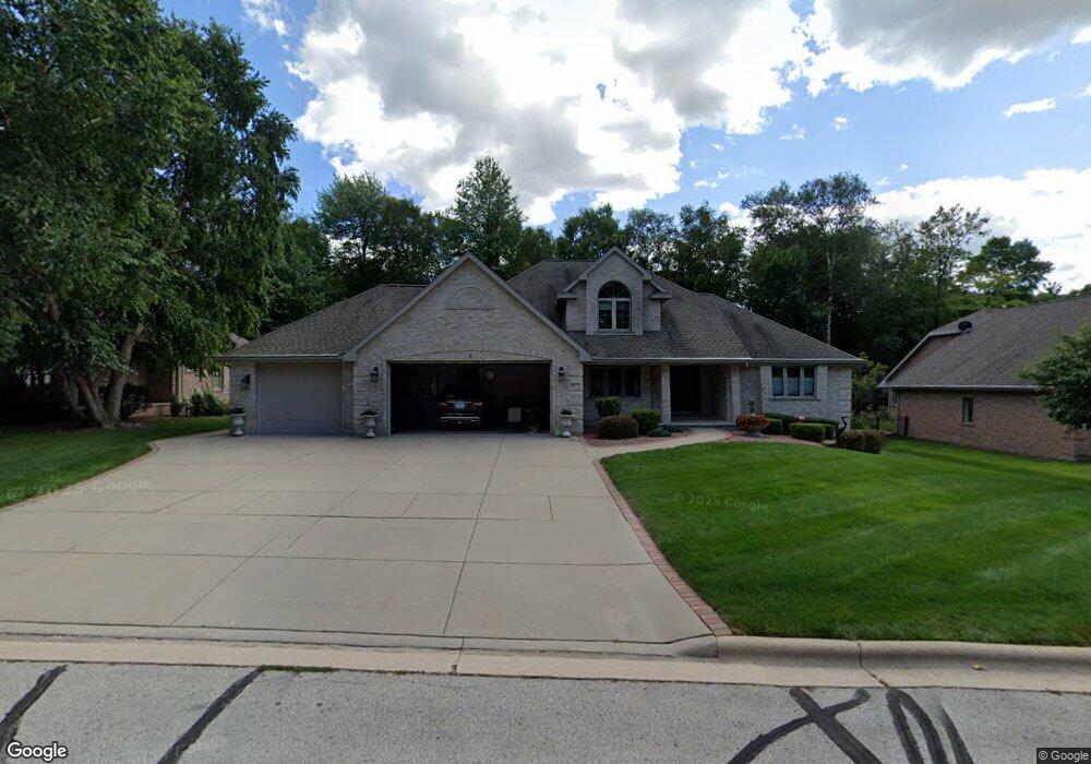
2879 Sweetfern Dr Green Bay, WI 54313
Westside NeighborhoodEstimated Value: $499,271 - $651,000
--
Bed
--
Bath
--
Sq Ft
0.34
Acres
About This Home
This home is located at 2879 Sweetfern Dr, Green Bay, WI 54313 and is currently estimated at $567,818. 2879 Sweetfern Dr is a home located in Brown County with nearby schools including King Elementary School, Lombardi Middle School, and Southwest High School.
Ownership History
Date
Name
Owned For
Owner Type
Purchase Details
Closed on
Dec 28, 1998
Sold by
Hutte Gordon Thomas and Hutte Phyllis Lucille
Bought by
Hutte Gordon T and Hutte Tom
Current Estimated Value
Home Financials for this Owner
Home Financials are based on the most recent Mortgage that was taken out on this home.
Original Mortgage
$160,000
Interest Rate
6.83%
Purchase Details
Closed on
Jul 13, 1998
Sold by
Jossart Ken and Jossart Kenneth L
Bought by
Hutte Gordon T and Hutte Phyllis L
Purchase Details
Closed on
Jul 10, 1998
Sold by
Baumgart Ronald L and Baumgart Elaine
Bought by
Jossart Ken and Perret David
Create a Home Valuation Report for This Property
The Home Valuation Report is an in-depth analysis detailing your home's value as well as a comparison with similar homes in the area
Home Values in the Area
Average Home Value in this Area
Purchase History
| Date | Buyer | Sale Price | Title Company |
|---|---|---|---|
| Hutte Gordon T | -- | Bay Title | |
| Hutte Gordon T | $45,500 | Bay Title & Abstract | |
| Jossart Ken | $3,000 | Evans Title |
Source: Public Records
Mortgage History
| Date | Status | Borrower | Loan Amount |
|---|---|---|---|
| Closed | Hutte Gordon T | $160,000 |
Source: Public Records
Tax History Compared to Growth
Tax History
| Year | Tax Paid | Tax Assessment Tax Assessment Total Assessment is a certain percentage of the fair market value that is determined by local assessors to be the total taxable value of land and additions on the property. | Land | Improvement |
|---|---|---|---|---|
| 2024 | $7,727 | $402,600 | $54,300 | $348,300 |
| 2023 | $7,435 | $402,600 | $54,300 | $348,300 |
| 2022 | $7,230 | $402,600 | $54,300 | $348,300 |
| 2021 | $6,897 | $290,500 | $55,000 | $235,500 |
| 2020 | $6,913 | $290,500 | $55,000 | $235,500 |
| 2019 | $6,727 | $290,500 | $55,000 | $235,500 |
| 2018 | $6,553 | $290,500 | $55,000 | $235,500 |
| 2017 | $6,430 | $290,500 | $55,000 | $235,500 |
| 2016 | $6,338 | $290,500 | $55,000 | $235,500 |
| 2015 | $6,408 | $290,500 | $55,000 | $235,500 |
| 2014 | $6,680 | $290,500 | $55,000 | $235,500 |
| 2013 | $6,680 | $290,500 | $55,000 | $235,500 |
Source: Public Records
Map
Nearby Homes
- 2768 Independence Dr
- 3023 Crusade Ln
- 1940 Renaissance Ct
- 1680 Cormier Rd
- 1433 Baumgart Rd Unit 1435
- 2060 Wintergreen Ct
- 3097 S Sandstone Ct
- 2044 Ann Ln
- 1602 W Crusade Ln
- 3096 S Sandstone Ct
- 2550 He Nis Ra Ln
- 2466 Parkwood Dr
- 2993 Fleetwood Dr
- 1310 Sandstone Place
- 1570 Mesa Dr
- 2441 Matchwood Ln
- 2439 W Point Rd
- 3102 Sandstone Ct
- 1973 Knotty Pine Dr
- 1514 Ashley Ct
- 2871 Sweetfern Dr
- 2895 Sweetfern Dr
- 2868 Branberry Ct
- 2057 Sweetfern Dr
- 2050 Meadowsweet Dr
- 2878 Branberry Ct
- 2880 Sweetfern Dr
- 2060 Meadowsweet Dr
- 2872 Sweetfern Dr
- 2886 Sweetfern Dr
- 2030 Meadowsweet Dr
- 2070 Meadowsweet Dr
- 2894 Sweetfern Dr
- 2879 Lobelia Ct
- 2871 Lobelia Ct
- 2044 Sweetfern Dr
- 2076 Meadowsweet Dr
- 2050 Sweetfern Dr
- 2060 Sweetfern Dr
- 2055 Meadowsweet Dr