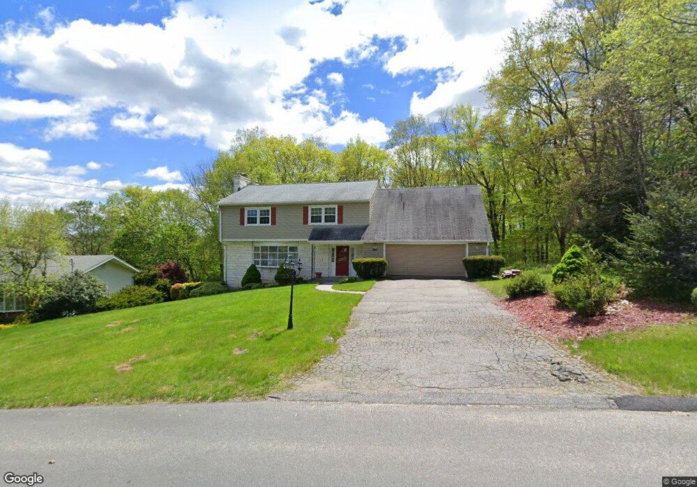
289 Forest Ridge Rd Waterbury, CT 06708
Bunker Hill NeighborhoodEstimated Value: $452,000 - $528,000
4
Beds
4
Baths
2,474
Sq Ft
$204/Sq Ft
Est. Value
About This Home
This home is located at 289 Forest Ridge Rd, Waterbury, CT 06708 and is currently estimated at $505,281, approximately $204 per square foot. 289 Forest Ridge Rd is a home located in New Haven County with nearby schools including Carrington Elementary School, Wilby High School, and Blessed Sacrament Catholic Day School.
Ownership History
Date
Name
Owned For
Owner Type
Purchase Details
Closed on
Sep 27, 1996
Sold by
Shay Nancy
Bought by
Adams David L and Adams Bertha G
Current Estimated Value
Home Financials for this Owner
Home Financials are based on the most recent Mortgage that was taken out on this home.
Original Mortgage
$149,000
Interest Rate
7.83%
Mortgage Type
Purchase Money Mortgage
Create a Home Valuation Report for This Property
The Home Valuation Report is an in-depth analysis detailing your home's value as well as a comparison with similar homes in the area
Home Values in the Area
Average Home Value in this Area
Purchase History
| Date | Buyer | Sale Price | Title Company |
|---|---|---|---|
| Adams David L | $169,000 | -- |
Source: Public Records
Mortgage History
| Date | Status | Borrower | Loan Amount |
|---|---|---|---|
| Closed | Adams David L | $134,500 | |
| Closed | Adams David L | $149,000 |
Source: Public Records
Tax History Compared to Growth
Tax History
| Year | Tax Paid | Tax Assessment Tax Assessment Total Assessment is a certain percentage of the fair market value that is determined by local assessors to be the total taxable value of land and additions on the property. | Land | Improvement |
|---|---|---|---|---|
| 2025 | $11,962 | $265,930 | $42,000 | $223,930 |
| 2024 | $13,148 | $265,930 | $42,000 | $223,930 |
| 2023 | $14,411 | $265,930 | $42,000 | $223,930 |
| 2022 | $10,038 | $166,720 | $42,000 | $124,720 |
| 2021 | $10,038 | $166,720 | $42,000 | $124,720 |
| 2020 | $10,038 | $166,720 | $42,000 | $124,720 |
| 2019 | $10,038 | $166,720 | $42,000 | $124,720 |
| 2018 | $10,038 | $166,720 | $42,000 | $124,720 |
| 2017 | $10,528 | $174,860 | $41,990 | $132,870 |
| 2016 | $10,528 | $174,860 | $41,990 | $132,870 |
| 2015 | $10,180 | $174,860 | $41,990 | $132,870 |
| 2014 | $10,180 | $174,860 | $41,990 | $132,870 |
Source: Public Records
Map
Nearby Homes
- 76 Kenmore Ave
- 208 Kendall Cir
- 62 Haddad Rd
- 51 Haddad Rd
- 32 Clough Rd
- 134 Heritage Dr
- 26 Kendall Cir
- 640 Bunker Hill Ave
- 859 Bunker Hill Ave
- 00 Bunker Hill Ave
- 28 Gaylord Glen
- 278 Georgetown Dr
- 00 Gaylord Glen
- 91 Devonwood Dr
- 107 Angel Dr Unit B
- 39 Glendale Dr
- 310 Parklawn Dr
- 98 Angel Dr
- 134 Plainfield Dr
- 112 Delaware Ave
- 281 Forest Ridge Rd
- 299 Forest Ridge Rd
- 288 Forest Ridge Rd
- 309 Forest Ridge Rd
- 278 Forest Ridge Rd
- 271 Forest Ridge Rd
- 266 Forest Ridge Rd
- 253 Clough Rd
- 328 Forest Ridge Rd
- 261 Forest Ridge Rd
- 186 Stoddard Rd
- 254 Forest Ridge Rd
- 331 Forest Ridge Rd
- 170 Stoddard Rd
- 34 Oak Hollow Dr
- 42 Oak Hollow Dr
- 26 Oak Hollow Dr
- 194 Stoddard Rd
- 18 Oak Hollow Dr
- 50 Oak Hollow Dr