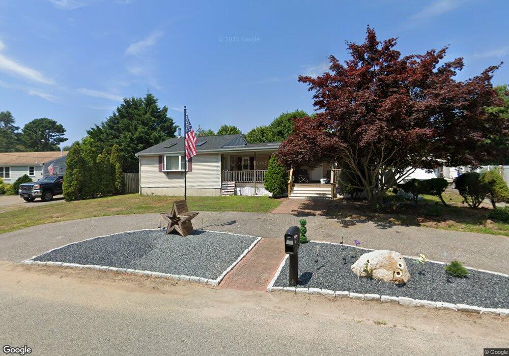
29 Meadowlark Dr Wareham, MA 02571
Estimated Value: $402,000 - $505,000
2
Beds
1
Bath
650
Sq Ft
$707/Sq Ft
Est. Value
About This Home
This home is located at 29 Meadowlark Dr, Wareham, MA 02571 and is currently estimated at $459,286, approximately $706 per square foot. 29 Meadowlark Dr is a home located in Plymouth County.
Ownership History
Date
Name
Owned For
Owner Type
Purchase Details
Closed on
Apr 16, 2024
Sold by
Lopes Michael P
Bought by
Michael P Lopes Ret and Lopes
Current Estimated Value
Purchase Details
Closed on
Apr 13, 2006
Sold by
Lopes Edwin J and Lopes Elaine J
Bought by
Lopes Michael P
Home Financials for this Owner
Home Financials are based on the most recent Mortgage that was taken out on this home.
Original Mortgage
$167,221
Interest Rate
6.4%
Purchase Details
Closed on
Mar 30, 1993
Sold by
Nestor Edward H and Nestor Joan
Bought by
Lopes Edwin J and Lopes Elaine J
Create a Home Valuation Report for This Property
The Home Valuation Report is an in-depth analysis detailing your home's value as well as a comparison with similar homes in the area
Home Values in the Area
Average Home Value in this Area
Purchase History
| Date | Buyer | Sale Price | Title Company |
|---|---|---|---|
| Michael P Lopes Ret | -- | None Available | |
| Michael P Lopes Ret | -- | None Available | |
| Michael P Lopes Ret | -- | None Available | |
| Lopes Michael P | -- | -- | |
| Lopes Michael P | -- | -- | |
| Lopes Edwin J | $67,000 | -- | |
| Lopes Edwin J | $67,000 | -- |
Source: Public Records
Mortgage History
| Date | Status | Borrower | Loan Amount |
|---|---|---|---|
| Previous Owner | Lopes Edwin J | $167,221 | |
| Previous Owner | Lopes Edwin J | $165,404 | |
| Previous Owner | Lopes Edwin J | $150,000 |
Source: Public Records
Tax History Compared to Growth
Tax History
| Year | Tax Paid | Tax Assessment Tax Assessment Total Assessment is a certain percentage of the fair market value that is determined by local assessors to be the total taxable value of land and additions on the property. | Land | Improvement |
|---|---|---|---|---|
| 2025 | $4,091 | $392,600 | $110,400 | $282,200 |
| 2024 | $4,170 | $371,300 | $86,400 | $284,900 |
| 2023 | $3,708 | $331,800 | $78,500 | $253,300 |
| 2022 | $3,708 | $281,300 | $78,500 | $202,800 |
| 2021 | $3,656 | $271,800 | $78,500 | $193,300 |
| 2020 | $3,395 | $256,000 | $78,500 | $177,500 |
| 2019 | $3,268 | $245,900 | $76,200 | $169,700 |
| 2018 | $3,059 | $224,400 | $76,200 | $148,200 |
| 2017 | $2,811 | $209,000 | $76,200 | $132,800 |
| 2016 | $2,552 | $188,600 | $74,300 | $114,300 |
| 2015 | $2,465 | $188,600 | $74,300 | $114,300 |
| 2014 | $2,417 | $188,100 | $70,600 | $117,500 |
Source: Public Records
Map
Nearby Homes
- 125 Jeffreys Path
- 2731 Cranberry Hwy
- 13 Cherry St
- 50 Avenue A St
- 6 Gilbert Way
- 24 Kimberly Ct
- 51 Minot Ave Unit 1
- 6 Back St
- 2783 Cranberry Hwy
- 5 Oak Hill Rd
- 12 Linwood Ave
- 110 Mayflower Ridge Dr
- 3 Cedar St
- 2596 Cranberry Hwy
- 425 Main St Unit E
- 2838 Cranberry Hwy
- 437 Main St
- 124 Minot Ave Unit 1
- 10 Nimrod Way
- 7 Knowles Ave
- 31 Meadowlark Dr
- 27 Meadowlark Dr
- 26 Pheasant Ave
- 24 Pheasant Ave
- 28 Pheasant Ave
- 30 Meadowlark Dr
- 33 Meadowlark Dr
- 25 Meadowlark Dr
- 22 Pheasant Ave
- 28 Meadowlark Dr
- 15 Mallard Rd
- 25 Pheasant Ave
- 1 Gull Ln
- 20 Pheasant Ave
- 13 Mallard Rd
- 23 Pheasant Ave
- 17 Wren Terrace
- 2 Gull Ln
- 13 Wren Terrace
- 26 Meadowlark Dr