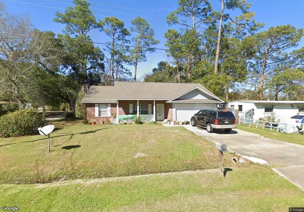
29 Mississippi Cir Pensacola, FL 32505
Estimated Value: $162,000 - $218,000
--
Bed
--
Bath
1,284
Sq Ft
$147/Sq Ft
Est. Value
About This Home
This home is located at 29 Mississippi Cir, Pensacola, FL 32505 and is currently estimated at $188,293, approximately $146 per square foot. 29 Mississippi Cir is a home located in Escambia County with nearby schools including Oakcrest Elementary School, Warrington Middle School, and Escambia High School.
Ownership History
Date
Name
Owned For
Owner Type
Purchase Details
Closed on
Jul 21, 2008
Sold by
Community Enterprise Investments Inc
Bought by
Lowery Shanda F
Current Estimated Value
Home Financials for this Owner
Home Financials are based on the most recent Mortgage that was taken out on this home.
Original Mortgage
$78,155
Outstanding Balance
$50,929
Interest Rate
6.27%
Mortgage Type
FHA
Estimated Equity
$137,364
Purchase Details
Closed on
Jul 28, 2006
Sold by
Beaty Raymond H
Bought by
Community Enterprise Investments Inc
Create a Home Valuation Report for This Property
The Home Valuation Report is an in-depth analysis detailing your home's value as well as a comparison with similar homes in the area
Home Values in the Area
Average Home Value in this Area
Purchase History
| Date | Buyer | Sale Price | Title Company |
|---|---|---|---|
| Lowery Shanda F | $125,000 | Citizens Title Group Inc | |
| Community Enterprise Investments Inc | $22,000 | Gulf Coast Title Partners Ll |
Source: Public Records
Mortgage History
| Date | Status | Borrower | Loan Amount |
|---|---|---|---|
| Open | Lowery Shanda F | $78,155 |
Source: Public Records
Tax History Compared to Growth
Tax History
| Year | Tax Paid | Tax Assessment Tax Assessment Total Assessment is a certain percentage of the fair market value that is determined by local assessors to be the total taxable value of land and additions on the property. | Land | Improvement |
|---|---|---|---|---|
| 2024 | $1,914 | $69,157 | -- | -- |
| 2023 | $1,914 | $172,706 | $0 | $0 |
| 2022 | $157 | $8,000 | $8,000 | $0 |
| 2021 | $576 | $63,289 | $0 | $0 |
| 2020 | $582 | $62,416 | $0 | $0 |
| 2019 | $578 | $61,013 | $0 | $0 |
| 2018 | $579 | $59,876 | $0 | $0 |
| 2017 | $582 | $58,645 | $0 | $0 |
| 2016 | $633 | $65,191 | $0 | $0 |
| 2015 | $613 | $64,738 | $0 | $0 |
| 2014 | $602 | $64,225 | $0 | $0 |
Source: Public Records
Map
Nearby Homes
- 837 S Madison Dr
- 835 S Madison Dr
- 901 S Madison Dr
- 200 Georgia Dr
- 823 S Madison Dr
- 6 Georgia Dr
- 102 Tennessee Dr
- 814 S Madison Dr
- 112 Saint Regis Dr
- 1005 Revere Dr
- 1014 Kearny Dr
- 213 Emerald Ave
- 1020 E Madison Dr
- 4639 Wabash Ave
- 305 N Madison Dr
- 245 Aquamarine Ave
- 2208 Oakwood Ave
- 104 Cherokee Trail
- 1414 Clio Dr
- 107 W Madison Dr
- 31 Mississippi Cir
- 1 Saint Regis Dr
- 0 Mississippi Cir
- 25 Mississippi Cir
- 401 New York Dr
- 3 Saint Regis Dr
- 403 New York Dr
- 28 Mississippi Cir
- 30 Mississippi Cir
- 26 Mississippi Cir
- 2 Saint Regis Dr
- 23 Mississippi Cir
- 405 New York Dr
- 24 Mississippi Cir
- 32 Mississippi Cir
- 5 Saint Regis Dr
- 5 St Regis Dr
- 4 Saint Regis Dr
- 22 Mississippi Cir
- 21 Mississippi Cir