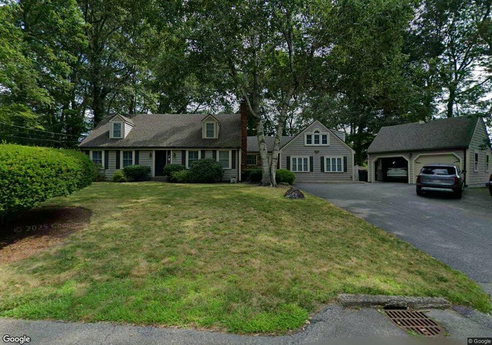
29 Newell Dr North Attleboro, MA 02760
North Attleboro NeighborhoodEstimated Value: $907,878 - $1,135,000
3
Beds
3
Baths
2,840
Sq Ft
$347/Sq Ft
Est. Value
About This Home
This home is located at 29 Newell Dr, North Attleboro, MA 02760 and is currently estimated at $985,470, approximately $346 per square foot. 29 Newell Dr is a home located in Bristol County with nearby schools including North Attleboro High School, Cadence Academy Preschool - North Attleborough, and Bishop Feehan High School.
Ownership History
Date
Name
Owned For
Owner Type
Purchase Details
Closed on
May 30, 2008
Sold by
Schmidle David M and Schmidle Cheryl A
Bought by
Wilson Brian C and Wilson Erica
Current Estimated Value
Home Financials for this Owner
Home Financials are based on the most recent Mortgage that was taken out on this home.
Original Mortgage
$400,000
Outstanding Balance
$254,835
Interest Rate
5.91%
Mortgage Type
Purchase Money Mortgage
Estimated Equity
$730,635
Purchase Details
Closed on
Feb 25, 2005
Sold by
Tompkins Steven S and Aislinn Tompkins M
Bought by
Schmidle David M and Schmidle Cheryl A
Home Financials for this Owner
Home Financials are based on the most recent Mortgage that was taken out on this home.
Original Mortgage
$376,000
Interest Rate
5.73%
Mortgage Type
Purchase Money Mortgage
Create a Home Valuation Report for This Property
The Home Valuation Report is an in-depth analysis detailing your home's value as well as a comparison with similar homes in the area
Home Values in the Area
Average Home Value in this Area
Purchase History
| Date | Buyer | Sale Price | Title Company |
|---|---|---|---|
| Wilson Brian C | $500,000 | -- | |
| Schmidle David M | $470,000 | -- |
Source: Public Records
Mortgage History
| Date | Status | Borrower | Loan Amount |
|---|---|---|---|
| Open | Wilson Brian C | $400,000 | |
| Previous Owner | Schmidle David M | $376,000 |
Source: Public Records
Tax History Compared to Growth
Tax History
| Year | Tax Paid | Tax Assessment Tax Assessment Total Assessment is a certain percentage of the fair market value that is determined by local assessors to be the total taxable value of land and additions on the property. | Land | Improvement |
|---|---|---|---|---|
| 2025 | $9,454 | $801,900 | $158,900 | $643,000 |
| 2024 | $9,031 | $782,600 | $165,500 | $617,100 |
| 2023 | $9,085 | $710,300 | $165,500 | $544,800 |
| 2022 | $8,407 | $603,500 | $172,200 | $431,300 |
| 2021 | $8,061 | $564,900 | $172,200 | $392,700 |
| 2020 | $7,834 | $545,900 | $172,200 | $373,700 |
| 2019 | $7,617 | $534,900 | $156,600 | $378,300 |
| 2018 | $6,830 | $512,000 | $162,600 | $349,400 |
| 2017 | $6,303 | $476,800 | $162,600 | $314,200 |
| 2016 | $6,432 | $486,500 | $187,400 | $299,100 |
| 2015 | $5,850 | $445,200 | $187,400 | $257,800 |
| 2014 | $5,393 | $407,300 | $155,800 | $251,500 |
Source: Public Records
Map
Nearby Homes
- 15 Old Wood Rd
- 16 Raymond Hall Dr
- 10 Sleepy Hollow Cir
- 116 George St
- 11 Landry Ave
- Lot 5 Jeffrey Dr
- 57 Vine St
- Lot 2 Jeffrey Dr
- 2 George St Unit C
- 9 Sunnyside Dr Unit 9
- 28 Messenger St
- 166 E Bacon St Unit 4
- 12 Houde St
- 33 Dublin Way
- 2 Woodridge St Unit 2
- 3 Serengeti Dr
- 4 Garden Ln
- 6 Hilltop Rd Unit 122
- 115 Westfield Dr
- 1066 Mount Hope St
- 26 Stone Hill Rd
- 41 Newell Dr
- 19 Newell Dr
- 14 Stone Hill Rd
- 28 Newell Dr
- 38 Stone Hill Rd
- 38 Newell Dr
- 35 Wagon Wheel Rd
- 18 Newell Dr
- 6 Old Wood Rd
- 140 Raymond Hall Dr
- 4 Stone Hill Rd
- 53 Newell Dr
- 19 Stone Hill Rd
- 29 Stone Hill Rd
- 26 Woodcock Ln
- 48 Stone Hill Rd
- 16 Woodcock Ln
- 36 Woodcock Ln
- 39 Stone Hill Rd