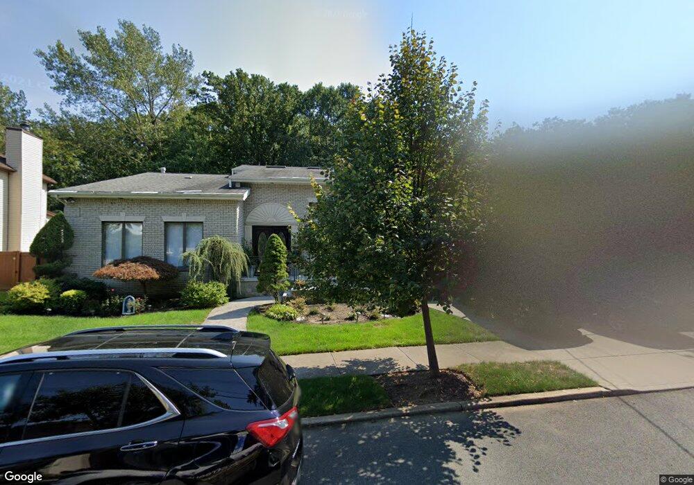
290 Noel St Staten Island, NY 10312
Annadale NeighborhoodEstimated Value: $1,253,000 - $1,981,000
--
Bed
4
Baths
3,686
Sq Ft
$420/Sq Ft
Est. Value
About This Home
This home is located at 290 Noel St, Staten Island, NY 10312 and is currently estimated at $1,547,678, approximately $419 per square foot. 290 Noel St is a home located in Richmond County with nearby schools including P.S. 5 - Huguenot, I.S. 007 Elias Bernstein, and Tottenville High School.
Ownership History
Date
Name
Owned For
Owner Type
Purchase Details
Closed on
Nov 15, 2013
Sold by
Mastroianni Armand P and Mastroianni Evelyn
Bought by
Ligouri John J and Ligouri Maryann F
Current Estimated Value
Home Financials for this Owner
Home Financials are based on the most recent Mortgage that was taken out on this home.
Original Mortgage
$417,000
Outstanding Balance
$110,891
Interest Rate
4.17%
Mortgage Type
New Conventional
Estimated Equity
$1,436,787
Purchase Details
Closed on
May 14, 1996
Sold by
Mastroianni Armand P and Mastroianni Evelyn
Bought by
Mastroianni Armand P and Mastroianni Evelyn
Create a Home Valuation Report for This Property
The Home Valuation Report is an in-depth analysis detailing your home's value as well as a comparison with similar homes in the area
Home Values in the Area
Average Home Value in this Area
Purchase History
| Date | Buyer | Sale Price | Title Company |
|---|---|---|---|
| Ligouri John J | $945,000 | Chicago Title Insurance Co | |
| Mastroianni Armand P | -- | -- |
Source: Public Records
Mortgage History
| Date | Status | Borrower | Loan Amount |
|---|---|---|---|
| Open | Ligouri John J | $417,000 |
Source: Public Records
Tax History Compared to Growth
Tax History
| Year | Tax Paid | Tax Assessment Tax Assessment Total Assessment is a certain percentage of the fair market value that is determined by local assessors to be the total taxable value of land and additions on the property. | Land | Improvement |
|---|---|---|---|---|
| 2025 | $14,317 | $80,220 | $16,627 | $63,593 |
| 2024 | $14,317 | $85,620 | $15,285 | $70,335 |
| 2023 | $13,815 | $68,022 | $15,805 | $52,217 |
| 2022 | $12,811 | $73,140 | $18,360 | $54,780 |
| 2021 | $12,741 | $60,540 | $18,360 | $42,180 |
| 2020 | $13,328 | $66,900 | $18,360 | $48,540 |
| 2019 | $12,426 | $64,260 | $18,360 | $45,900 |
| 2018 | $11,811 | $59,400 | $17,961 | $41,439 |
| 2017 | $11,185 | $56,340 | $18,360 | $37,980 |
| 2016 | $10,809 | $55,618 | $15,402 | $40,216 |
| 2015 | $9,195 | $52,470 | $14,069 | $38,401 |
| 2014 | $9,195 | $49,500 | $15,300 | $34,200 |
Source: Public Records
Map
Nearby Homes
- 262 Noel St
- 21 Allen Place
- 47 Ravenna St
- 59 Newton St
- 330 Shirley Ave
- 344 Poillon Ave
- 62 Bennett Place
- 350 Poillon Ave
- 41 Bennett Place
- 207 Eylandt St
- 456 Holdridge Ave
- 151 Lipsett Ave
- 383 Philip Ave
- 389 Philip Ave
- 393 Philip Ave
- 161 Boardwalk Ave
- 422 Harold Ave
- 174 Tallman St
- 84 Discala Ln
- 440 Harold Ave