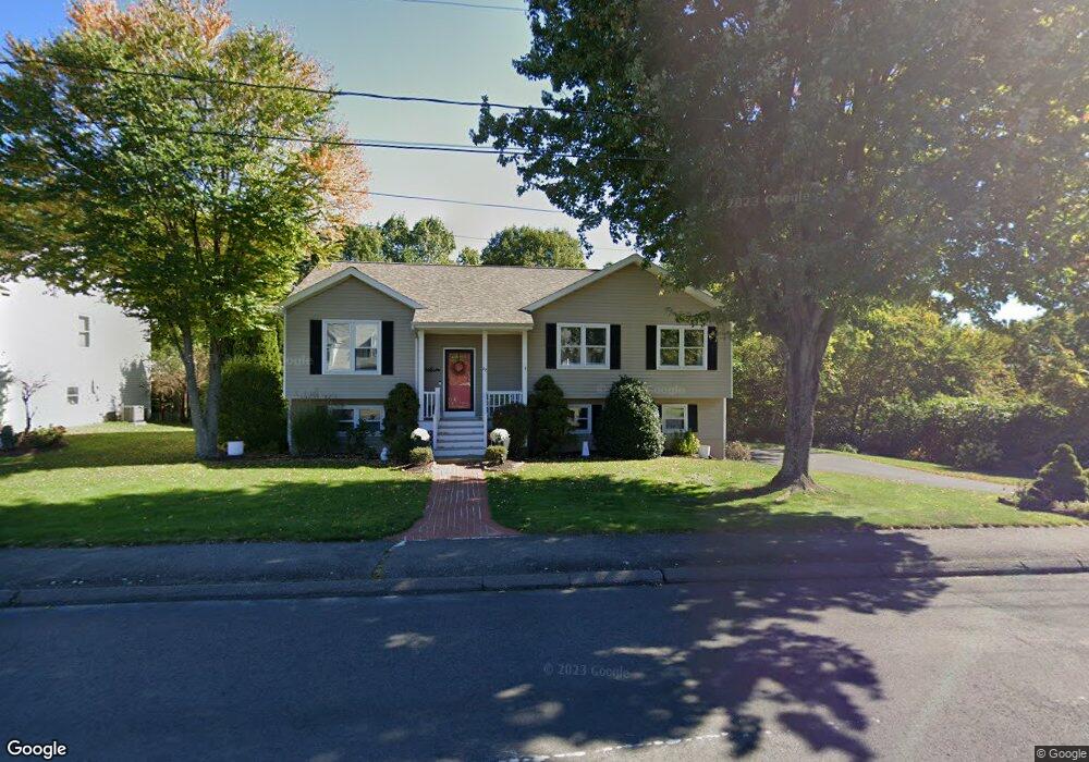
291 Stoddard Rd Waterbury, CT 06708
Bunker Hill NeighborhoodEstimated Value: $371,000 - $454,000
3
Beds
3
Baths
1,418
Sq Ft
$282/Sq Ft
Est. Value
About This Home
This home is located at 291 Stoddard Rd, Waterbury, CT 06708 and is currently estimated at $400,261, approximately $282 per square foot. 291 Stoddard Rd is a home located in New Haven County with nearby schools including Carrington Elementary School, Wilby High School, and Blessed Sacrament Catholic Day School.
Ownership History
Date
Name
Owned For
Owner Type
Purchase Details
Closed on
Apr 4, 1994
Sold by
Oakcrest Mtg Corp
Bought by
Madigan Scott and Madigan Kristen
Current Estimated Value
Home Financials for this Owner
Home Financials are based on the most recent Mortgage that was taken out on this home.
Original Mortgage
$119,600
Interest Rate
7.07%
Mortgage Type
Unknown
Create a Home Valuation Report for This Property
The Home Valuation Report is an in-depth analysis detailing your home's value as well as a comparison with similar homes in the area
Home Values in the Area
Average Home Value in this Area
Purchase History
| Date | Buyer | Sale Price | Title Company |
|---|---|---|---|
| Madigan Scott | $133,000 | -- | |
| Madigan Scott | $133,000 | -- |
Source: Public Records
Mortgage History
| Date | Status | Borrower | Loan Amount |
|---|---|---|---|
| Open | Madigan Scott | $140,000 | |
| Closed | Madigan Scott | $45,000 | |
| Closed | Madigan Scott | $110,000 | |
| Closed | Madigan Scott | $119,600 |
Source: Public Records
Tax History Compared to Growth
Tax History
| Year | Tax Paid | Tax Assessment Tax Assessment Total Assessment is a certain percentage of the fair market value that is determined by local assessors to be the total taxable value of land and additions on the property. | Land | Improvement |
|---|---|---|---|---|
| 2025 | $7,132 | $158,550 | $27,090 | $131,460 |
| 2024 | $7,839 | $158,550 | $27,090 | $131,460 |
| 2023 | $8,592 | $158,550 | $27,090 | $131,460 |
| 2022 | $6,258 | $103,940 | $27,110 | $76,830 |
| 2021 | $6,258 | $103,940 | $27,110 | $76,830 |
| 2020 | $6,258 | $103,940 | $27,110 | $76,830 |
| 2019 | $6,258 | $103,940 | $27,110 | $76,830 |
| 2018 | $6,258 | $103,940 | $27,110 | $76,830 |
| 2017 | $7,158 | $118,890 | $27,110 | $91,780 |
| 2016 | $7,158 | $118,890 | $27,110 | $91,780 |
| 2015 | $6,922 | $118,890 | $27,110 | $91,780 |
| 2014 | $6,922 | $118,890 | $27,110 | $91,780 |
Source: Public Records
Map
Nearby Homes
- 208 Kendall Cir
- 62 Haddad Rd
- 51 Haddad Rd
- 76 Kenmore Ave
- 28 Gaylord Glen
- 91 Devonwood Dr
- 26 Kendall Cir
- 00 Gaylord Glen
- 32 Clough Rd
- 310 Parklawn Dr
- 640 Bunker Hill Ave
- 00 Bunker Hill Ave
- 134 Heritage Dr
- 112 Delaware Ave
- 0004 Westwood Ave
- 859 Bunker Hill Ave
- 278 Georgetown Dr
- 604 Lakeside Blvd W
- 66 Revere St
- 39 Glendale Dr
- 285 Stoddard Rd
- 1 Oakcrest Cir
- 281 Stoddard Rd
- 292 Stoddard Rd
- 284 Stoddard Rd
- 280 Stoddard Rd
- 298 Stoddard Rd
- 275 Stoddard Rd
- 12 Oakcrest Cir
- 267 Stoddard Rd
- 18 Oakcrest Cir
- 29 Oakcrest Cir
- 43 Oakcrest Cir
- 49 Oakcrest Cir
- 261 Stoddard Rd
- 22 Oakcrest Cir
- 390 Ardsley Rd
- 30 Oakcrest Cir
- 36 Oakcrest Cir
- 44 Georges Ct