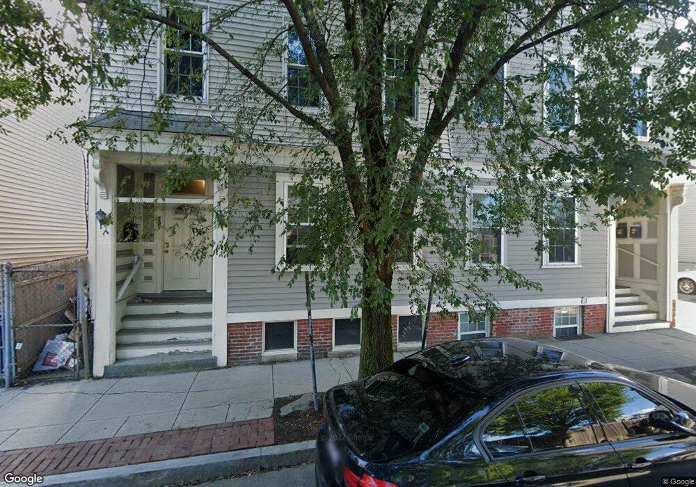
291 W 2nd St Boston, MA 02127
South Boston NeighborhoodEstimated Value: $1,131,000 - $1,997,072
5
Beds
3
Baths
2,275
Sq Ft
$669/Sq Ft
Est. Value
About This Home
This home is located at 291 W 2nd St, Boston, MA 02127 and is currently estimated at $1,523,018, approximately $669 per square foot. 291 W 2nd St is a home located in Suffolk County with nearby schools including Up Academy Charter School Of Boston, St Peter Academy, and Gate of Heaven Elementary School.
Ownership History
Date
Name
Owned For
Owner Type
Purchase Details
Closed on
Jun 29, 2018
Sold by
291 West 2Nd Street Ll
Bought by
J Derenzo Properties L
Current Estimated Value
Purchase Details
Closed on
Jun 28, 2018
Sold by
Copps Hill Rt
Bought by
291 West 2Nd Street Ll
Purchase Details
Closed on
Jan 31, 2013
Sold by
Kierman Owen
Bought by
Copps Hill Rt
Home Financials for this Owner
Home Financials are based on the most recent Mortgage that was taken out on this home.
Original Mortgage
$610,000
Interest Rate
3.41%
Mortgage Type
Purchase Money Mortgage
Purchase Details
Closed on
Nov 21, 2000
Sold by
Kiernan Ailis D
Bought by
Kiernan Owen
Home Financials for this Owner
Home Financials are based on the most recent Mortgage that was taken out on this home.
Original Mortgage
$206,500
Interest Rate
7.78%
Mortgage Type
Purchase Money Mortgage
Purchase Details
Closed on
Aug 12, 1993
Sold by
Foster Mtg Cop
Bought by
Kiernan Ailis D
Create a Home Valuation Report for This Property
The Home Valuation Report is an in-depth analysis detailing your home's value as well as a comparison with similar homes in the area
Home Values in the Area
Average Home Value in this Area
Purchase History
| Date | Buyer | Sale Price | Title Company |
|---|---|---|---|
| J Derenzo Properties L | $1,350,000 | -- | |
| 291 West 2Nd Street Ll | $1,300,000 | -- | |
| Copps Hill Rt | $875,000 | -- | |
| Kiernan Owen | $295,000 | -- | |
| Kiernan Ailis D | $23,000 | -- |
Source: Public Records
Mortgage History
| Date | Status | Borrower | Loan Amount |
|---|---|---|---|
| Previous Owner | Copps Hill Rt | $610,000 | |
| Previous Owner | Kiernan Ailis D | $370,000 | |
| Previous Owner | Kiernan Ailis D | $206,500 | |
| Previous Owner | Kiernan Ailis D | $101,200 |
Source: Public Records
Tax History Compared to Growth
Tax History
| Year | Tax Paid | Tax Assessment Tax Assessment Total Assessment is a certain percentage of the fair market value that is determined by local assessors to be the total taxable value of land and additions on the property. | Land | Improvement |
|---|---|---|---|---|
| 2025 | $11,602 | $1,001,900 | $224,700 | $777,200 |
| 2024 | $10,404 | $954,500 | $232,300 | $722,200 |
| 2023 | $9,495 | $884,100 | $215,200 | $668,900 |
| 2022 | $8,744 | $803,700 | $195,600 | $608,100 |
| 2021 | $8,168 | $765,500 | $186,300 | $579,200 |
| 2020 | $8,004 | $758,000 | $186,300 | $571,700 |
| 2019 | $7,119 | $675,400 | $139,900 | $535,500 |
| 2018 | $6,874 | $655,900 | $139,900 | $516,000 |
| 2017 | $6,615 | $624,600 | $139,900 | $484,700 |
| 2016 | $6,135 | $557,700 | $139,900 | $417,800 |
| 2015 | $5,568 | $459,800 | $123,100 | $336,700 |
| 2014 | $5,013 | $398,500 | $123,100 | $275,400 |
Source: Public Records
Map
Nearby Homes
- 320 W 2nd St Unit 502
- 251 W 3rd St Unit 251
- 251 W 3rd St
- 340 W 2nd St Unit 5
- 340 W 2nd St Unit 19
- 340 W 2nd St Unit 17
- 340 W 2nd St Unit 23
- 340 W 2nd St Unit 13
- 258-260 W 3rd St Unit 1
- 360 W 2nd St Unit 14
- 9 W Broadway Unit 206
- 9 W Broadway Unit 618
- 9 W Broadway Unit 314
- 321 W Broadway Unit 6
- 166 F St Unit 1
- 364-368 Athens St
- 262-264 W Broadway
- 350 W 4th St Unit 103
- 309 E St Unit 46
- 309 E St Unit 36
- 291 W 2nd St
- 291 W 2nd St Unit 3
- 291 W 2nd St Unit 1
- 291 W 2nd St Unit 2
- 289 W 2nd St Unit 3
- 289 W 2nd St Unit 2
- 289 W 2nd St Unit 1
- 293 W 2nd St
- 293 W 2nd St Unit 3
- 293 W 2nd St Unit 2
- 293 W 2nd St Unit 1
- 182 Bolton St
- 182 Bolton St Unit 3
- 182 Bolton St Unit 2
- 182 Bolton St Unit 1
- 295 W 2nd St
- 295 W 2nd St Unit 2
- 180 Bolton St
- 180 Bolton St
- 180 Bolton St Unit 2