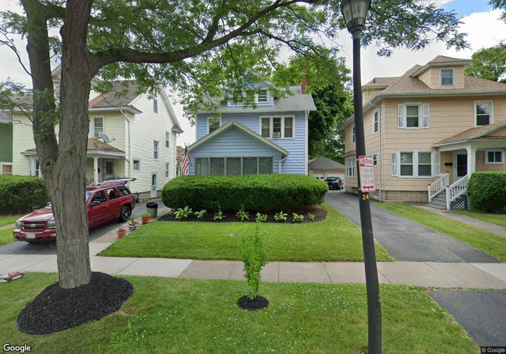
292 Sherwood Ave Rochester, NY 14619
19th Ward NeighborhoodEstimated Value: $162,000 - $177,000
3
Beds
2
Baths
1,264
Sq Ft
$136/Sq Ft
Est. Value
About This Home
This home is located at 292 Sherwood Ave, Rochester, NY 14619 and is currently estimated at $171,484, approximately $135 per square foot. 292 Sherwood Ave is a home located in Monroe County with nearby schools including John Walton Spencer School No. 16, Adlai E. Stevenson School 29, and George Mather Forbes School No. 4.
Ownership History
Date
Name
Owned For
Owner Type
Purchase Details
Closed on
Feb 21, 2009
Sold by
Gilchrist Roger L and Gilchrist Denis
Bought by
Gilchrist Roger
Current Estimated Value
Home Financials for this Owner
Home Financials are based on the most recent Mortgage that was taken out on this home.
Original Mortgage
$62,830
Interest Rate
4.76%
Mortgage Type
FHA
Create a Home Valuation Report for This Property
The Home Valuation Report is an in-depth analysis detailing your home's value as well as a comparison with similar homes in the area
Home Values in the Area
Average Home Value in this Area
Purchase History
| Date | Buyer | Sale Price | Title Company |
|---|---|---|---|
| Gilchrist Roger | -- | -- |
Source: Public Records
Mortgage History
| Date | Status | Borrower | Loan Amount |
|---|---|---|---|
| Closed | Gilchrist Roger | $62,830 |
Source: Public Records
Tax History Compared to Growth
Tax History
| Year | Tax Paid | Tax Assessment Tax Assessment Total Assessment is a certain percentage of the fair market value that is determined by local assessors to be the total taxable value of land and additions on the property. | Land | Improvement |
|---|---|---|---|---|
| 2024 | $1,164 | $117,300 | $9,600 | $107,700 |
| 2023 | $1,126 | $82,700 | $7,500 | $75,200 |
| 2022 | $1,099 | $82,700 | $7,500 | $75,200 |
| 2021 | $1,105 | $82,700 | $7,500 | $75,200 |
| 2020 | $1,088 | $82,700 | $7,500 | $75,200 |
| 2019 | $940 | $69,600 | $7,500 | $62,100 |
| 2018 | $1,560 | $69,600 | $7,500 | $62,100 |
| 2017 | $0 | $69,600 | $7,500 | $62,100 |
| 2016 | $940 | $69,600 | $7,500 | $62,100 |
| 2015 | $1,466 | $63,500 | $7,500 | $56,000 |
| 2014 | $1,466 | $63,500 | $7,500 | $56,000 |
Source: Public Records
Map
Nearby Homes
- 469 Arnett Blvd
- 3 Ravenwood Ave
- 409 Arnett Blvd
- 485 Rugby Ave
- 119-121 Thurston Rd
- 91-97 Thurston Rd
- 261 Warwick Ave
- 64 Flanders St
- 359 Wellington Ave
- 51 Penhurst St
- 101 Roxborough Rd
- 56 Chili Terrace
- 132-134 Salina St
- 66 Ringle St
- 190 Roslyn St
- 133 Rugby Ave
- 457-459 Chili Ave
- 137 Aldine St
- 179 Warwick Ave
- 564 Chili Ave
- 296 Sherwood Ave
- 286 Sherwood Ave
- 280 Sherwood Ave
- 300 Sherwood Ave
- 274 Sherwood Ave
- 315 Woodbine Ave
- 305 Woodbine Ave
- 306 Sherwood Ave
- 299 Woodbine Ave
- 321 Woodbine Ave
- 268 Sherwood Ave
- 310 Sherwood Ave
- 293 Woodbine Ave
- 325 Woodbine Ave
- 291 Sherwood Ave
- 285 Sherwood Ave
- 295 Sherwood Ave
- 281 Sherwood Ave
- 299 Sherwood Ave
- 287 Woodbine Ave