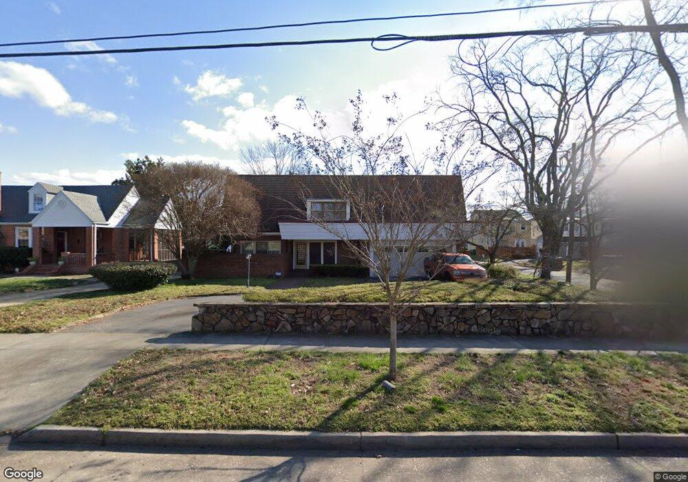
2921 Brook Rd Richmond, VA 23220
Virginia Union NeighborhoodEstimated Value: $503,000 - $729,000
3
Beds
2
Baths
4,560
Sq Ft
$129/Sq Ft
Est. Value
About This Home
This home is located at 2921 Brook Rd, Richmond, VA 23220 and is currently estimated at $588,837, approximately $129 per square foot. 2921 Brook Rd is a home located in Richmond City with nearby schools including Linwood Holton Elementary School, Henderson Middle School, and John Marshall High School.
Ownership History
Date
Name
Owned For
Owner Type
Purchase Details
Closed on
Nov 27, 1996
Sold by
Hicks Thomas L
Bought by
Stewart James E
Current Estimated Value
Home Financials for this Owner
Home Financials are based on the most recent Mortgage that was taken out on this home.
Original Mortgage
$73,600
Outstanding Balance
$7,562
Interest Rate
7.82%
Mortgage Type
New Conventional
Estimated Equity
$581,275
Create a Home Valuation Report for This Property
The Home Valuation Report is an in-depth analysis detailing your home's value as well as a comparison with similar homes in the area
Home Values in the Area
Average Home Value in this Area
Purchase History
| Date | Buyer | Sale Price | Title Company |
|---|---|---|---|
| Stewart James E | $143,000 | -- |
Source: Public Records
Mortgage History
| Date | Status | Borrower | Loan Amount |
|---|---|---|---|
| Open | Stewart James E | $73,600 |
Source: Public Records
Tax History Compared to Growth
Tax History
| Year | Tax Paid | Tax Assessment Tax Assessment Total Assessment is a certain percentage of the fair market value that is determined by local assessors to be the total taxable value of land and additions on the property. | Land | Improvement |
|---|---|---|---|---|
| 2025 | $4,656 | $388,000 | $110,000 | $278,000 |
| 2024 | $4,452 | $371,000 | $105,000 | $266,000 |
| 2023 | $4,092 | $341,000 | $75,000 | $266,000 |
| 2022 | $3,684 | $307,000 | $65,000 | $242,000 |
| 2021 | $3,276 | $287,000 | $50,000 | $237,000 |
| 2020 | $3,276 | $273,000 | $50,000 | $223,000 |
| 2019 | $3,204 | $267,000 | $45,000 | $222,000 |
| 2018 | $2,976 | $248,000 | $45,000 | $203,000 |
| 2017 | $2,844 | $237,000 | $40,000 | $197,000 |
| 2016 | $2,616 | $218,000 | $36,000 | $182,000 |
| 2015 | $2,580 | $215,000 | $36,000 | $179,000 |
| 2014 | $2,580 | $215,000 | $36,000 | $179,000 |
Source: Public Records
Map
Nearby Homes
- 2938 Northumberland Ave
- 2912 Hawthorne Ave
- 811 Edge Hill Rd
- 1320 Brookland Pkwy
- 2606 Hawthorne Ave
- 2916 Montrose Ave
- 2918 Montrose Ave
- 613 W Lancaster Rd
- 3012 Montrose Ave
- 3304 Loxley Rd
- 2441 Ownby Ln Unit B14
- 611 1/2 W Lancaster Rd
- 640 Overby Bend Rd
- 636 Overby Bend Rd
- 3036 Montrose Ave
- 628 Overby Bend Rd
- 16107 Cedarwood Tree Ct
- 2805 Griffin Ave
- 3118 Griffin Ave
- 3122 Griffin Ave
- 2923 Brook Rd
- 2922 Northumberland Ave
- 2925 Brook Rd
- 2913 Brook Rd
- 2924 Northumberland Ave
- 2920 Northumberland Ave
- 2926 Northumberland Ave
- 2918 Northumberland Ave
- 2927 Brook Rd
- 2916 Northumberland Ave
- 2911 Brook Rd
- 2928 Northumberland Ave
- 2914 Northumberland Ave
- 2929 Brook Rd
- 2912 Northumberland Ave
- 2930 Northumberland Ave
- 2915 Northumberland Ave
- 2907 Brook Rd
- 2917 Northumberland Ave
- 2913 Northumberland Ave