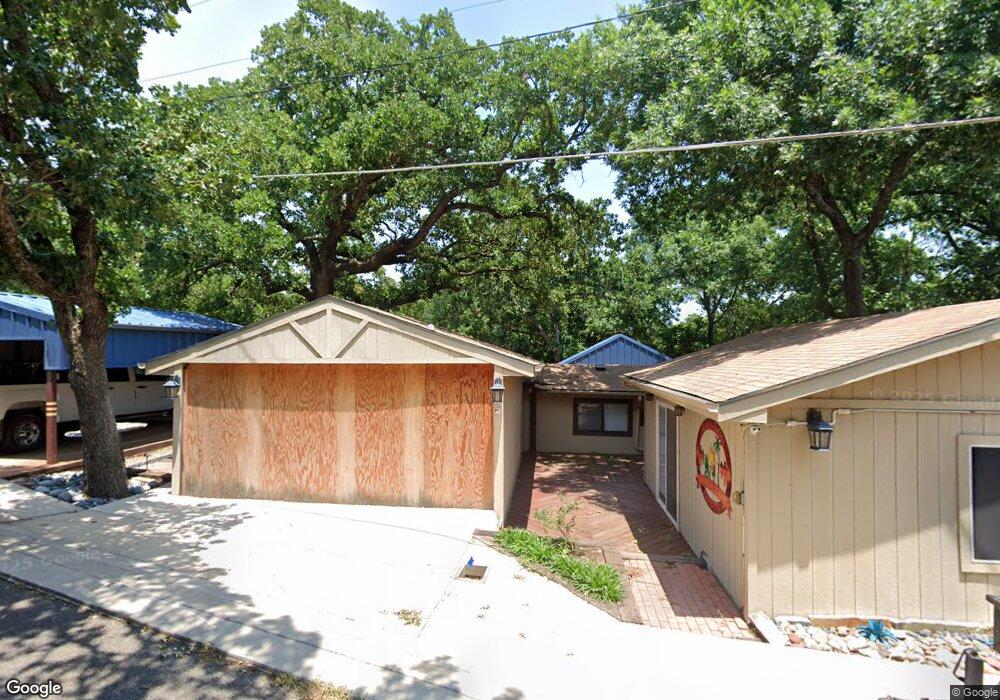
294 Black Forest Dr Pottsboro, TX 75076
Estimated Value: $284,590 - $506,000
--
Bed
--
Bath
1,751
Sq Ft
$236/Sq Ft
Est. Value
About This Home
This home is located at 294 Black Forest Dr, Pottsboro, TX 75076 and is currently estimated at $412,898, approximately $235 per square foot. 294 Black Forest Dr is a home located in Grayson County with nearby schools including Pottsboro Elementary School, Pottsboro Middle School, and Pottsboro High School.
Ownership History
Date
Name
Owned For
Owner Type
Purchase Details
Closed on
Jun 29, 2011
Sold by
Wood Clarence J and Wood Mary E
Bought by
Stumberg Julie K and Stumberg Richard
Current Estimated Value
Home Financials for this Owner
Home Financials are based on the most recent Mortgage that was taken out on this home.
Original Mortgage
$40,000
Outstanding Balance
$2,883
Interest Rate
3.88%
Mortgage Type
New Conventional
Estimated Equity
$410,015
Create a Home Valuation Report for This Property
The Home Valuation Report is an in-depth analysis detailing your home's value as well as a comparison with similar homes in the area
Home Values in the Area
Average Home Value in this Area
Purchase History
| Date | Buyer | Sale Price | Title Company |
|---|---|---|---|
| Stumberg Julie K | -- | Providence Title Co |
Source: Public Records
Mortgage History
| Date | Status | Borrower | Loan Amount |
|---|---|---|---|
| Open | Stumberg Julie K | $40,000 |
Source: Public Records
Tax History Compared to Growth
Tax History
| Year | Tax Paid | Tax Assessment Tax Assessment Total Assessment is a certain percentage of the fair market value that is determined by local assessors to be the total taxable value of land and additions on the property. | Land | Improvement |
|---|---|---|---|---|
| 2025 | $997 | $195,818 | -- | -- |
| 2024 | $2,466 | $178,016 | $0 | $0 |
| 2023 | $998 | $161,833 | $0 | $0 |
| 2022 | $1,705 | $147,121 | $0 | $0 |
| 2021 | $2,175 | $156,127 | $13,525 | $142,602 |
| 2020 | $2,053 | $137,054 | $14,878 | $122,176 |
| 2019 | $1,956 | $141,896 | $18,935 | $122,961 |
| 2018 | $1,800 | $121,722 | $10,820 | $110,902 |
| 2017 | $1,658 | $111,820 | $10,820 | $101,000 |
| 2016 | $1,507 | $112,143 | $10,820 | $101,323 |
| 2015 | $950 | $71,111 | $10,820 | $60,291 |
| 2014 | $1,284 | $68,942 | $10,820 | $58,122 |
Source: Public Records
Map
Nearby Homes
- 16 Wales Dr
- 191 Black Forest Dr
- 226 Cambridge Dr
- 491 Black Forest Dr
- 142 Wales Dr
- 207 Wales Dr
- 545 Black Forest Dr
- 81 Windsor Dr
- 83 Mayfield Ln
- 34 Cambridge Dr
- 11 Mayfield Ln
- 344 Castle Dr
- 219 Ray Rd
- 33 Queens Dr
- 116 Oak Hills Dr
- 766 Lakepoint Loop
- 118 Hacienda Dr
- 258 Lou-Sand Hill Rd
- 188 Hacienda Dr
- 588 Lakepoint Loop
- 278 Oxford Dr
- 278 Black Forest Dr
- 328 Black Forest Dr
- 210 Black Forest Dr
- 262 Black Forest Dr
- 35 Author Dr
- 237 Cedar Oak Dr
- 341 Black Forest Dr
- 341 Black Forest Dr
- 302 Cambridge Dr
- 1 Wales Dr
- 271 Cambridge Dr
- 401 Black Forest Dr
- 272 Cambridge Dr
- 0 Westminster
- 364 Black Forest Dr
- 467 Black Forest Dr
- 47 Wales Dr
- 245 Cambridge Dr
- 248 Cambridge Dr