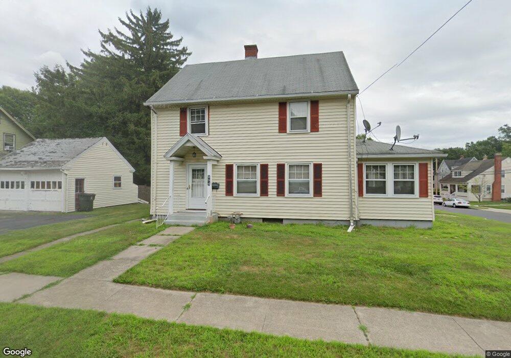
294 Whiting Ln West Hartford, CT 06119
Estimated Value: $405,154 - $435,000
4
Beds
2
Baths
1,700
Sq Ft
$245/Sq Ft
Est. Value
About This Home
This home is located at 294 Whiting Ln, West Hartford, CT 06119 and is currently estimated at $416,539, approximately $245 per square foot. 294 Whiting Ln is a home located in Hartford County with nearby schools including Smith School, King Philip Middle School, and Hall High School.
Ownership History
Date
Name
Owned For
Owner Type
Purchase Details
Closed on
Jul 3, 2008
Sold by
Demers Joseph C and Yager Lorraine T
Bought by
Amin Dipak K and Amin Dakshaben D
Current Estimated Value
Home Financials for this Owner
Home Financials are based on the most recent Mortgage that was taken out on this home.
Original Mortgage
$180,000
Outstanding Balance
$115,769
Interest Rate
6.01%
Estimated Equity
$300,770
Create a Home Valuation Report for This Property
The Home Valuation Report is an in-depth analysis detailing your home's value as well as a comparison with similar homes in the area
Home Values in the Area
Average Home Value in this Area
Purchase History
| Date | Buyer | Sale Price | Title Company |
|---|---|---|---|
| Amin Dipak K | $230,000 | -- |
Source: Public Records
Mortgage History
| Date | Status | Borrower | Loan Amount |
|---|---|---|---|
| Open | Amin Dipak K | $180,000 |
Source: Public Records
Tax History Compared to Growth
Tax History
| Year | Tax Paid | Tax Assessment Tax Assessment Total Assessment is a certain percentage of the fair market value that is determined by local assessors to be the total taxable value of land and additions on the property. | Land | Improvement |
|---|---|---|---|---|
| 2025 | $8,369 | $186,900 | $68,950 | $117,950 |
| 2024 | $7,915 | $186,900 | $68,950 | $117,950 |
| 2023 | $7,648 | $186,900 | $68,950 | $117,950 |
| 2022 | $7,603 | $186,900 | $68,950 | $117,950 |
| 2021 | $7,311 | $172,340 | $62,650 | $109,690 |
| 2020 | $6,469 | $154,770 | $53,620 | $101,150 |
| 2019 | $6,469 | $154,770 | $53,620 | $101,150 |
| 2018 | $6,346 | $154,770 | $53,620 | $101,150 |
| 2017 | $6,352 | $154,770 | $53,620 | $101,150 |
| 2016 | $6,107 | $154,560 | $52,150 | $102,410 |
| 2015 | $5,921 | $154,560 | $52,150 | $102,410 |
| 2014 | $5,776 | $154,560 | $52,150 | $102,410 |
Source: Public Records
Map
Nearby Homes
- 11 Crosby St
- 102 Oakwood Ave Unit B5
- 89 Price Blvd
- 136 Kane St Unit B10
- 50 Acadia St
- 100 Kane St Unit D10
- 72 Saint Charles St
- 39 Fairlawn St
- 26 Saint Augustine St
- 99 Caya Ave
- 16 Lockwood Terrace
- 395 Park Rd
- 69 Saint Augustine St
- 101 Madison Ave
- 89 Madison Ave Unit 91
- 61 Woodmere Rd
- 90-92 Rowe Ave
- 478 Prospect Ave
- 101 Englewood Ave
- 54 James St Unit 56
- 22 Richard St
- 290 Whiting Ln
- 34 Richard St
- 16 Richard St
- 38 Richard St
- 27 Richard St
- 282 Whiting Ln
- 21 Richard St
- 33 Richard St
- 17 Richard St
- 283 Whiting Ln
- 5 Richard St
- 39 Richard St
- 278 Whiting Ln
- 79 Oakwood Ave Unit 79 Oakwood
- 77 Oakwood Ave
- 81 Oakwood Ave
- 279 Whiting Ln
- 87 Oakwood Ave
- 46 Richard St