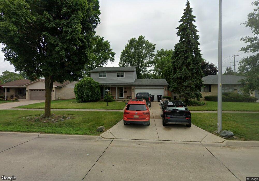
29420 Lyndon St Livonia, MI 48154
Estimated Value: $334,000 - $379,000
3
Beds
2
Baths
1,611
Sq Ft
$220/Sq Ft
Est. Value
About This Home
This home is located at 29420 Lyndon St, Livonia, MI 48154 and is currently estimated at $353,901, approximately $219 per square foot. 29420 Lyndon St is a home located in Wayne County with nearby schools including Roosevelt Elementary School, Emerson Middle School, and Cooper Upper Elementary School.
Ownership History
Date
Name
Owned For
Owner Type
Purchase Details
Closed on
Aug 21, 2000
Sold by
Russell Jerry L
Bought by
Sissom Gary L
Current Estimated Value
Purchase Details
Closed on
Apr 13, 1995
Sold by
Williamson Theodore R
Bought by
Russell Jerry L and Russell Sandra
Purchase Details
Closed on
Jul 25, 1994
Sold by
Pryor John C
Bought by
Theodore R Williamson
Home Financials for this Owner
Home Financials are based on the most recent Mortgage that was taken out on this home.
Original Mortgage
$106,200
Interest Rate
8.72%
Mortgage Type
New Conventional
Create a Home Valuation Report for This Property
The Home Valuation Report is an in-depth analysis detailing your home's value as well as a comparison with similar homes in the area
Home Values in the Area
Average Home Value in this Area
Purchase History
| Date | Buyer | Sale Price | Title Company |
|---|---|---|---|
| Sissom Gary L | $172,400 | -- | |
| Russell Jerry L | $122,000 | -- | |
| Theodore R Williamson | $118,000 | -- |
Source: Public Records
Mortgage History
| Date | Status | Borrower | Loan Amount |
|---|---|---|---|
| Previous Owner | Theodore R Williamson | $106,200 |
Source: Public Records
Tax History Compared to Growth
Tax History
| Year | Tax Paid | Tax Assessment Tax Assessment Total Assessment is a certain percentage of the fair market value that is determined by local assessors to be the total taxable value of land and additions on the property. | Land | Improvement |
|---|---|---|---|---|
| 2025 | $2,036 | $165,200 | $0 | $0 |
| 2024 | $2,036 | $157,700 | $0 | $0 |
| 2023 | $1,942 | $146,300 | $0 | $0 |
| 2022 | $3,474 | $128,000 | $0 | $0 |
| 2021 | $3,375 | $123,100 | $0 | $0 |
| 2019 | $3,251 | $107,100 | $0 | $0 |
| 2018 | $1,642 | $97,500 | $0 | $0 |
| 2017 | $3,048 | $94,500 | $0 | $0 |
| 2016 | $3,334 | $89,400 | $0 | $0 |
| 2015 | $7,213 | $77,340 | $0 | $0 |
| 2012 | -- | $68,690 | $16,440 | $52,250 |
Source: Public Records
Map
Nearby Homes
- 29631 Lyndon St
- 29831 Oakley St
- 14962 Beatrice St
- 29109 Perth St
- 14334 Sunbury St
- 29760 Hoy St
- 30261 Buckingham St
- 30831 Lyndon St
- 14127 Hillcrest St
- 15608 Hidden Ln
- 28692 Bayberry Park Dr
- 14292 Hubbell St
- 14154 Hubbell St
- 31221 Lyndon St
- 31126 Grennada St
- 14164 Bainbridge St
- 27674 Western Golf Dr
- 14907 Taylor Blvd
- 15345 Bainbridge St
- 14920 Taylor Blvd
- 29432 Lyndon St
- 29408 Lyndon St
- 29421 Lori St
- 29444 Lyndon St
- 29409 Lori St
- 29433 Lori St
- 29445 Lori St
- 29510 Lyndon St
- 29429 Lyndon St
- 29407 Lyndon St
- 29443 Lyndon St
- 29457 Lori St
- 29526 Lyndon St
- 29290 Lyndon St
- 29505 Lyndon St
- 29511 Lori St
- 29247 Lori St
- 29420 Lori St
- 29426 Oakview St
- 29432 Lori St