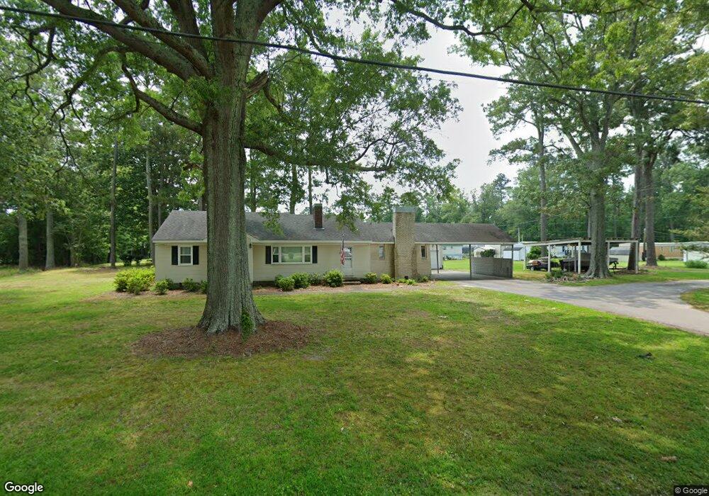
2957 Kings Hwy Suffolk, VA 23435
Sleepy Hole NeighborhoodEstimated Value: $1,633,179
3
Beds
2
Baths
1,572
Sq Ft
$1,039/Sq Ft
Est. Value
About This Home
This home is located at 2957 Kings Hwy, Suffolk, VA 23435 and is currently estimated at $1,633,179, approximately $1,038 per square foot. 2957 Kings Hwy is a home located in Suffolk City with nearby schools including Driver Elementary School, John Yeates Middle School, and Nansemond River High School.
Ownership History
Date
Name
Owned For
Owner Type
Purchase Details
Closed on
May 6, 2025
Sold by
Blair Thomas W and Blair Karen V
Bought by
Outlaw Mhp Llc
Current Estimated Value
Home Financials for this Owner
Home Financials are based on the most recent Mortgage that was taken out on this home.
Original Mortgage
$1,475,000
Outstanding Balance
$1,469,777
Interest Rate
6.65%
Mortgage Type
Seller Take Back
Estimated Equity
$163,402
Create a Home Valuation Report for This Property
The Home Valuation Report is an in-depth analysis detailing your home's value as well as a comparison with similar homes in the area
Home Values in the Area
Average Home Value in this Area
Purchase History
| Date | Buyer | Sale Price | Title Company |
|---|---|---|---|
| Outlaw Mhp Llc | $1,625,000 | Old Republic Title |
Source: Public Records
Mortgage History
| Date | Status | Borrower | Loan Amount |
|---|---|---|---|
| Open | Outlaw Mhp Llc | $1,475,000 |
Source: Public Records
Tax History Compared to Growth
Tax History
| Year | Tax Paid | Tax Assessment Tax Assessment Total Assessment is a certain percentage of the fair market value that is determined by local assessors to be the total taxable value of land and additions on the property. | Land | Improvement |
|---|---|---|---|---|
| 2024 | $7,261 | $577,700 | $498,700 | $79,000 |
| 2023 | $7,261 | $577,700 | $498,700 | $79,000 |
| 2022 | $6,297 | $577,700 | $498,700 | $79,000 |
| 2021 | $4,918 | $443,100 | $364,800 | $78,300 |
| 2020 | $4,880 | $439,600 | $364,800 | $74,800 |
| 2019 | $4,933 | $444,400 | $364,800 | $79,600 |
| 2018 | $5,277 | $444,500 | $364,800 | $79,700 |
| 2017 | $4,756 | $444,500 | $364,800 | $79,700 |
| 2016 | $4,756 | $444,500 | $364,800 | $79,700 |
| 2015 | $2,564 | $444,500 | $364,800 | $79,700 |
| 2014 | $2,564 | $444,500 | $364,800 | $79,700 |
Source: Public Records
Map
Nearby Homes
- 3010 Beech Grove Ln
- 3109 Driver Station Way
- Lot 30 Patrick Dr
- 3102 Caroline Crescent
- 2226 Patrick Dr
- 3019 Dalton Cir
- 3023 Dalton Cir
- 3029 Dalton Cir
- 3017 Dalton Cir
- 3014 Dalton Cir
- 3021 Dalton Cir
- 2221 Patrick Dr
- 2213 Patrick Dr
- 2228 Patrick Dr
- 2241 Patrick Dr
- 2030 Canvasback Dr
- 2230 Patrick Dr
- 3032 Dalton Cir
- Franklin Plan at Creekside Reserve
- Taylor Plan at Creekside Reserve
- 2972 Kings Hwy
- 2944 Kings Hwy
- 2999 Kings Hwy
- 2938 Kings Hwy
- 2998 Kings Hwy
- 3017 Kings Hwy
- 1 Blair Brothers Rd
- 3021 Kings Hwy
- 3016 Kings Hwy
- 2948 Kings Hwy
- 3024 Kings Hwy
- 4109 Driver Ln
- 3033 Kings Hwy
- 3036 Kings Hwy
- 4087 Driver Ln
- 3040 Kings Hwy
- 3049 Kings Hwy
- 4237 Driver Ln
- 3057 Kings Hwy
- 3056 Kings Hwy