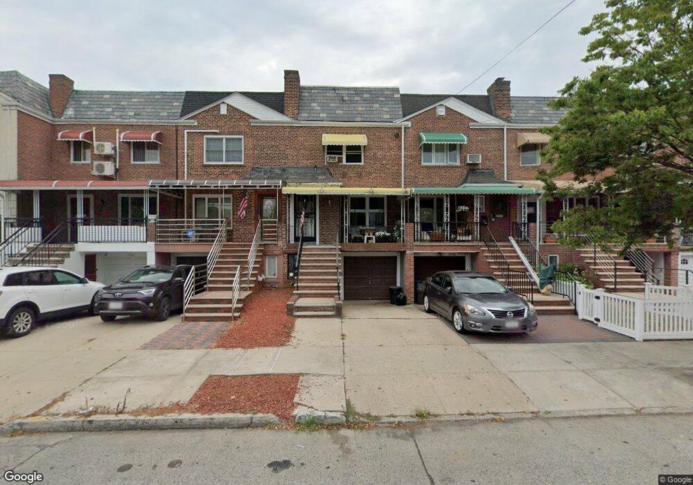
2960 Avenue R Brooklyn, NY 11229
Madison NeighborhoodEstimated Value: $805,000 - $915,000
--
Bed
--
Bath
1,780
Sq Ft
$479/Sq Ft
Est. Value
About This Home
This home is located at 2960 Avenue R, Brooklyn, NY 11229 and is currently estimated at $853,126, approximately $479 per square foot. 2960 Avenue R is a home located in Kings County with nearby schools including PS 222 Katherine R Snyder, J.H.S. 278 Marine Park, and James Madison High School.
Ownership History
Date
Name
Owned For
Owner Type
Purchase Details
Closed on
Nov 23, 2010
Sold by
Michael Beck As Trustee and The Catherine Mccarthy Family Trust
Bought by
Fountaine Peter
Current Estimated Value
Purchase Details
Closed on
Aug 8, 2006
Sold by
Hassan Margaret and Mccarthy Catherine
Bought by
The Catherine Mccarthy Family Trust
Create a Home Valuation Report for This Property
The Home Valuation Report is an in-depth analysis detailing your home's value as well as a comparison with similar homes in the area
Home Values in the Area
Average Home Value in this Area
Purchase History
| Date | Buyer | Sale Price | Title Company |
|---|---|---|---|
| Fountaine Peter | $425,000 | -- | |
| Fountaine Peter | $425,000 | -- | |
| The Catherine Mccarthy Family Trust | -- | -- | |
| The Catherine Mccarthy Family Trust | -- | -- |
Source: Public Records
Tax History Compared to Growth
Tax History
| Year | Tax Paid | Tax Assessment Tax Assessment Total Assessment is a certain percentage of the fair market value that is determined by local assessors to be the total taxable value of land and additions on the property. | Land | Improvement |
|---|---|---|---|---|
| 2025 | $6,816 | $50,160 | $8,340 | $41,820 |
| 2024 | $6,816 | $43,920 | $8,340 | $35,580 |
| 2023 | $6,734 | $49,020 | $8,340 | $40,680 |
| 2022 | $4,959 | $48,240 | $8,340 | $39,900 |
| 2021 | $6,667 | $47,400 | $8,340 | $39,060 |
| 2020 | $3,117 | $43,140 | $8,340 | $34,800 |
| 2019 | $5,866 | $43,140 | $8,340 | $34,800 |
| 2018 | $5,573 | $28,800 | $5,537 | $23,263 |
| 2017 | $5,571 | $28,800 | $6,751 | $22,049 |
| 2016 | $5,202 | $27,572 | $7,006 | $20,566 |
| 2015 | $3,492 | $26,012 | $8,158 | $17,854 |
| 2014 | $3,492 | $24,540 | $9,240 | $15,300 |
Source: Public Records
Map
Nearby Homes
- 1848 Haring St
- 3165 Nostrand Ave Unit 1N
- 3165 Nostrand Ave Unit 2L
- 3165 Nostrand Ave Unit 4P
- 3165 Nostrand Ave Unit 4V
- 3165 Nostrand Ave Unit 1H
- 3165 Nostrand Ave Unit 1G
- 3165 Nostrand Ave Unit 1S
- 3165 Nostrand Ave Unit 1P
- 3203 Nostrand Ave Unit 4H
- 3203 Nostrand Ave Unit LB
- 1908 Gerritsen Ave
- 3178 Nostrand Ave Unit 1C
- 3178 Nostrand Ave Unit 1M
- 1882 Batchelder St
- 2622 Fillmore Ave
- 1746 Gerritsen Ave
- 2810 Avenue R
- 1934 Haring St
- 1837 Burnett St
- 2958 Avenue R
- 2962 Avenue R
- 2956 Avenue R
- 2964 Avenue R
- 2954 Avenue R
- 2966 Avenue R
- 1815 Haring St
- 1850 Gerritsen Ave
- 1817 Haring St
- 1852 Gerritsen Ave
- 1819 Haring St
- 1821 Haring St
- 1808 Haring St
- 1856 Gerritsen Ave
- 1823 Haring St
- 1820 Brown St
- 2950 Avenue R
- 1825 Haring St
- 1816 Gerritsen Ave
- 1824 Brown St