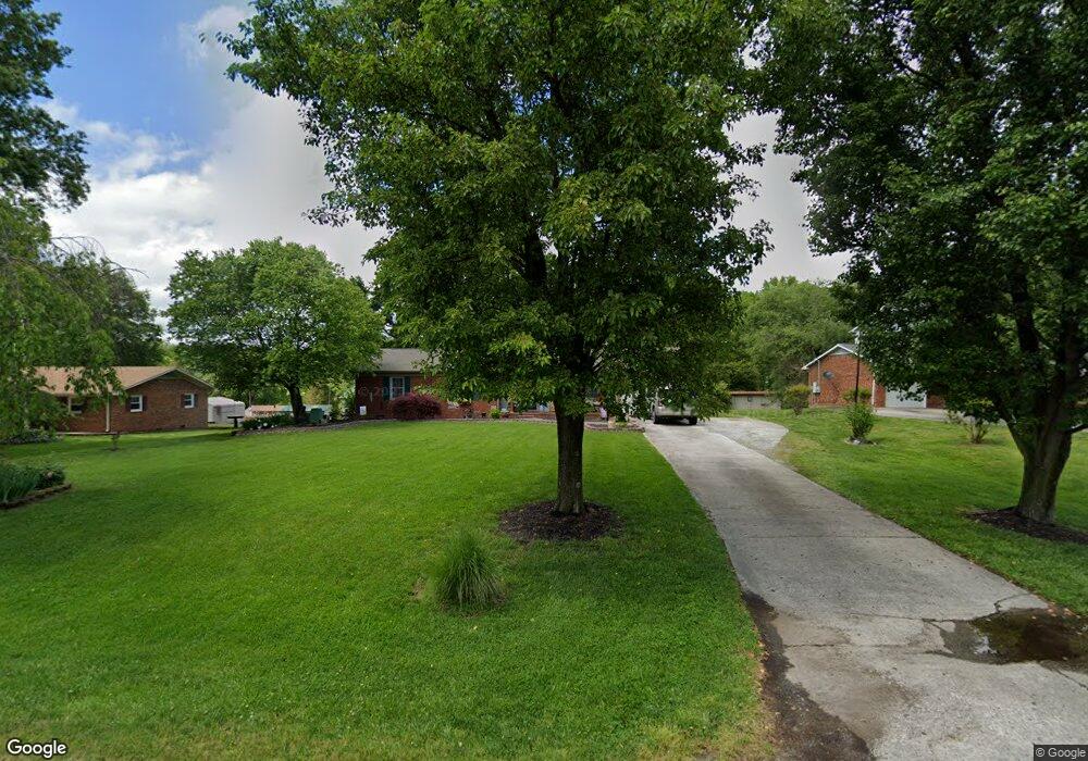
2960 Ebb Shore Dr High Point, NC 27263
Estimated Value: $245,000 - $288,000
3
Beds
2
Baths
1,765
Sq Ft
$151/Sq Ft
Est. Value
About This Home
This home is located at 2960 Ebb Shore Dr, High Point, NC 27263 and is currently estimated at $267,028, approximately $151 per square foot. 2960 Ebb Shore Dr is a home located in Randolph County with nearby schools including John R. Lawrence Elementary School, Wheatmore Middle School, and Trinity High School.
Ownership History
Date
Name
Owned For
Owner Type
Purchase Details
Closed on
Aug 30, 2006
Sold by
Coltrane Karen and Allred Tony R
Bought by
Greene Richard D and Greene Angela D
Current Estimated Value
Home Financials for this Owner
Home Financials are based on the most recent Mortgage that was taken out on this home.
Original Mortgage
$139,000
Outstanding Balance
$88,880
Interest Rate
7.99%
Mortgage Type
Purchase Money Mortgage
Estimated Equity
$178,148
Create a Home Valuation Report for This Property
The Home Valuation Report is an in-depth analysis detailing your home's value as well as a comparison with similar homes in the area
Home Values in the Area
Average Home Value in this Area
Purchase History
| Date | Buyer | Sale Price | Title Company |
|---|---|---|---|
| Greene Richard D | $139,000 | None Available |
Source: Public Records
Mortgage History
| Date | Status | Borrower | Loan Amount |
|---|---|---|---|
| Open | Greene Richard D | $139,000 |
Source: Public Records
Tax History Compared to Growth
Tax History
| Year | Tax Paid | Tax Assessment Tax Assessment Total Assessment is a certain percentage of the fair market value that is determined by local assessors to be the total taxable value of land and additions on the property. | Land | Improvement |
|---|---|---|---|---|
| 2025 | $1,181 | $161,670 | $34,510 | $127,160 |
| 2024 | $1,165 | $161,670 | $34,510 | $127,160 |
| 2023 | $1,165 | $161,670 | $34,510 | $127,160 |
| 2022 | $968 | $110,590 | $20,840 | $89,750 |
| 2021 | $968 | $110,590 | $20,840 | $89,750 |
| 2020 | $960 | $110,590 | $20,840 | $89,750 |
| 2019 | $960 | $110,590 | $20,840 | $89,750 |
| 2018 | $970 | $107,990 | $20,840 | $87,150 |
| 2016 | $944 | $107,991 | $20,840 | $87,151 |
| 2015 | $947 | $107,991 | $20,840 | $87,151 |
| 2014 | -- | $107,991 | $20,840 | $87,151 |
Source: Public Records
Map
Nearby Homes
- 6955 Harlow Dr
- 6007 Checker Rd
- 0 Waterbury Dr
- 301 Oak Ridge Dr
- 108 Willow Terrace
- 6534 Frazier Marsh Rd
- 105 Willow Terrace
- 202 Oak Ridge Dr
- 105 Oak Ridge Dr
- 1843 Weant Rd
- 6318 Gray Farm Rd
- 6071 Weant Rd
- 107 Autumn Hill Ct
- 0 Harlow Rd
- 5988 Weant Rd
- 104 Autumn Hill Ct
- 115 Lindsay Dr
- 100 Lindsay Dr
- 0-C Us Highway 311
- 3827 Wood Ave
- 2952 Ebb Shore Dr
- 2980 Ebb Shore Dr
- 2938 Ebb Shore Dr
- 2959 Ebb Shore Dr
- 2967 Ebb Shore Dr
- 2955 Ebb Shore Dr
- 7105 Sleepy Hollow Dr
- 2979 Ebb Shore Dr
- 2937 Ebb Shore Dr
- 6924 Burrwood Dr
- 2929 Ebb Shore Dr
- 6938 Burrwood Dr
- 2993 Ebb Shore Dr
- 2908 Ebb Shore Dr
- 7106 Wincrest Dr
- 5515 Grove Forrest Dr
- 7104 Wincrest Dr
- 7104 Sleepy Hollow Dr
- 7108 Sleepy Hollow Dr
- 7100 Sleepy Hollow Dr