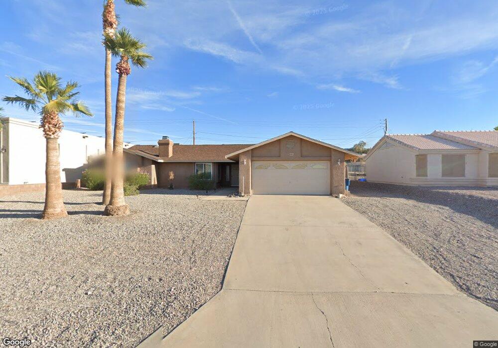
2991 Indian Land Dr Lake Havasu City, AZ 86406
Estimated Value: $426,000 - $505,896
3
Beds
2
Baths
1,711
Sq Ft
$278/Sq Ft
Est. Value
About This Home
This home is located at 2991 Indian Land Dr, Lake Havasu City, AZ 86406 and is currently estimated at $475,474, approximately $277 per square foot. 2991 Indian Land Dr is a home located in Mohave County with nearby schools including Starline Elementary School, Thunderbolt Middle School, and Lake Havasu High School.
Ownership History
Date
Name
Owned For
Owner Type
Purchase Details
Closed on
May 19, 2005
Sold by
Becker Frederick Ernest and Hood Irma Irmergard
Bought by
Cruz Manuel and Cruz Kathryn E
Current Estimated Value
Home Financials for this Owner
Home Financials are based on the most recent Mortgage that was taken out on this home.
Original Mortgage
$211,350
Outstanding Balance
$109,348
Interest Rate
5.72%
Mortgage Type
Fannie Mae Freddie Mac
Estimated Equity
$366,126
Purchase Details
Closed on
Jun 10, 1999
Sold by
Becker Frederick E and Hood Irma I
Bought by
Becker Frederick Earnest and Hood Irma Irmergard
Create a Home Valuation Report for This Property
The Home Valuation Report is an in-depth analysis detailing your home's value as well as a comparison with similar homes in the area
Home Values in the Area
Average Home Value in this Area
Purchase History
| Date | Buyer | Sale Price | Title Company |
|---|---|---|---|
| Cruz Manuel | $222,500 | First American Title Ins Co | |
| Becker Frederick Earnest | -- | -- |
Source: Public Records
Mortgage History
| Date | Status | Borrower | Loan Amount |
|---|---|---|---|
| Open | Cruz Manuel | $211,350 |
Source: Public Records
Tax History Compared to Growth
Tax History
| Year | Tax Paid | Tax Assessment Tax Assessment Total Assessment is a certain percentage of the fair market value that is determined by local assessors to be the total taxable value of land and additions on the property. | Land | Improvement |
|---|---|---|---|---|
| 2026 | $814 | -- | -- | -- |
| 2025 | $1,651 | $42,347 | $0 | $0 |
| 2024 | $1,651 | $44,787 | $0 | $0 |
| 2023 | $1,651 | $36,961 | $0 | $0 |
| 2022 | $1,580 | $27,098 | $0 | $0 |
| 2021 | $1,750 | $24,933 | $0 | $0 |
| 2019 | $1,663 | $20,763 | $0 | $0 |
| 2018 | $1,607 | $19,183 | $0 | $0 |
| 2017 | $1,591 | $17,960 | $0 | $0 |
| 2016 | $1,442 | $16,396 | $0 | $0 |
| 2015 | $1,233 | $12,467 | $0 | $0 |
Source: Public Records
Map
Nearby Homes
- 3066 Star Dr
- 3150 Star Dr
- 2890 Yuma Dr
- 3135 Cotati Dr
- 700 Apache Dr
- 2820 Indian Springs Dr
- 850 Thunderbolt Ave
- 2970 War Eagle Dr
- 815 Rolling Hills Plaza N
- 2910 Coconino Dr
- 680 Yosemite Dr
- 3261 Thundercloud Dr
- 691 Rolling Hills Dr
- 532 Roanoke Dr
- 786 Powder Dr
- 2951 Inca Dr
- 2821 Indian Pipe Dr
- 2741 Jericho Dr
- 3118 Shoshone Dr
- 3040 Gypsy Dr
- 2981 Indian Land Dr
- 2981 Indian Land
- 2981 Indian Land Dr
- 3001 Indian Land Dr
- 2971 Indian Land Dr
- 3021 Star Dr
- 3011 Indian Land Dr
- 2980 Indian Land Dr
- 2970 Indian Land Dr
- 3031 Star Dr
- 2990 Indian Land Dr
- 2961 Indian Land Dr
- 2960 Indian Land Dr
- 3041 Star Dr
- 3000 Indian Land Dr
- 2950 Indian Land Dr
- 2951 Indian Land Dr
- 2975 Yuma Dr
- 2981 Yuma Dr
- 3051 Star Dr