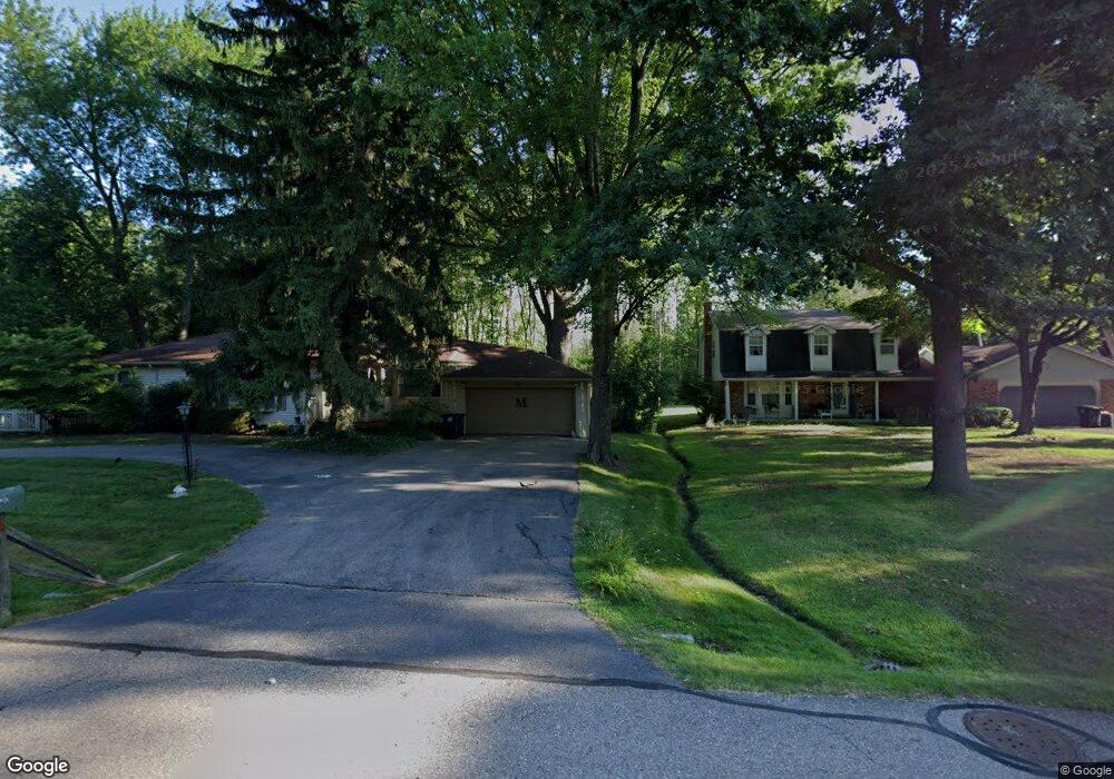
29930 Munger Dr Livonia, MI 48154
Estimated Value: $255,000 - $321,000
--
Bed
2
Baths
1,150
Sq Ft
$241/Sq Ft
Est. Value
About This Home
This home is located at 29930 Munger Dr, Livonia, MI 48154 and is currently estimated at $277,630, approximately $241 per square foot. 29930 Munger Dr is a home located in Wayne County with nearby schools including Riley Upper Elementary School, Buchanan Elementary School, and Holmes Middle School.
Ownership History
Date
Name
Owned For
Owner Type
Purchase Details
Closed on
Oct 29, 2020
Sold by
Michelson Dale S and Michelson Diane C
Bought by
Michelson Dale S and Michelson Diane C
Current Estimated Value
Home Financials for this Owner
Home Financials are based on the most recent Mortgage that was taken out on this home.
Original Mortgage
$98,500
Outstanding Balance
$54,442
Interest Rate
2.9%
Mortgage Type
New Conventional
Estimated Equity
$223,188
Purchase Details
Closed on
Oct 18, 2018
Sold by
Michelson Dale S
Bought by
Michelson Dale S and Michelson Dianme C
Purchase Details
Closed on
Aug 27, 2003
Sold by
Caswell Harry L and Caswell Gayle W
Bought by
Michelson Dale S
Purchase Details
Closed on
Mar 20, 2001
Sold by
Caswell Gayle W
Bought by
Caswell Gayle W
Create a Home Valuation Report for This Property
The Home Valuation Report is an in-depth analysis detailing your home's value as well as a comparison with similar homes in the area
Home Values in the Area
Average Home Value in this Area
Purchase History
| Date | Buyer | Sale Price | Title Company |
|---|---|---|---|
| Michelson Dale S | -- | Devon Title Agency | |
| Michelson Dale S | -- | Devon Title Agency | |
| Michelson Dale S | -- | None Available | |
| Michelson Dale S | $195,000 | Multiple | |
| Caswell Gayle W | -- | -- |
Source: Public Records
Mortgage History
| Date | Status | Borrower | Loan Amount |
|---|---|---|---|
| Open | Michelson Dale S | $98,500 |
Source: Public Records
Tax History Compared to Growth
Tax History
| Year | Tax Paid | Tax Assessment Tax Assessment Total Assessment is a certain percentage of the fair market value that is determined by local assessors to be the total taxable value of land and additions on the property. | Land | Improvement |
|---|---|---|---|---|
| 2025 | $1,627 | $113,500 | $0 | $0 |
| 2024 | $1,627 | $102,200 | $0 | $0 |
| 2023 | $1,552 | $94,900 | $0 | $0 |
| 2022 | $2,725 | $85,300 | $0 | $0 |
| 2021 | $2,647 | $81,700 | $0 | $0 |
| 2019 | $2,540 | $76,300 | $0 | $0 |
| 2018 | $1,312 | $71,000 | $0 | $0 |
| 2017 | $2,322 | $69,500 | $0 | $0 |
| 2016 | $2,311 | $67,900 | $0 | $0 |
| 2015 | $5,595 | $59,700 | $0 | $0 |
| 2012 | -- | $55,460 | $20,000 | $35,460 |
Source: Public Records
Map
Nearby Homes
- 29945 6 Mile Rd
- 30115 Munger Dr
- 30425 Munger Dr
- 29836 Bobrich St
- 15608 Hidden Ln
- 31069 Munger Dr
- 29106 Broadmoor St
- 31366 Mayville St
- 29721 Pickford St
- 28692 Bayberry Park Dr
- 31005 Roycroft St
- 29760 Hoy St
- 15345 Bainbridge St
- 18061 Lathers St
- 29560 Clarita St Unit 11
- 18659 Flamingo Blvd
- 18001 Floral St
- 18725 Flamingo Blvd
- 18071 Floral St
- 14962 Beatrice St
- 0 Munger Dr Unit 3253616
- 0 Munger Dr Unit 3258900
- 29950 Munger St
- 29960 Munger St
- 29900 Munger Dr
- 29970 Munger Dr
- 29931 Munger Dr
- 29860 Munger St
- 29970 Munger St
- 29963 Munger Dr
- 29640 Munger Dr
- 29998 Munger Dr
- 29998 Munger St
- 29641 Munger Dr
- 29634 Munger Dr
- 30024 Munger St
- 30009 Munger St
- 29635 Munger St
- 29905 Munger St
- 29991 Munger St