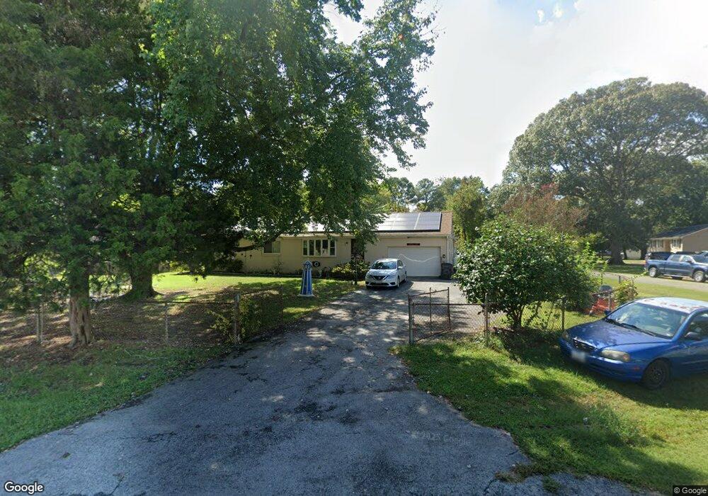
29977 Burton Rd Mechanicsville, MD 20659
Estimated Value: $364,055 - $416,000
--
Bed
2
Baths
2,120
Sq Ft
$187/Sq Ft
Est. Value
About This Home
This home is located at 29977 Burton Rd, Mechanicsville, MD 20659 and is currently estimated at $397,014, approximately $187 per square foot. 29977 Burton Rd is a home located in St. Mary's County with nearby schools including Lettie Marshall Dent Elementary School, Margaret Brent Middle School, and Chopticon High School.
Ownership History
Date
Name
Owned For
Owner Type
Purchase Details
Closed on
Apr 23, 2002
Sold by
Zelaya Patricia A
Bought by
Denham Ronald William and Denham Patricia A
Current Estimated Value
Purchase Details
Closed on
Oct 3, 1991
Sold by
Zelaya Joseph S
Bought by
Zelaya Patricia A
Home Financials for this Owner
Home Financials are based on the most recent Mortgage that was taken out on this home.
Original Mortgage
$100,000
Interest Rate
8.92%
Create a Home Valuation Report for This Property
The Home Valuation Report is an in-depth analysis detailing your home's value as well as a comparison with similar homes in the area
Home Values in the Area
Average Home Value in this Area
Purchase History
| Date | Buyer | Sale Price | Title Company |
|---|---|---|---|
| Denham Ronald William | -- | -- | |
| Zelaya Patricia A | $125,000 | -- |
Source: Public Records
Mortgage History
| Date | Status | Borrower | Loan Amount |
|---|---|---|---|
| Previous Owner | Zelaya Patricia A | $100,000 | |
| Closed | Denham Ronald William | -- |
Source: Public Records
Tax History Compared to Growth
Tax History
| Year | Tax Paid | Tax Assessment Tax Assessment Total Assessment is a certain percentage of the fair market value that is determined by local assessors to be the total taxable value of land and additions on the property. | Land | Improvement |
|---|---|---|---|---|
| 2025 | $3,366 | $320,367 | $0 | $0 |
| 2024 | $3,262 | $303,100 | $107,800 | $195,300 |
| 2023 | $3,139 | $291,733 | $0 | $0 |
| 2022 | $3,047 | $280,367 | $0 | $0 |
| 2021 | $2,957 | $269,000 | $100,700 | $168,300 |
| 2020 | $2,873 | $260,633 | $0 | $0 |
| 2019 | $2,791 | $252,267 | $0 | $0 |
| 2018 | $2,697 | $243,900 | $95,700 | $148,200 |
| 2017 | $2,678 | $243,900 | $0 | $0 |
| 2016 | -- | $243,900 | $0 | $0 |
| 2015 | $2,353 | $252,000 | $0 | $0 |
| 2014 | $2,353 | $252,000 | $0 | $0 |
Source: Public Records
Map
Nearby Homes
- 0 Bay Dr Unit MDSM2025208
- 0 Unknown Unit MDSM2021062
- 29845 Coolidge Dr
- 40147 Dockser Dr
- 29885 Washington Rd
- 0 Waterview Dr Unit MDSM2017204
- 30087 Cross Woods Dr
- 0 Scott Cir Unit MDSM2027260
- 29813 Scott Cir
- 30090 Cherokee Ct
- 7391 Benedict Ave
- 29954 Richard Cir
- 18980 Kennon Place
- 7267 Benedict Ave
- 29697 Dogwood Cir
- LOT 10 Bridgeview Place
- 29057 Ann Cir
- 39550 Mount Wolf Rd
- 7036 Grace Landing Ct
- 5935 Ketch Rd
- 29967 Burton Rd
- 40293 Wolfe Dr
- 29957 Burton Rd
- 29998 Burton Rd
- 40316 Wolfe Dr
- 40306 Wolfe Dr
- 40326 Wolfe Dr
- 40283 Wolfe Dr
- 29984 Burton Rd
- 29990 Burton Rd
- 40330 Half Moon Cir
- 29974 Burton Rd
- 29947 Burton Rd
- 40343 Wolfe Dr
- 40296 Wolfe Dr
- 40336 Wolfe Dr
- 29964 Burton Rd
- 40281 Wolfe Dr
- 40320 Half Moon Cir
- 40301 Waterview Dr