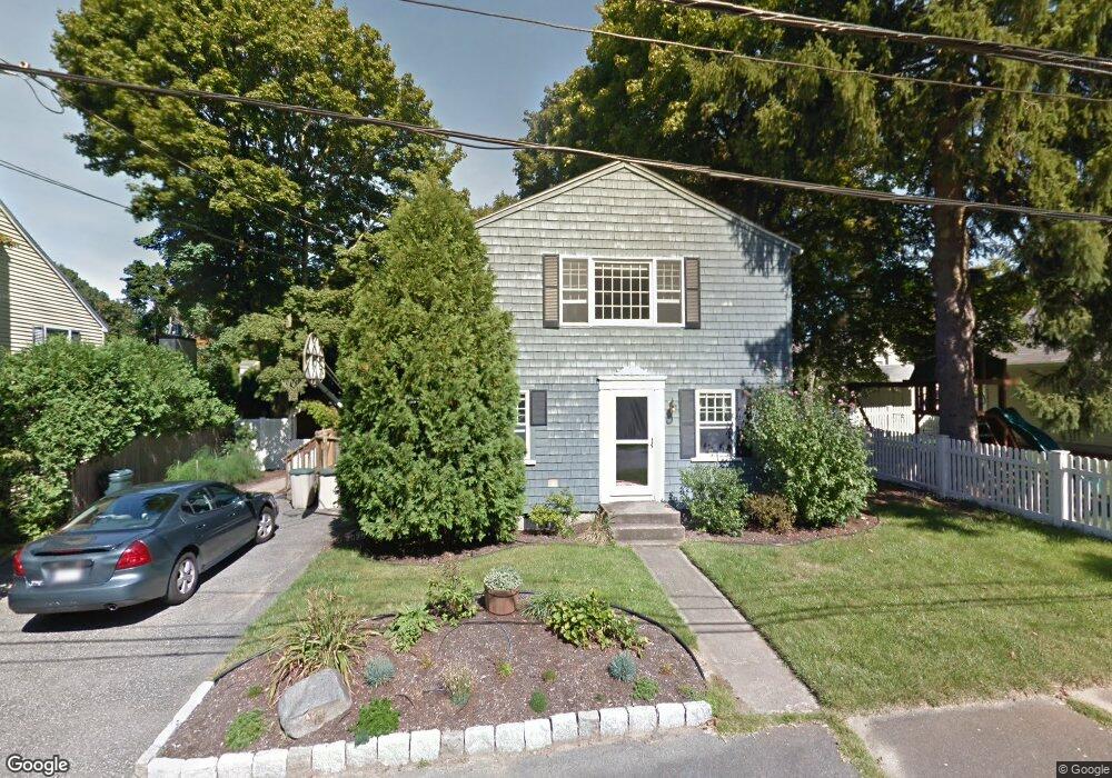
3 Bolser Ave Natick, MA 01760
Estimated Value: $833,624 - $970,000
3
Beds
2
Baths
1,920
Sq Ft
$475/Sq Ft
Est. Value
About This Home
This home is located at 3 Bolser Ave, Natick, MA 01760 and is currently estimated at $911,156, approximately $474 per square foot. 3 Bolser Ave is a home located in Middlesex County with nearby schools including Natick High School, J F Kennedy Middle School, and Johnson Elementary School.
Ownership History
Date
Name
Owned For
Owner Type
Purchase Details
Closed on
Oct 17, 2005
Sold by
Vantassel Alva D
Bought by
Santos Jaeda Noelle and Santos Peter F
Current Estimated Value
Home Financials for this Owner
Home Financials are based on the most recent Mortgage that was taken out on this home.
Original Mortgage
$359,200
Outstanding Balance
$192,503
Interest Rate
5.78%
Mortgage Type
Purchase Money Mortgage
Estimated Equity
$718,653
Create a Home Valuation Report for This Property
The Home Valuation Report is an in-depth analysis detailing your home's value as well as a comparison with similar homes in the area
Home Values in the Area
Average Home Value in this Area
Purchase History
| Date | Buyer | Sale Price | Title Company |
|---|---|---|---|
| Santos Jaeda Noelle | $449,800 | -- |
Source: Public Records
Mortgage History
| Date | Status | Borrower | Loan Amount |
|---|---|---|---|
| Open | Santos Jaeda Noelle | $359,200 |
Source: Public Records
Tax History Compared to Growth
Tax History
| Year | Tax Paid | Tax Assessment Tax Assessment Total Assessment is a certain percentage of the fair market value that is determined by local assessors to be the total taxable value of land and additions on the property. | Land | Improvement |
|---|---|---|---|---|
| 2025 | $8,294 | $693,500 | $391,800 | $301,700 |
| 2024 | $7,973 | $650,300 | $368,700 | $281,600 |
| 2023 | $7,865 | $622,200 | $354,900 | $267,300 |
| 2022 | $7,612 | $570,600 | $322,700 | $247,900 |
| 2021 | $7,230 | $531,200 | $304,200 | $227,000 |
| 2020 | $7,042 | $517,400 | $290,400 | $227,000 |
| 2019 | $4,635 | $517,400 | $290,400 | $227,000 |
| 2018 | $6,653 | $509,800 | $276,600 | $233,200 |
| 2017 | $4,251 | $442,700 | $235,100 | $207,600 |
| 2016 | $4,979 | $366,900 | $208,400 | $158,500 |
| 2015 | $4,899 | $354,500 | $208,400 | $146,100 |
Source: Public Records
Map
Nearby Homes
- 91 Speen St
- 1 Fern St
- 4 Sylvia Ave
- 40 Silver Hill Ln Unit 4
- 46 Silver Hill Ln Unit 1
- 9 Silver Hill Ln Unit 19
- 32 Silver Hill Ln Unit 1
- 26 Walden Dr Unit 4
- 12 Walden Dr Unit 19
- 2 Lodge Rd
- 16 West St
- 10 Kelsey Rd
- 57 Village Brook Ln Unit 5
- 50 Village Brook Ln Unit 4
- 25 Forest Ave
- 38 Ranger Rd
- 51 Village Brook Ln Unit 16
- 47 High St
- 216-218 S Main St
- 4 Village Rock Ln Unit 9