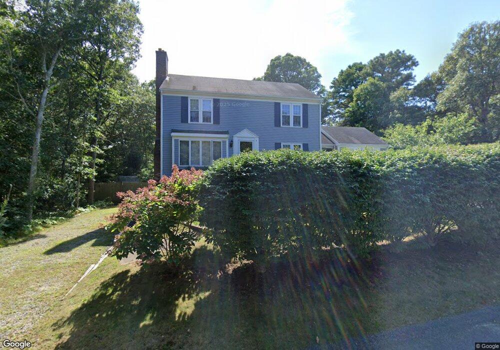
3 Hummock Ln Yarmouth Port, MA 02675
Yarmouth Port NeighborhoodEstimated Value: $678,000 - $851,000
3
Beds
3
Baths
1,760
Sq Ft
$435/Sq Ft
Est. Value
About This Home
This home is located at 3 Hummock Ln, Yarmouth Port, MA 02675 and is currently estimated at $766,135, approximately $435 per square foot. 3 Hummock Ln is a home located in Barnstable County with nearby schools including Dennis-Yarmouth Regional High School and St. Pius X. School.
Ownership History
Date
Name
Owned For
Owner Type
Purchase Details
Closed on
Apr 30, 2010
Sold by
Primrose David E and Primrose Sandra A
Bought by
Garbitt April J
Current Estimated Value
Home Financials for this Owner
Home Financials are based on the most recent Mortgage that was taken out on this home.
Original Mortgage
$353,479
Outstanding Balance
$236,226
Interest Rate
4.99%
Mortgage Type
Purchase Money Mortgage
Estimated Equity
$529,909
Purchase Details
Closed on
Dec 29, 2004
Sold by
Iannessa Virginia
Bought by
Primrose David E and Primrose Sandra A
Home Financials for this Owner
Home Financials are based on the most recent Mortgage that was taken out on this home.
Original Mortgage
$210,000
Interest Rate
5.73%
Mortgage Type
Purchase Money Mortgage
Create a Home Valuation Report for This Property
The Home Valuation Report is an in-depth analysis detailing your home's value as well as a comparison with similar homes in the area
Home Values in the Area
Average Home Value in this Area
Purchase History
| Date | Buyer | Sale Price | Title Company |
|---|---|---|---|
| Garbitt April J | $360,000 | -- | |
| Primrose David E | $435,000 | -- |
Source: Public Records
Mortgage History
| Date | Status | Borrower | Loan Amount |
|---|---|---|---|
| Open | Garbitt April J | $353,479 | |
| Previous Owner | Primrose David E | $210,000 |
Source: Public Records
Tax History Compared to Growth
Tax History
| Year | Tax Paid | Tax Assessment Tax Assessment Total Assessment is a certain percentage of the fair market value that is determined by local assessors to be the total taxable value of land and additions on the property. | Land | Improvement |
|---|---|---|---|---|
| 2025 | $4,763 | $672,800 | $172,000 | $500,800 |
| 2024 | $4,416 | $598,400 | $149,600 | $448,800 |
| 2023 | $4,378 | $539,800 | $136,000 | $403,800 |
| 2022 | $4,097 | $446,300 | $129,800 | $316,500 |
| 2021 | $3,703 | $387,300 | $129,800 | $257,500 |
| 2020 | $3,775 | $377,500 | $137,400 | $240,100 |
| 2019 | $3,614 | $357,800 | $137,400 | $220,400 |
| 2018 | $3,446 | $334,900 | $114,500 | $220,400 |
| 2017 | $3,356 | $334,900 | $114,500 | $220,400 |
| 2016 | $3,251 | $325,800 | $105,400 | $220,400 |
| 2015 | $3,266 | $325,300 | $100,800 | $224,500 |
Source: Public Records
Map
Nearby Homes
- 111 Merchant Ave
- 13 Covey Dr
- 6 Nimble Hill Dr
- 4 Ebb Rd
- 118 Driftwood Ln
- 153 Bayridge Dr
- 129 Driftwood Ln
- 11 Uncle Stanleys Way
- 59 Massachusetts 6a Unit 19-2
- 59 Main St Unit 19-2
- 59 Route 6a Unit 29-4
- 44 Stratford Ln
- 4 Old Colony Way
- 86 Pompano Rd
- 15 Captain Jud Rd
- 43 Canterbury Rd
- 64 Kates Path
- 34 Kates Path
- 34 Kates Path Unit 34
- 9 Hummock Ln
- 402 N Dennis Rd
- 4 Hummock Ln
- 10 Hummock Ln
- 15 Hummock Ln
- 417 N Dennis Rd
- 394A N Dennis Rd
- 394-A N Dennis Rd
- 11 Macomber Dr
- 394 N Dennis Rd
- 394 N Dennis Rd Unit A
- 22 Macomber Dr
- 16 Macomber Dr
- 28 Macomber Dr
- 384A N Dennis Rd
- 384 N Dennis Rd
- 384A N Dennis Rd
- 10 Macomber Dr
- 427 N Dennis Rd
- 23 Aunt Dorahs Ln