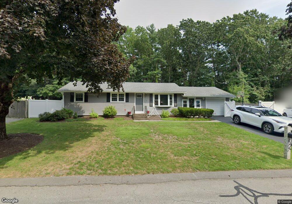
3 Roger Rd South Easton, MA 02375
Estimated Value: $496,000 - $586,000
3
Beds
1
Bath
1,075
Sq Ft
$512/Sq Ft
Est. Value
About This Home
This home is located at 3 Roger Rd, South Easton, MA 02375 and is currently estimated at $550,747, approximately $512 per square foot. 3 Roger Rd is a home located in Bristol County with nearby schools including Easton Middle School, Dovecrest Montessori Academy, and New England Baptist Academy.
Ownership History
Date
Name
Owned For
Owner Type
Purchase Details
Closed on
Aug 15, 2003
Sold by
Clark Danna J
Bought by
Burton Robert N
Current Estimated Value
Home Financials for this Owner
Home Financials are based on the most recent Mortgage that was taken out on this home.
Original Mortgage
$280,100
Outstanding Balance
$119,845
Interest Rate
5.46%
Mortgage Type
Purchase Money Mortgage
Estimated Equity
$430,902
Create a Home Valuation Report for This Property
The Home Valuation Report is an in-depth analysis detailing your home's value as well as a comparison with similar homes in the area
Home Values in the Area
Average Home Value in this Area
Purchase History
| Date | Buyer | Sale Price | Title Company |
|---|---|---|---|
| Burton Robert N | $294,900 | -- | |
| Burton Robert N | $294,900 | -- |
Source: Public Records
Mortgage History
| Date | Status | Borrower | Loan Amount |
|---|---|---|---|
| Open | Burton Robert N | $280,100 | |
| Closed | Burton Robert N | $280,100 | |
| Previous Owner | Burton Robert N | $141,000 | |
| Previous Owner | Burton Robert N | $121,000 |
Source: Public Records
Tax History Compared to Growth
Tax History
| Year | Tax Paid | Tax Assessment Tax Assessment Total Assessment is a certain percentage of the fair market value that is determined by local assessors to be the total taxable value of land and additions on the property. | Land | Improvement |
|---|---|---|---|---|
| 2025 | $5,696 | $456,400 | $285,100 | $171,300 |
| 2024 | $5,710 | $427,700 | $256,400 | $171,300 |
| 2023 | $5,438 | $372,700 | $256,400 | $116,300 |
| 2022 | $5,346 | $347,400 | $235,400 | $112,000 |
| 2021 | $5,237 | $338,300 | $226,500 | $111,800 |
| 2020 | $5,069 | $329,600 | $217,800 | $111,800 |
| 2019 | $4,716 | $295,500 | $197,100 | $98,400 |
| 2018 | $4,618 | $284,900 | $197,100 | $87,800 |
| 2017 | $4,574 | $282,000 | $197,100 | $84,900 |
| 2016 | $4,339 | $268,000 | $186,200 | $81,800 |
| 2015 | $4,349 | $259,200 | $179,500 | $79,700 |
| 2014 | $3,883 | $233,200 | $152,500 | $80,700 |
Source: Public Records
Map
Nearby Homes
- 5 Indian Cove Way Unit 5
- 6 Indian Cove Way Unit 6
- 88 Village St Unit 88
- 26 Indian Cove Way
- 453 Turnpike St Unit 6
- 305 Turnpike St=237 5th St Unit 237
- 76 Foundry St
- 41 Foundry St Unit 11-7
- 23 Windchime Rd
- 305 Turnpike St Unit 26 2nd St
- 15 Foundry St Unit A1
- 15 Foundry St Unit A3
- 15 Foundry St Unit A8
- 585 Turnpike St Unit 2
- 165 Pine Street (23 Lili Way)
- 47 Cutter Dr
- 63 Pine St
- 741 Washington St Unit 7
- 24 Pine St
- 431 Depot St - L4 Overlook Ln