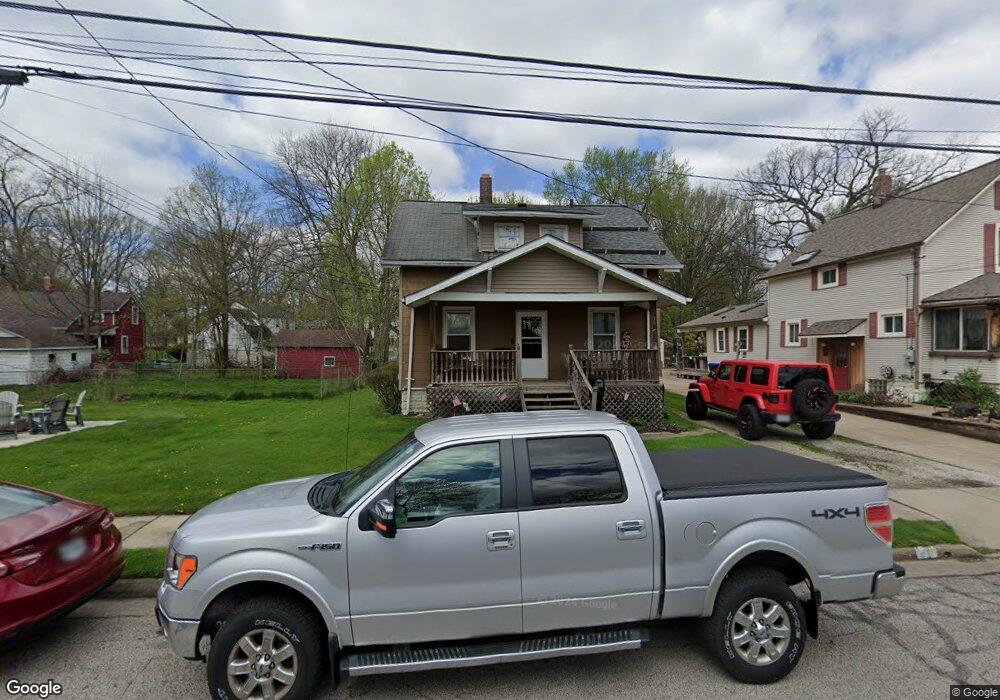
301 Ashland Ave Cuyahoga Falls, OH 44221
Downtown Cuyahoga Falls NeighborhoodEstimated Value: $158,000 - $180,000
3
Beds
1
Bath
1,098
Sq Ft
$155/Sq Ft
Est. Value
About This Home
This home is located at 301 Ashland Ave, Cuyahoga Falls, OH 44221 and is currently estimated at $170,094, approximately $154 per square foot. 301 Ashland Ave is a home located in Summit County with nearby schools including Lincoln Elementary School, Roberts Middle School, and Cuyahoga Falls High School.
Ownership History
Date
Name
Owned For
Owner Type
Purchase Details
Closed on
Jun 12, 2000
Sold by
Mcmillion Henry H
Bought by
Sondles Anthony W and Sondles Robin L
Current Estimated Value
Home Financials for this Owner
Home Financials are based on the most recent Mortgage that was taken out on this home.
Original Mortgage
$75,900
Interest Rate
8.31%
Create a Home Valuation Report for This Property
The Home Valuation Report is an in-depth analysis detailing your home's value as well as a comparison with similar homes in the area
Home Values in the Area
Average Home Value in this Area
Purchase History
| Date | Buyer | Sale Price | Title Company |
|---|---|---|---|
| Sondles Anthony W | $79,900 | Chicago Title Insurance Comp |
Source: Public Records
Mortgage History
| Date | Status | Borrower | Loan Amount |
|---|---|---|---|
| Closed | Sondles Anthony W | $75,900 |
Source: Public Records
Tax History Compared to Growth
Tax History
| Year | Tax Paid | Tax Assessment Tax Assessment Total Assessment is a certain percentage of the fair market value that is determined by local assessors to be the total taxable value of land and additions on the property. | Land | Improvement |
|---|---|---|---|---|
| 2025 | $2,255 | $41,756 | $10,392 | $31,364 |
| 2024 | $2,255 | $41,756 | $10,392 | $31,364 |
| 2023 | $2,255 | $41,756 | $10,392 | $31,364 |
| 2022 | $2,231 | $33,552 | $8,313 | $25,239 |
| 2021 | $2,231 | $33,552 | $8,313 | $25,239 |
| 2020 | $2,194 | $33,550 | $8,310 | $25,240 |
| 2019 | $2,460 | $34,270 | $8,230 | $26,040 |
| 2018 | $2,089 | $34,270 | $8,230 | $26,040 |
| 2017 | $1,887 | $34,270 | $8,230 | $26,040 |
| 2016 | $1,889 | $31,380 | $8,230 | $23,150 |
| 2015 | $1,887 | $31,380 | $8,230 | $23,150 |
| 2014 | $1,888 | $31,380 | $8,230 | $23,150 |
| 2013 | $1,872 | $31,380 | $8,230 | $23,150 |
Source: Public Records
Map
Nearby Homes
- 2762 Bailey Rd
- 2834 Norwood St
- 2693 Northland St
- 54 Washington Ave
- 419 Keenan Ave
- 2711 Ironwood St
- 2886 Norwood St
- 2890 Bailey Rd
- 455 Marguerite Ave
- 2736 Maplewood St
- 2762 Elmwood St
- 2534 Berk St
- 2610 Hawthorne Rd
- 2604 Hawthorne Rd
- 218 Monroe Ave
- 2870 Kent Rd
- 2869 Lakewood Dr
- 2873 Oakwood Dr
- 435 Roanoke Ave
- 2855 6th St
- 307 Ashland Ave
- 2757 Bailey Rd
- 313 Ashland Ave
- 2761 Bailey Rd
- 2753 Bailey Rd
- 319 Ashland Ave
- 2765 Bailey Rd
- 300 Ashland Ave
- 306 Ashland Ave
- 2745 Bailey Rd
- 325 Ashland Ave
- 2741 Bailey Rd
- 312 Ashland Ave
- 318 Ashland Ave
- 2773 Bailey Rd
- 2737 Bailey Rd
- 2756 Bailey Rd
- 2756 Bailey Rd
- 2781 Bailey Rd
- 324 Ashland Ave