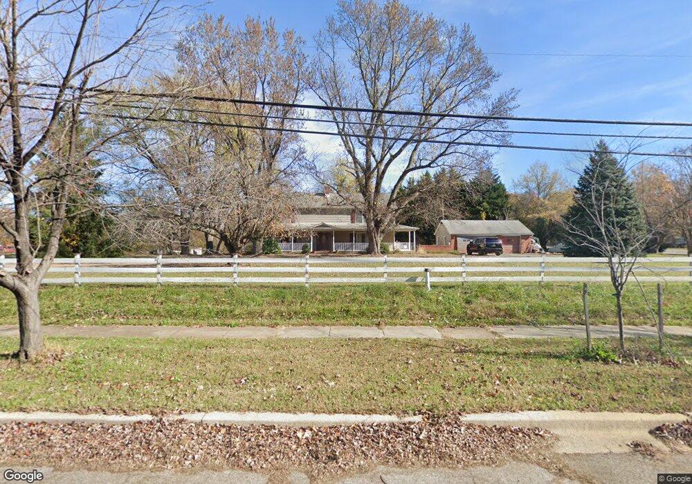
301 Bay Dale Dr Arnold, MD 21012
Estimated Value: $704,000 - $929,000
--
Bed
2
Baths
3,380
Sq Ft
$239/Sq Ft
Est. Value
About This Home
This home is located at 301 Bay Dale Dr, Arnold, MD 21012 and is currently estimated at $808,702, approximately $239 per square foot. 301 Bay Dale Dr is a home located in Anne Arundel County with nearby schools including Arnold Elementary School, Severn River Middle School, and Broadneck High School.
Ownership History
Date
Name
Owned For
Owner Type
Purchase Details
Closed on
Sep 29, 2014
Sold by
Superczynski Thomas W and Superczynski Melissa L
Bought by
Superczynski Thomas W
Current Estimated Value
Purchase Details
Closed on
May 2, 2013
Sold by
Superczynski Michael John and Dirado Julia Ann
Bought by
Superczynski Thomas W and Superczynski Melissa L
Purchase Details
Closed on
Apr 30, 2004
Sold by
Superczynski Michael J
Bought by
Superczynski Thomas W and Superczynski Melissa L
Purchase Details
Closed on
Dec 29, 1997
Sold by
Huss Janice E
Bought by
Superczynski Michael J and Dirado Julia A
Create a Home Valuation Report for This Property
The Home Valuation Report is an in-depth analysis detailing your home's value as well as a comparison with similar homes in the area
Home Values in the Area
Average Home Value in this Area
Purchase History
| Date | Buyer | Sale Price | Title Company |
|---|---|---|---|
| Superczynski Thomas W | -- | None Available | |
| Superczynski Thomas W | -- | None Available | |
| Superczynski Thomas W | -- | -- | |
| Superczynski Michael J | $432,500 | -- |
Source: Public Records
Tax History Compared to Growth
Tax History
| Year | Tax Paid | Tax Assessment Tax Assessment Total Assessment is a certain percentage of the fair market value that is determined by local assessors to be the total taxable value of land and additions on the property. | Land | Improvement |
|---|---|---|---|---|
| 2025 | $5,470 | $637,867 | -- | -- |
| 2024 | $5,470 | $604,400 | $271,600 | $332,800 |
| 2023 | $5,341 | $600,967 | $0 | $0 |
| 2022 | $5,014 | $597,533 | $0 | $0 |
| 2021 | $886 | $594,100 | $261,600 | $332,500 |
| 2020 | $4,793 | $570,800 | $0 | $0 |
| 2019 | $4,697 | $547,500 | $0 | $0 |
| 2018 | $886 | $524,200 | $211,600 | $312,600 |
| 2017 | $4,407 | $515,767 | $0 | $0 |
| 2016 | $886 | $507,333 | $0 | $0 |
| 2015 | $886 | $498,900 | $0 | $0 |
| 2014 | -- | $491,267 | $0 | $0 |
Source: Public Records
Map
Nearby Homes
- 1553 Star Pine Dr
- 1512 Winterberry Dr
- 332 Carronade Way
- 1583 Star Pine Dr
- 1116 Riverboat Ct
- 478 Bay Green Dr
- 349 Candle Ridge Ct
- 1742 Woodtree Cir
- 493 Colonial Ridge Ln
- 332 Charred Oak Ct
- 1410 Greendale Ct Unit 2-1410
- 1424 Millwood Ct
- 543 Bay Green Dr
- 1447 Falcon Nest Ct Unit 45
- 1455 Falcon Nest Ct
- 633 Andrew Hill Rd
- 618 Andrew Hill Rd
- 628 Southern Hills Dr Unit B
- 624 Southern Hills Dr Unit B-2A
- 1272 Seminole Dr
- 302 Bay Dale Dr
- 306 Bay Dale Dr
- 235 Bay Dale Dr
- 310 Bay Dale Dr
- 234 Bay Dale Dr
- 311 Bay Dale Dr
- 1538 Star Pine Dr
- 232 Bay Dale Dr
- 1540 Star Pine Dr
- 1536 Star Pine Dr
- 398 Carronade Way
- 396 Carronade Way
- 394 Carronade Way
- 392 Carronade Way
- 390 Carronade Way
- 388 Carronade Way
- 386 Carronade Way
- 384 Carronade Way
- 330324 Jones Station Rd
- 1514 Jones Station Rd