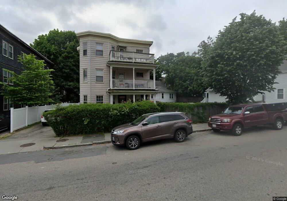
301 Cummins Hwy Unit 303 Roslindale, MA 02131
Roslindale NeighborhoodEstimated Value: $827,516 - $1,204,000
6
Beds
4
Baths
3,546
Sq Ft
$297/Sq Ft
Est. Value
About This Home
This home is located at 301 Cummins Hwy Unit 303, Roslindale, MA 02131 and is currently estimated at $1,053,629, approximately $297 per square foot. 301 Cummins Hwy Unit 303 is a home located in Suffolk County with nearby schools including Brooke Charter School Roslindale, Sacred Heart STEM School, and St. Clare High School.
Ownership History
Date
Name
Owned For
Owner Type
Purchase Details
Closed on
Feb 3, 2014
Sold by
Desanges Jean C
Bought by
Nikj Desanges Rt
Current Estimated Value
Purchase Details
Closed on
Sep 26, 1991
Sold by
Moruzzi Pierina Est
Bought by
Desanges Jean C and Desanges Marie A
Home Financials for this Owner
Home Financials are based on the most recent Mortgage that was taken out on this home.
Original Mortgage
$175,500
Interest Rate
9.1%
Mortgage Type
Purchase Money Mortgage
Create a Home Valuation Report for This Property
The Home Valuation Report is an in-depth analysis detailing your home's value as well as a comparison with similar homes in the area
Home Values in the Area
Average Home Value in this Area
Purchase History
| Date | Buyer | Sale Price | Title Company |
|---|---|---|---|
| Nikj Desanges Rt | -- | -- | |
| Desanges Jean C | $195,000 | -- |
Source: Public Records
Mortgage History
| Date | Status | Borrower | Loan Amount |
|---|---|---|---|
| Previous Owner | Desanges Jean C | $179,000 | |
| Previous Owner | Desanges Jean C | $166,500 | |
| Previous Owner | Desanges Jean C | $175,500 |
Source: Public Records
Tax History Compared to Growth
Tax History
| Year | Tax Paid | Tax Assessment Tax Assessment Total Assessment is a certain percentage of the fair market value that is determined by local assessors to be the total taxable value of land and additions on the property. | Land | Improvement |
|---|---|---|---|---|
| 2025 | $12,259 | $1,058,600 | $296,100 | $762,500 |
| 2024 | $10,369 | $951,300 | $259,100 | $692,200 |
| 2023 | $9,921 | $923,700 | $251,600 | $672,100 |
| 2022 | $9,567 | $879,300 | $239,500 | $639,800 |
| 2021 | $8,935 | $837,400 | $228,100 | $609,300 |
| 2020 | $7,285 | $689,900 | $223,500 | $466,400 |
| 2019 | $6,605 | $626,700 | $172,000 | $454,700 |
| 2018 | $5,973 | $569,900 | $172,000 | $397,900 |
| 2017 | $5,862 | $553,500 | $172,000 | $381,500 |
| 2016 | $5,638 | $512,500 | $172,000 | $340,500 |
| 2015 | $5,313 | $438,700 | $166,300 | $272,400 |
| 2014 | $5,110 | $406,200 | $166,300 | $239,900 |
Source: Public Records
Map
Nearby Homes
- 543 Hyde Park Ave Unit 1
- 25 Pinedale Rd Unit 1
- 8 Mount Calvary Rd Unit 4
- 16 Hilburn Place
- 87 Clare Ave
- 27 Rowe St
- 250 Poplar St Unit 1
- 417 Poplar St
- 32 Jewett St
- 415 Poplar St
- 273 Metropolitan Ave Unit 2
- 25 Crandall St
- 175 Clare Ave Unit B3
- 36 Neponset Ave Unit 1
- 67 Cummins Hwy Unit 101
- 103-105 Neponset Ave
- 103 Neponset Ave Unit 103A
- 105 Neponset Ave Unit 105
- 71 Wyvern St
- 187 Florence St Unit 2L
- 301 Cummins Hwy Unit 3
- 295 Cummins Hwy Unit 297R
- 297 Cummins Hwy Unit 2
- 305 Cummins Hwy Unit 3L
- 305 Cummins Hwy
- 305 Cummins Hwy Unit 1R
- 305 Cummins Hwy Unit 1L
- 305 Cummins Hwy
- 309 Cummins Hwy
- 291 Cummins Hwy Unit 293
- 291 Cummins Hwy Unit 1
- 293 Cummins Hwy Unit 2
- 612 Hyde Park Ave Unit 614
- 306 Cummins Hwy Unit 2
- 304 Cummins Hwy Unit 306
- 304 Cummins Hwy Unit 1
- 304 Cummins Hwy Unit 3
- 612 Hyde Park Ave
- 618 Hyde Park Ave Unit 3
- 618 Hyde Park Ave Unit 2