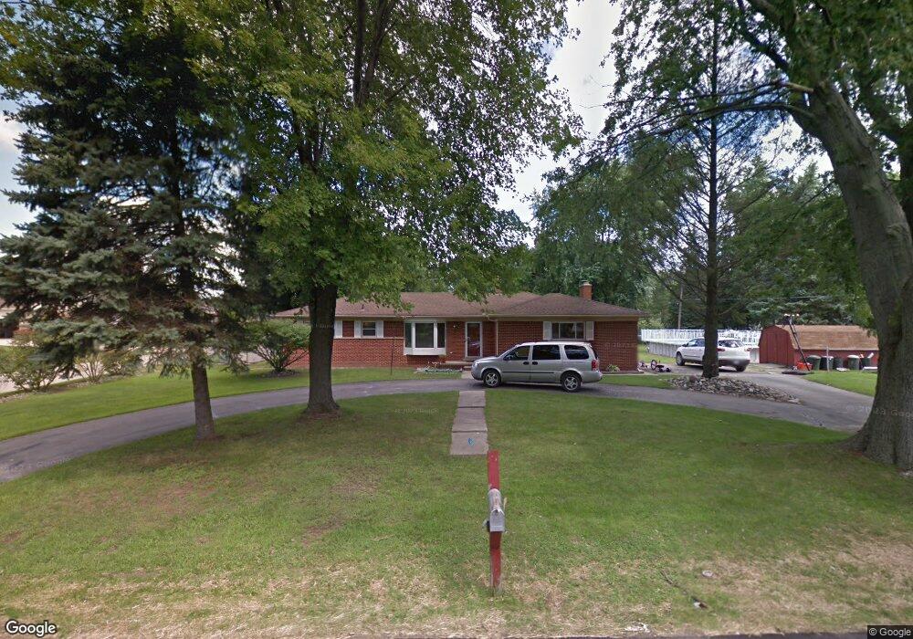
30116 Munger St Livonia, MI 48154
Estimated Value: $303,000 - $354,000
3
Beds
3
Baths
1,252
Sq Ft
$262/Sq Ft
Est. Value
About This Home
This home is located at 30116 Munger St, Livonia, MI 48154 and is currently estimated at $327,469, approximately $261 per square foot. 30116 Munger St is a home located in Wayne County with nearby schools including Riley Upper Elementary School, Buchanan Elementary School, and Holmes Middle School.
Ownership History
Date
Name
Owned For
Owner Type
Purchase Details
Closed on
Jun 2, 2023
Sold by
Mueller Rochelle
Bought by
Mueller Barclay W
Current Estimated Value
Purchase Details
Closed on
Jun 9, 2021
Sold by
Mueller Barclay W and Mueller Rochelle
Bought by
Mueller Barclay W and Mueller Rochelle
Home Financials for this Owner
Home Financials are based on the most recent Mortgage that was taken out on this home.
Original Mortgage
$96,500
Interest Rate
2.9%
Mortgage Type
New Conventional
Purchase Details
Closed on
Oct 25, 2012
Sold by
Kolenda David M and Citimortgage Inc
Bought by
The Federal Home Loan Mortgage Corporati
Purchase Details
Closed on
Aug 17, 2000
Sold by
Wagner John J
Bought by
Kolenda David
Create a Home Valuation Report for This Property
The Home Valuation Report is an in-depth analysis detailing your home's value as well as a comparison with similar homes in the area
Home Values in the Area
Average Home Value in this Area
Purchase History
| Date | Buyer | Sale Price | Title Company |
|---|---|---|---|
| Mueller Barclay W | -- | None Listed On Document | |
| Mueller Barclay W | -- | First American Title | |
| The Federal Home Loan Mortgage Corporati | $154,514 | None Available | |
| Kolenda David | $210,000 | -- |
Source: Public Records
Mortgage History
| Date | Status | Borrower | Loan Amount |
|---|---|---|---|
| Previous Owner | Mueller Barclay W | $96,500 |
Source: Public Records
Tax History Compared to Growth
Tax History
| Year | Tax Paid | Tax Assessment Tax Assessment Total Assessment is a certain percentage of the fair market value that is determined by local assessors to be the total taxable value of land and additions on the property. | Land | Improvement |
|---|---|---|---|---|
| 2025 | $2,171 | $153,100 | $0 | $0 |
| 2024 | $2,171 | $137,200 | $0 | $0 |
| 2023 | $2,072 | $127,000 | $0 | $0 |
| 2022 | $3,637 | $113,000 | $0 | $0 |
| 2021 | $3,533 | $108,100 | $0 | $0 |
| 2019 | $3,390 | $100,900 | $0 | $0 |
| 2018 | $1,751 | $94,700 | $0 | $0 |
| 2017 | $3,100 | $92,800 | $0 | $0 |
| 2016 | $3,149 | $90,700 | $0 | $0 |
| 2015 | $7,623 | $81,060 | $0 | $0 |
| 2012 | -- | $74,190 | $26,000 | $48,190 |
Source: Public Records
Map
Nearby Homes
- 30115 Munger Dr
- 30425 Munger Dr
- 29945 6 Mile Rd
- 29836 Bobrich St
- 31069 Munger Dr
- 15608 Hidden Ln
- 31366 Mayville St
- 29106 Broadmoor St
- 31005 Roycroft St
- 29721 Pickford St
- 15345 Bainbridge St
- 18659 Flamingo Blvd
- 29760 Hoy St
- 18725 Flamingo Blvd
- 15600 Auburndale St
- 28692 Bayberry Park Dr
- 29560 Clarita St Unit 11
- 18872 Hillcrest St
- 14962 Beatrice St
- 18061 Lathers St
- 30116 Munger Dr
- 16905 Oporto St
- 16911 Doris St
- 30109 Munger Dr
- 30109 Munger Dr
- 30115 Munger Dr
- 16927 Oporto St
- 16933 Doris St
- 16945 Oporto St
- 16955 Oporto St
- 30091 Munger Dr
- 30091 Munger Dr
- 16904 Oporto St
- 17017 Doris St
- 16999 Doris St
- 16928 Oporto St
- 30175 Munger Dr
- 16971 Oporto St
- 16977 Doris St
- 30069 Munger Dr