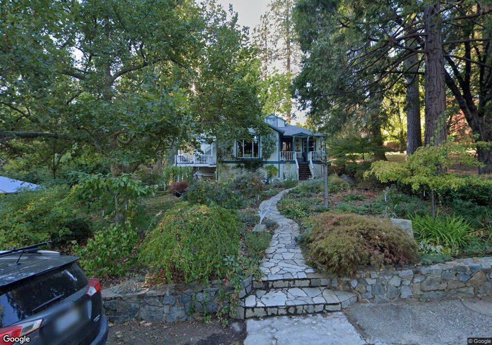
302 Drummond St Nevada City, CA 95959
Estimated Value: $744,214 - $993,000
4
Beds
3
Baths
2,444
Sq Ft
$349/Sq Ft
Est. Value
About This Home
This home is located at 302 Drummond St, Nevada City, CA 95959 and is currently estimated at $852,054, approximately $348 per square foot. 302 Drummond St is a home located in Nevada County with nearby schools including Deer Creek Elementary School, Seven Hills Intermediate School, and Forest Charter School.
Ownership History
Date
Name
Owned For
Owner Type
Purchase Details
Closed on
Feb 19, 2015
Sold by
Daly John M and Byles Daly Merry Lynn
Bought by
The Daly Family Trust
Current Estimated Value
Home Financials for this Owner
Home Financials are based on the most recent Mortgage that was taken out on this home.
Original Mortgage
$417,000
Interest Rate
3.6%
Mortgage Type
New Conventional
Purchase Details
Closed on
Feb 23, 2005
Sold by
Daly John M and Byles Daly Merry Lynn
Bought by
Daly John M and Byles Daly Merry Lynn
Home Financials for this Owner
Home Financials are based on the most recent Mortgage that was taken out on this home.
Original Mortgage
$225,000
Interest Rate
5.73%
Mortgage Type
New Conventional
Purchase Details
Closed on
Jul 3, 2002
Sold by
Daly John M and Daly Merry Lynn
Bought by
Daly John M and Byles Daly Merry Lynn
Create a Home Valuation Report for This Property
The Home Valuation Report is an in-depth analysis detailing your home's value as well as a comparison with similar homes in the area
Home Values in the Area
Average Home Value in this Area
Purchase History
| Date | Buyer | Sale Price | Title Company |
|---|---|---|---|
| The Daly Family Trust | -- | Placer Title Company | |
| Daly John M | -- | Placer Title Co | |
| Daly John M | -- | Placer Title Company | |
| Daly John M | -- | Placer Title Company | |
| Daly John M | -- | -- |
Source: Public Records
Mortgage History
| Date | Status | Borrower | Loan Amount |
|---|---|---|---|
| Closed | Daly John M | $417,000 | |
| Closed | Daly John M | $225,000 |
Source: Public Records
Tax History Compared to Growth
Tax History
| Year | Tax Paid | Tax Assessment Tax Assessment Total Assessment is a certain percentage of the fair market value that is determined by local assessors to be the total taxable value of land and additions on the property. | Land | Improvement |
|---|---|---|---|---|
| 2025 | $2,453 | $238,945 | $76,544 | $162,401 |
| 2024 | $2,407 | $234,261 | $75,044 | $159,217 |
| 2023 | $2,407 | $229,669 | $73,573 | $156,096 |
| 2022 | $2,358 | $225,167 | $72,131 | $153,036 |
| 2021 | $2,289 | $220,753 | $70,717 | $150,036 |
| 2020 | $2,285 | $218,490 | $69,992 | $148,498 |
| 2019 | $2,239 | $214,207 | $68,620 | $145,587 |
| 2018 | $0 | $210,008 | $67,275 | $142,733 |
| 2017 | $2,154 | $205,892 | $65,956 | $139,936 |
| 2016 | $2,075 | $201,856 | $64,663 | $137,193 |
| 2015 | $2,046 | $198,825 | $63,692 | $135,133 |
| 2014 | -- | $194,932 | $62,445 | $132,487 |
Source: Public Records
Map
Nearby Homes
- 327 Drummond St
- 520 Lost Hill Ct
- 500 Factory St
- 214 Mill St
- 210 Mill St
- 631 Chief Kelly Dr
- 421 Broad St
- 660 Chief Kelly Dr
- 651 Chief Kelly Dr
- 661 Chief Kelly Dr
- 140 Redbud Way
- 708 W Broad St
- 447 Zion St
- 16970 Old Downieville Hwy
- 342 Bridge Way
- 439 Washington St
- 327 Bridge Way
- 336 Bridge Way
- 134 Boulder St
- 347 Nile St
- 310 Drummond St
- 102 Gold Tunnel Dr
- 318 Drummond St
- 104 Gold Tunnel Dr
- 242 American Hill Rd
- 221 Drummond St
- 300 Austin St
- 101 Gold Tunnel Dr
- 324 Drummond St
- 218 Drummond St
- 238 American Hill Rd
- 219 Drummond St
- 321 Drummond St
- 103 Gold Tunnel Dr
- 308 Monroe St
- 306 American Hill Rd
- 237 American Hill Rd
- 214 Drummond St