Estimated Value: $215,099 - $341,000
--
Bed
1
Bath
1,832
Sq Ft
$147/Sq Ft
Est. Value
About This Home
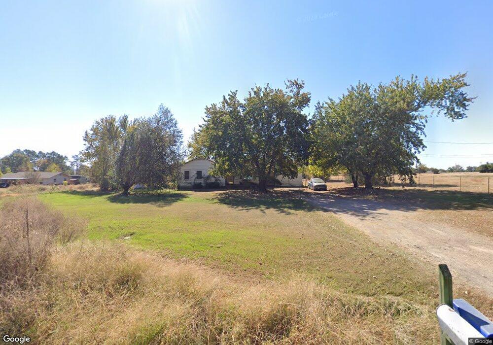
This home is located at 3023 Dow Jones Rd, Alma, AR 72921 and is currently estimated at $269,525, approximately $147 per square foot. 3023 Dow Jones Rd is a home located in Crawford County with nearby schools including Alma Intermediate School, Alma Primary School, and Alma Middle School.
Ownership History
Date
Name
Owned For
Owner Type
Purchase Details
Closed on
Oct 25, 2009
Sold by
Piaquadio Adam Gilbert
Bought by
Landfair Kendra Leona
Current Estimated Value
Purchase Details
Closed on
Sep 20, 2009
Sold by
Piaquadio Adam Gilbert
Bought by
Landfair Kendra Leona
Purchase Details
Closed on
Apr 25, 2003
Bought by
White-White
Purchase Details
Closed on
Aug 24, 1998
Bought by
Gregory-White
Purchase Details
Closed on
May 1, 1996
Bought by
Kenney-Gregory
Create a Home Valuation Report for This Property
The Home Valuation Report is an in-depth analysis detailing your home's value as well as a comparison with similar homes in the area
Home Values in the Area
Average Home Value in this Area
Purchase History
| Date | Buyer | Sale Price | Title Company |
|---|---|---|---|
| Landfair Kendra Leona | -- | -- | |
| Landfair Kendra Leona | -- | -- | |
| White-White | -- | -- | |
| Gregory-White | $56,000 | -- | |
| Kenney-Gregory | -- | -- | |
| Kenney-Gregory | $53,000 | -- |
Source: Public Records
Tax History Compared to Growth
Tax History
| Year | Tax Paid | Tax Assessment Tax Assessment Total Assessment is a certain percentage of the fair market value that is determined by local assessors to be the total taxable value of land and additions on the property. | Land | Improvement |
|---|---|---|---|---|
| 2025 | $62 | $26,000 | $5,240 | $20,760 |
| 2024 | $62 | $26,000 | $5,240 | $20,760 |
| 2023 | $137 | $26,000 | $5,240 | $20,760 |
| 2022 | $187 | $16,420 | $3,020 | $13,400 |
| 2021 | $187 | $16,420 | $3,020 | $13,400 |
| 2020 | $187 | $16,420 | $3,020 | $13,400 |
| 2019 | $198 | $16,420 | $3,020 | $13,400 |
| 2018 | $223 | $16,420 | $3,020 | $13,400 |
| 2017 | $221 | $14,630 | $3,020 | $11,610 |
| 2016 | $221 | $14,630 | $3,020 | $11,610 |
| 2015 | $221 | $14,630 | $3,020 | $11,610 |
| 2014 | $221 | $14,630 | $3,020 | $11,610 |
Source: Public Records
Map
Nearby Homes
- 00 Dean Rd
- 6562 Broadleaf Dr
- 2215 Deepwood Dr
- 6106 Dean Rd
- 1230 Dow Jones Rd
- 1206 Dow Jones Rd
- 9625 N Highway 71
- TBD Abby Rose Ln
- 8828 S Graphic Dr
- 8761 Highway 282
- 4504 Ridge Rd
- 2428 Winn Mountain Loop
- 3911 Brownstead Ct
- 3828 Edwards Rd
- TBD Lancaster Rd
- Tbd Lancaster Rd Unit LotWP001
- 421 Stone Mountain Loop
- 6424 Georgia Ridge Rd
- 11350 N Highway 71
- 11314 Cain Rd
- 3111 Dow Jones Rd
- 3001 Dow Jones Rd
- 3125 Dow Jones Rd
- 7418 Dean Rd
- 3202 Dow Jones Rd
- 2822 Dow Jones Rd
- 7501 Robinswood Rd
- 2819 Dow Jones Rd
- 7607 Cain Rd
- 7311 Robinswood Rd
- 7311 Robinswood Rd
- 3022 Dow Jones Rd
- 7428 Robinswood Rd
- 7426 Robinswood Rd
- 2716 Dow Jones Rd
- 7114 Dean Rd
- 7631 Cain Rd
- 7608 Cain Rd
- 3404 Robinhaven Dr
- 7320 Robinswood Rd