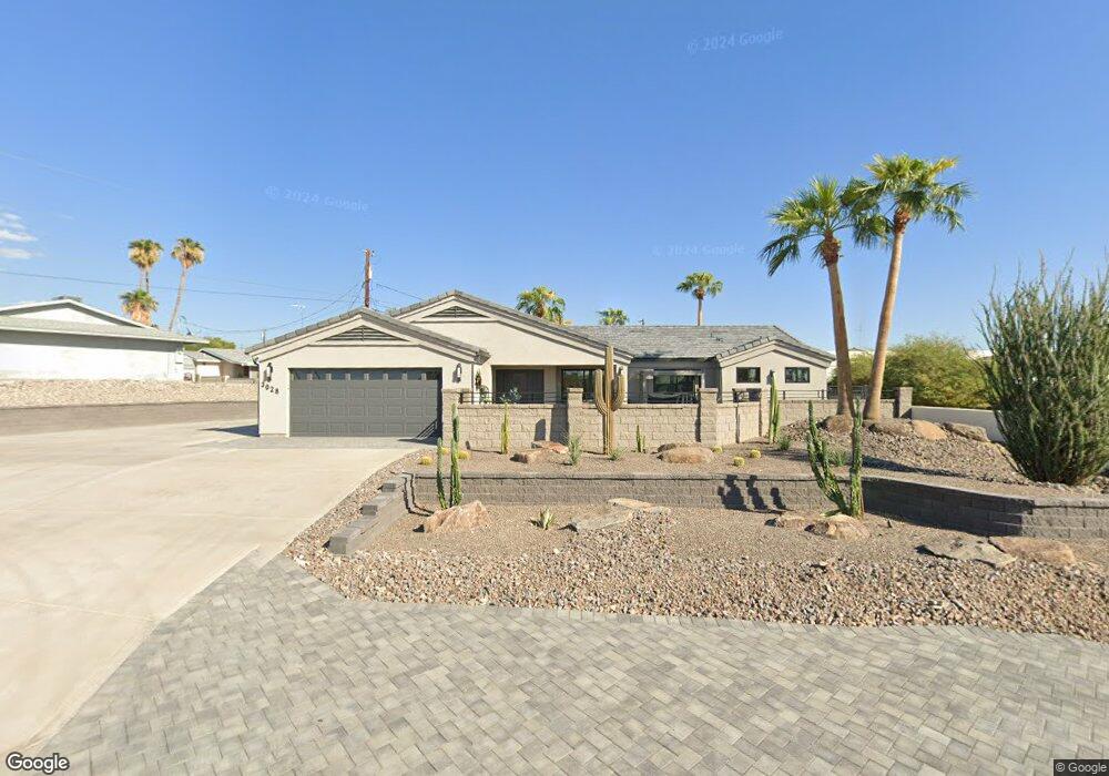
3028 Silversmith Dr Lake Havasu City, AZ 86406
Estimated Value: $545,000 - $772,000
4
Beds
3
Baths
2,920
Sq Ft
$216/Sq Ft
Est. Value
About This Home
This home is located at 3028 Silversmith Dr, Lake Havasu City, AZ 86406 and is currently estimated at $631,949, approximately $216 per square foot. 3028 Silversmith Dr is a home located in Mohave County with nearby schools including Starline Elementary School, Thunderbolt Middle School, and Lake Havasu High School.
Ownership History
Date
Name
Owned For
Owner Type
Purchase Details
Closed on
Feb 9, 2021
Sold by
Ramos Andy P and Ramos Charlotte E
Bought by
Ramos Andy P and Ramos Charlotte E
Current Estimated Value
Purchase Details
Closed on
Mar 21, 2002
Sold by
Soto Frank and Soto Onelia
Bought by
Ramos Andy and Ramos Charlotte
Home Financials for this Owner
Home Financials are based on the most recent Mortgage that was taken out on this home.
Original Mortgage
$154,350
Interest Rate
6.78%
Mortgage Type
New Conventional
Create a Home Valuation Report for This Property
The Home Valuation Report is an in-depth analysis detailing your home's value as well as a comparison with similar homes in the area
Home Values in the Area
Average Home Value in this Area
Purchase History
| Date | Buyer | Sale Price | Title Company |
|---|---|---|---|
| Ramos Andy P | -- | None Available | |
| Ramos Andy P | -- | None Available | |
| Ramos Andy | $162,500 | Chicago Title Insurance Co |
Source: Public Records
Mortgage History
| Date | Status | Borrower | Loan Amount |
|---|---|---|---|
| Closed | Ramos Andy | $154,350 |
Source: Public Records
Tax History Compared to Growth
Tax History
| Year | Tax Paid | Tax Assessment Tax Assessment Total Assessment is a certain percentage of the fair market value that is determined by local assessors to be the total taxable value of land and additions on the property. | Land | Improvement |
|---|---|---|---|---|
| 2026 | $871 | -- | -- | -- |
| 2025 | $1,765 | $54,627 | $0 | $0 |
| 2024 | $1,765 | $46,114 | $0 | $0 |
| 2023 | $1,765 | $39,102 | $0 | $0 |
| 2022 | $1,689 | $29,761 | $0 | $0 |
| 2021 | $1,861 | $27,030 | $0 | $0 |
| 2019 | $1,768 | $22,945 | $0 | $0 |
| 2018 | $1,708 | $21,187 | $0 | $0 |
| 2017 | $1,692 | $19,889 | $0 | $0 |
| 2016 | $1,532 | $18,495 | $0 | $0 |
| 2015 | $1,468 | $14,921 | $0 | $0 |
Source: Public Records
Map
Nearby Homes
- 2997 Edgewood Dr
- 2951 Saddleback Dr
- 3040 Gypsy Dr
- 3062 Appaloosa Dr
- 3651 Jamaica Blvd S
- 2947 Jamaica Blvd S
- 2897 Castaway Dr
- 2876 Plaza Del Oro
- 2892 Ranchero Dr
- 3235 Silverspoon Dr
- 532 Roanoke Dr
- 2860 Ranchero Dr
- 2954 Caravelle Dr
- 3201 Silver Saddle Dr
- 3260 Silverspoon Dr
- 786 Powder Dr
- 3267 Saddleback Dr
- 2970 War Eagle Dr
- 3150 Caravelle Dr
- 2910 Coconino Dr
- 400 Brite Dr
- 375 Corvair Dr
- 3036 Silversmith Dr
- 410 Brite Dr
- 385 Corvair Dr
- 3023 Silversmith Dr
- 3029 Silversmith Dr
- 420 Brite Dr
- 395 Corvair Dr
- 3011 Silversmith Dr
- 405 Brite Dr
- 3035 Silversmith Dr
- 3005 Silversmith Dr
- 370 Corvair Dr
- 360 Corvair Dr
- 430 Brite Dr
- 405 Corvair Dr
- 380 Corvair Dr
- 3004 Silversmith Dr
- 415 Brite Dr