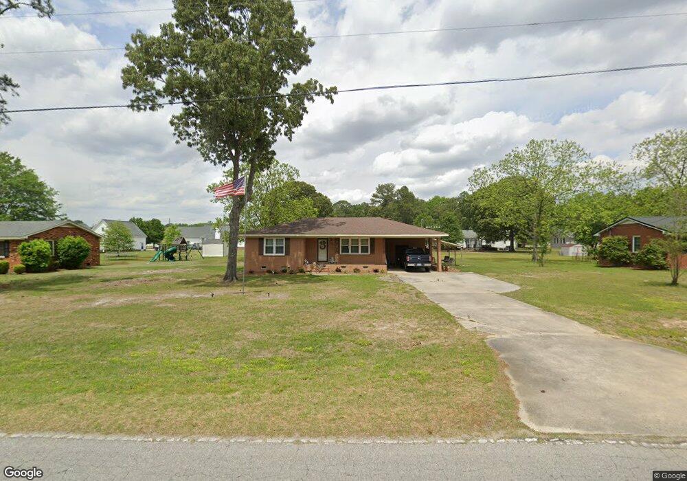
303 Fire Tower Rd La Grange, NC 28551
Estimated Value: $111,000 - $163,000
3
Beds
1
Bath
1,030
Sq Ft
$136/Sq Ft
Est. Value
About This Home
This home is located at 303 Fire Tower Rd, La Grange, NC 28551 and is currently estimated at $139,606, approximately $135 per square foot. 303 Fire Tower Rd is a home located in Lenoir County with nearby schools including La Grange Elementary School, E.B. Frink Middle School, and North Lenoir High School.
Ownership History
Date
Name
Owned For
Owner Type
Purchase Details
Closed on
Mar 9, 2021
Sold by
Lamb Judy A and Lamb Richard B
Bought by
Hartley Richard Edward
Current Estimated Value
Home Financials for this Owner
Home Financials are based on the most recent Mortgage that was taken out on this home.
Original Mortgage
$67,900
Outstanding Balance
$60,729
Interest Rate
2.7%
Mortgage Type
New Conventional
Estimated Equity
$78,877
Purchase Details
Closed on
Feb 21, 2005
Sold by
Alphin Katie Rouse
Bought by
Bake Judy Alphin
Create a Home Valuation Report for This Property
The Home Valuation Report is an in-depth analysis detailing your home's value as well as a comparison with similar homes in the area
Home Values in the Area
Average Home Value in this Area
Purchase History
| Date | Buyer | Sale Price | Title Company |
|---|---|---|---|
| Hartley Richard Edward | $70,000 | None Available | |
| Bake Judy Alphin | -- | None Available |
Source: Public Records
Mortgage History
| Date | Status | Borrower | Loan Amount |
|---|---|---|---|
| Open | Hartley Richard Edward | $67,900 |
Source: Public Records
Tax History Compared to Growth
Tax History
| Year | Tax Paid | Tax Assessment Tax Assessment Total Assessment is a certain percentage of the fair market value that is determined by local assessors to be the total taxable value of land and additions on the property. | Land | Improvement |
|---|---|---|---|---|
| 2025 | $1,383 | $137,797 | $30,426 | $107,371 |
| 2024 | $1,030 | $74,829 | $16,000 | $58,829 |
| 2023 | $1,030 | $74,829 | $16,000 | $58,829 |
| 2022 | $1,030 | $74,829 | $16,000 | $58,829 |
| 2021 | $1,030 | $74,829 | $16,000 | $58,829 |
| 2020 | $1,030 | $74,829 | $16,000 | $58,829 |
| 2019 | $1,030 | $74,829 | $16,000 | $58,829 |
| 2018 | $1,019 | $74,829 | $16,000 | $58,829 |
| 2017 | $1,023 | $74,829 | $16,000 | $58,829 |
| 2014 | $935 | $72,777 | $11,408 | $61,369 |
| 2013 | -- | $72,777 | $11,408 | $61,369 |
| 2011 | -- | $75,794 | $16,000 | $59,794 |
Source: Public Records
Map
Nearby Homes
- 210 Wood St
- 201 Wood St
- 202 Wood St
- 208 Wood St
- 217 Wood St
- 204 Wood St
- 205 Wood St
- 206 Wood St
- Hayden Plan at Blair Ridge
- Freeport Plan at Blair Ridge
- Cali Plan at Blair Ridge
- Belhaven Plan at Blair Ridge
- 219 Wood St
- 805 Madison Ann Dr
- 614 S Caswell St
- 3619 S Caswell St
- 4725 Packhouse Rd
- 6272 Highway 70 E
- 101 Forest Dr
- 202 E Washington St
- 305 Fire Tower Rd
- 301 Fire Tower Rd
- 304 Spence St
- 306 Spence St
- 307 Fire Tower Rd
- 306 Fire Tower Rd
- 209 Fire Tower Rd
- 302 Fire Tower Rd
- 308 Spence St
- 308 Fire Tower Rd
- 210 Spence St
- 402 Firetower Rd
- 210 Fire Tower Rd
- 402 Fire Tower Rd
- 305 Spence St
- 401 Fire Tower Rd
- 303 Spence St
- 301 Spence St
- 902 Madison Ann Dr
- 900 Madison Ann Dr