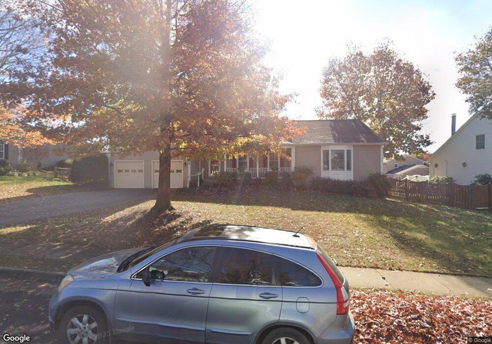
303 Lounsbury Ct NE Leesburg, VA 20176
Estimated Value: $807,486 - $867,000
4
Beds
4
Baths
2,408
Sq Ft
$349/Sq Ft
Est. Value
About This Home
This home is located at 303 Lounsbury Ct NE, Leesburg, VA 20176 and is currently estimated at $839,872, approximately $348 per square foot. 303 Lounsbury Ct NE is a home located in Loudoun County with nearby schools including Leesburg Elementary School, Smart's Mill Middle School, and Tuscarora High School.
Ownership History
Date
Name
Owned For
Owner Type
Purchase Details
Closed on
Feb 14, 1997
Sold by
Gibson Ronald J and Gibson Patricia A
Bought by
Rist Mark C and Rist Phoebe D
Current Estimated Value
Home Financials for this Owner
Home Financials are based on the most recent Mortgage that was taken out on this home.
Original Mortgage
$179,450
Outstanding Balance
$20,360
Interest Rate
7.6%
Mortgage Type
New Conventional
Estimated Equity
$819,512
Create a Home Valuation Report for This Property
The Home Valuation Report is an in-depth analysis detailing your home's value as well as a comparison with similar homes in the area
Home Values in the Area
Average Home Value in this Area
Purchase History
| Date | Buyer | Sale Price | Title Company |
|---|---|---|---|
| Rist Mark C | $185,000 | Island Title Corp |
Source: Public Records
Mortgage History
| Date | Status | Borrower | Loan Amount |
|---|---|---|---|
| Open | Rist Mark C | $179,450 |
Source: Public Records
Tax History Compared to Growth
Tax History
| Year | Tax Paid | Tax Assessment Tax Assessment Total Assessment is a certain percentage of the fair market value that is determined by local assessors to be the total taxable value of land and additions on the property. | Land | Improvement |
|---|---|---|---|---|
| 2025 | $6,205 | $770,750 | $262,300 | $508,450 |
| 2024 | $6,257 | $723,350 | $242,300 | $481,050 |
| 2023 | $6,541 | $747,540 | $227,300 | $520,240 |
| 2022 | $5,986 | $672,620 | $202,300 | $470,320 |
| 2021 | $5,674 | $578,970 | $200,300 | $378,670 |
| 2020 | $5,445 | $526,050 | $180,300 | $345,750 |
| 2019 | $5,403 | $517,000 | $180,300 | $336,700 |
| 2018 | $5,428 | $500,240 | $150,300 | $349,940 |
| 2017 | $5,562 | $494,370 | $150,300 | $344,070 |
| 2016 | $5,762 | $503,230 | $0 | $0 |
| 2015 | $854 | $316,350 | $0 | $316,350 |
| 2014 | $796 | $284,880 | $0 | $284,880 |
Source: Public Records
Map
Nearby Homes
- 216 Wildman St NE
- 293 Ariel Dr NE
- 276 Ariel Dr NE
- 710 North St NE
- BIRKHALL Plan at Brickyard
- HIGHGROVE Plan at Brickyard
- BALMORAL Plan at Brickyard
- 222 Wirt St NW
- 5 Stationmaster St SE Unit 202
- 202 Murdoch Square SE
- 2 Stationmaster St SE Unit 302
- 514 Covington Terrace NE
- 3 Stationmaster St SE Unit 402
- 1102 Huntmaster Terrace NE Unit 301
- 523 Currant Terrace NE
- 265 High Rail Terrace SE
- 411 Bicksler Square SE
- 414 Madison Ct SE
- 459 Kornblau Terrace SE
- 503 Richmond Square NE
- 305 Lounsbury Ct NE
- 301 Lounsbury Ct NE
- 304 North St NE
- 144 Woodberry Rd NE
- 304 Lounsbury Ct NE
- 302 Lounsbury Ct NE
- 306 North St NE
- 307 Lounsbury Ct NE
- 306 Lounsbury Ct NE
- 210 Woodberry Rd NE
- 308 North St NE
- 308 Lounsbury Ct NE
- 205 Woodberry Rd NE
- 309 Lounsbury Ct NE
- 232 North St NE
- 207 Woodberry Rd NE
- 309 Hanberry Ct NE
- 212 Woodberry Rd NE
- 209 Woodberry Rd NE
- 310 Lounsbury Ct NE