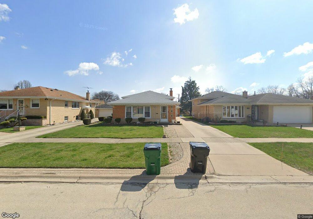
3035 Mayfair Ave Westchester, IL 60154
Estimated Value: $387,000 - $431,000
3
Beds
2
Baths
1,378
Sq Ft
$298/Sq Ft
Est. Value
About This Home
This home is located at 3035 Mayfair Ave, Westchester, IL 60154 and is currently estimated at $410,332, approximately $297 per square foot. 3035 Mayfair Ave is a home located in Cook County with nearby schools including Westchester Primary School, Westchester Intermediate School, and Westchester Middle School.
Ownership History
Date
Name
Owned For
Owner Type
Purchase Details
Closed on
Jul 21, 2005
Sold by
Macabulos Noel T and Macabulos Jocelyn A
Bought by
Barrientos Miguel A and Barrientos Yanet D
Current Estimated Value
Home Financials for this Owner
Home Financials are based on the most recent Mortgage that was taken out on this home.
Original Mortgage
$225,400
Outstanding Balance
$117,814
Interest Rate
5.68%
Mortgage Type
Fannie Mae Freddie Mac
Estimated Equity
$292,518
Create a Home Valuation Report for This Property
The Home Valuation Report is an in-depth analysis detailing your home's value as well as a comparison with similar homes in the area
Home Values in the Area
Average Home Value in this Area
Purchase History
| Date | Buyer | Sale Price | Title Company |
|---|---|---|---|
| Barrientos Miguel A | $322,000 | Ticor Title |
Source: Public Records
Mortgage History
| Date | Status | Borrower | Loan Amount |
|---|---|---|---|
| Open | Barrientos Miguel A | $225,400 |
Source: Public Records
Tax History Compared to Growth
Tax History
| Year | Tax Paid | Tax Assessment Tax Assessment Total Assessment is a certain percentage of the fair market value that is determined by local assessors to be the total taxable value of land and additions on the property. | Land | Improvement |
|---|---|---|---|---|
| 2024 | $8,053 | $34,000 | $4,500 | $29,500 |
| 2023 | $6,537 | $34,000 | $4,500 | $29,500 |
| 2022 | $6,537 | $24,848 | $3,900 | $20,948 |
| 2021 | $6,354 | $24,847 | $3,900 | $20,947 |
| 2020 | $6,274 | $24,847 | $3,900 | $20,947 |
| 2019 | $5,109 | $21,514 | $3,600 | $17,914 |
| 2018 | $5,040 | $21,514 | $3,600 | $17,914 |
| 2017 | $5,638 | $23,991 | $3,600 | $20,391 |
| 2016 | $4,610 | $18,303 | $3,300 | $15,003 |
| 2015 | $4,514 | $18,303 | $3,300 | $15,003 |
| 2014 | $4,425 | $18,303 | $3,300 | $15,003 |
| 2013 | $5,372 | $23,998 | $3,300 | $20,698 |
Source: Public Records
Map
Nearby Homes
- 3036 Downing Ave
- 2925 Denton Ct
- 2858 Kensington Ave
- 16 Princess Ct Unit 16
- 2623 Sunnyside Ave
- 2610 Sunnyside Ave
- 10916 Kingston St
- 10511 Preston St
- 2401 Mayfair Ave
- 10610 Essex St
- 2316 Boeger Ave
- 11140 Windsor Dr
- 636 N Stone Ave
- 606 N Brainard Ave
- 2230 Kensington Ave
- 4 Garden Dr Unit 4
- 2228 High Ridge Pkwy
- 2205 Mayfair Ave
- 818 N La Grange Rd
- 2550 Camberley Cir Unit 5-810
- 3029 Mayfair Ave
- 3039 Mayfair Ave
- 3039 Mayfair Ave
- 3034 Kensington Ave
- 3023 Mayfair Ave
- 3023 Mayfair Ave
- 3023 Mayfair Ave
- 3040 Kensington Ave
- 3028 Kensington Ave
- 3028 Kensington Ave
- 10752 31st St
- 3019 Mayfair Ave
- 3019 Mayfair Ave
- 10756 31st St
- 10756 31st St
- 10746 31st St
- 3024 Kensington Ave
- 10740 31st St
- 10740 31st St
- 3040 Mayfair Ave