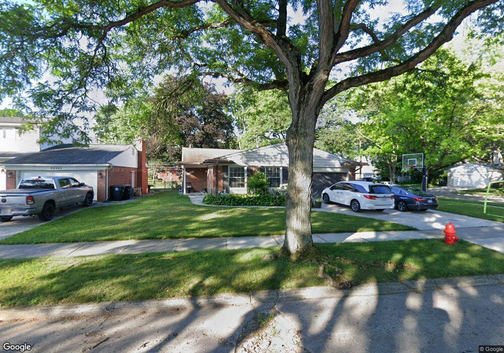
30461 Brookview Dr Livonia, MI 48152
Estimated Value: $322,597 - $377,000
--
Bed
1
Bath
1,527
Sq Ft
$234/Sq Ft
Est. Value
About This Home
This home is located at 30461 Brookview Dr, Livonia, MI 48152 and is currently estimated at $356,899, approximately $233 per square foot. 30461 Brookview Dr is a home located in Wayne County with nearby schools including Coolidge Elementary School, Webster Elementary School, and Riley Upper Elementary School.
Ownership History
Date
Name
Owned For
Owner Type
Purchase Details
Closed on
Jun 29, 2012
Sold by
The Norbert Roger Angel Revocable Trust
Bought by
Daley Joseph A
Current Estimated Value
Home Financials for this Owner
Home Financials are based on the most recent Mortgage that was taken out on this home.
Original Mortgage
$112,100
Outstanding Balance
$77,965
Interest Rate
3.83%
Mortgage Type
New Conventional
Estimated Equity
$278,934
Purchase Details
Closed on
Sep 25, 2009
Sold by
Angel Norbert Robert
Bought by
Angel Norbert Robert and Norbert Robert Angel Revocable Trust
Create a Home Valuation Report for This Property
The Home Valuation Report is an in-depth analysis detailing your home's value as well as a comparison with similar homes in the area
Home Values in the Area
Average Home Value in this Area
Purchase History
| Date | Buyer | Sale Price | Title Company |
|---|---|---|---|
| Daley Joseph A | $118,000 | None Available | |
| Angel Norbert Robert | -- | None Available |
Source: Public Records
Mortgage History
| Date | Status | Borrower | Loan Amount |
|---|---|---|---|
| Open | Daley Joseph A | $112,100 |
Source: Public Records
Tax History Compared to Growth
Tax History
| Year | Tax Paid | Tax Assessment Tax Assessment Total Assessment is a certain percentage of the fair market value that is determined by local assessors to be the total taxable value of land and additions on the property. | Land | Improvement |
|---|---|---|---|---|
| 2025 | $2,446 | $183,600 | $0 | $0 |
| 2024 | $2,446 | $169,400 | $0 | $0 |
| 2023 | $2,333 | $155,500 | $0 | $0 |
| 2022 | $4,097 | $146,400 | $0 | $0 |
| 2021 | $3,980 | $138,500 | $0 | $0 |
| 2019 | $3,818 | $121,400 | $0 | $0 |
| 2018 | $1,763 | $103,000 | $0 | $0 |
| 2017 | $3,120 | $100,000 | $0 | $0 |
| 2016 | $3,156 | $95,300 | $0 | $0 |
| 2015 | $7,640 | $84,600 | $0 | $0 |
| 2012 | -- | $71,670 | $25,080 | $46,590 |
Source: Public Records
Map
Nearby Homes
- 18659 Flamingo Blvd
- 18725 Flamingo Blvd
- 29836 Bobrich St
- 31366 Mayville St
- 29721 Pickford St
- 18872 Hillcrest St
- 29945 6 Mile Rd
- 30285 7 Mile Rd
- 30115 Munger Dr
- 30425 Munger Dr
- 29560 Clarita St Unit 11
- 19021 Merriman Rd
- 31069 Munger Dr
- 19436 Donna St
- 29675 Nottingham Cir Unit 20
- 18496 Brentwood St
- 19443 Auburndale St
- 18061 Lathers St
- 31419 Fairfax St
- 18500 Mayfield St
- 30445 Brookview Dr
- 17640 Hillcrest St
- 30429 Brookview Dr
- 30525 Brookview Dr
- 17624 Hillcrest St
- 30464 Brookview Dr
- 30448 Brookview Dr
- 30415 Brookview Dr
- 30537 Brookview Dr
- 30514 Brookview Dr
- 30432 Brookview Dr
- 17625 Rexwood St
- 17641 Hillcrest St
- 17608 Hillcrest St
- 17627 Hillcrest St
- 30530 Brookview Dr
- 30549 Brookview Dr
- 30416 Brookview Dr
- 17611 Rexwood St
- 17615 Hillcrest St