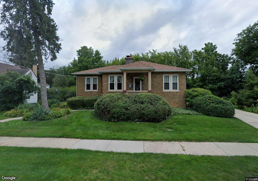
305 Johnson Ave Libertyville, IL 60048
Estimated Value: $314,407 - $491,000
--
Bed
1
Bath
1,008
Sq Ft
$396/Sq Ft
Est. Value
About This Home
This home is located at 305 Johnson Ave, Libertyville, IL 60048 and is currently estimated at $398,852, approximately $395 per square foot. 305 Johnson Ave is a home located in Lake County with nearby schools including Adler Park School, Highland Middle School, and Libertyville High School.
Ownership History
Date
Name
Owned For
Owner Type
Purchase Details
Closed on
May 8, 2002
Sold by
Cronin Margaret A
Bought by
Cronin Margaret A and Margaret A Cronin Trust
Current Estimated Value
Purchase Details
Closed on
Apr 6, 2002
Sold by
Dean Craig
Bought by
Cronin Margaret
Purchase Details
Closed on
Jul 24, 2000
Sold by
Sweeney Edwin Joseph and Sweeney Jennifer M
Bought by
Cronin Margaret A
Purchase Details
Closed on
Jul 10, 1996
Sold by
Delacey Loretta B
Bought by
Sweeney Edwin Joseph and Sweeney Jennifer M
Create a Home Valuation Report for This Property
The Home Valuation Report is an in-depth analysis detailing your home's value as well as a comparison with similar homes in the area
Home Values in the Area
Average Home Value in this Area
Purchase History
| Date | Buyer | Sale Price | Title Company |
|---|---|---|---|
| Cronin Margaret A | -- | -- | |
| Cronin Margaret | -- | -- | |
| Cronin Margaret A | $222,000 | -- | |
| Sweeney Edwin Joseph | $122,000 | -- |
Source: Public Records
Tax History Compared to Growth
Tax History
| Year | Tax Paid | Tax Assessment Tax Assessment Total Assessment is a certain percentage of the fair market value that is determined by local assessors to be the total taxable value of land and additions on the property. | Land | Improvement |
|---|---|---|---|---|
| 2024 | $6,002 | $98,146 | $55,332 | $42,814 |
| 2023 | $6,156 | $90,524 | $51,035 | $39,489 |
| 2022 | $6,156 | $87,976 | $49,053 | $38,923 |
| 2021 | $5,913 | $86,082 | $47,997 | $38,085 |
| 2020 | $5,680 | $84,635 | $47,190 | $37,445 |
| 2019 | $5,092 | $83,830 | $46,741 | $37,089 |
| 2018 | $5,583 | $82,057 | $45,926 | $36,131 |
| 2017 | $5,502 | $79,466 | $44,476 | $34,990 |
| 2016 | $5,307 | $75,344 | $42,169 | $33,175 |
| 2015 | $5,242 | $70,422 | $39,414 | $31,008 |
| 2014 | $5,122 | $67,627 | $37,034 | $30,593 |
| 2012 | $4,902 | $68,213 | $37,355 | $30,858 |
Source: Public Records
Map
Nearby Homes
- 212 W Ellis Ave
- 208 W Ellis Ave
- 204 W Ellis Ave
- 619 Parkside Ct
- 922 N Milwaukee Ave Unit A
- 616 Parkside Ct
- 662 Parkside Ct
- 694 Parkside Ct
- 505 Lange Ct
- 420 W Cook Ave
- 1211 Parliament Ct
- 212 Elm Ct
- 224 Newberry Ave
- 217 E Church St
- 31132-31140 N Milwaukee Ave
- 551 W Park Ave Unit E
- 308 Mckinley Ave
- 1754 Glenmore Rd
- 601 Broadway St
- 112 3rd St
- 303 Johnson Ave
- 223 Johnson Ave
- 313 Johnson Ave
- 304 Johnson Ave
- 302 Johnson Ave
- 221 Johnson Ave
- 905 Wheeler Ct
- 321 Merrill Ct
- 219 Johnson Ave
- 216 Johnson Ave
- 215 Johnson Ave
- 908 Wheeler Ct
- 211 Johnson Ave
- 914 Wheeler Ct
- 212 Johnson Ave
- 916 Wheeler Ct
- 310 Merrill Ct
- 207 Johnson Ave
- 314 Merrill Ct
- 320 Merrill Ct