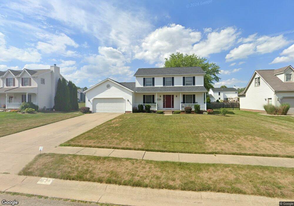
305 Rodeo Cir Louisville, OH 44641
Estimated Value: $260,000 - $301,000
3
Beds
3
Baths
1,848
Sq Ft
$152/Sq Ft
Est. Value
About This Home
This home is located at 305 Rodeo Cir, Louisville, OH 44641 and is currently estimated at $280,413, approximately $151 per square foot. 305 Rodeo Cir is a home located in Stark County with nearby schools including Louisville High School and St. Thomas Aquinas High School & Middle School.
Ownership History
Date
Name
Owned For
Owner Type
Purchase Details
Closed on
May 15, 1997
Sold by
Buffalo Ridge Allotment
Bought by
Lautner Daniel M and Lautner Kathleen
Current Estimated Value
Home Financials for this Owner
Home Financials are based on the most recent Mortgage that was taken out on this home.
Original Mortgage
$115,000
Outstanding Balance
$15,751
Interest Rate
8%
Mortgage Type
New Conventional
Estimated Equity
$264,662
Create a Home Valuation Report for This Property
The Home Valuation Report is an in-depth analysis detailing your home's value as well as a comparison with similar homes in the area
Home Values in the Area
Average Home Value in this Area
Purchase History
| Date | Buyer | Sale Price | Title Company |
|---|---|---|---|
| Lautner Daniel M | $25,900 | -- |
Source: Public Records
Mortgage History
| Date | Status | Borrower | Loan Amount |
|---|---|---|---|
| Open | Lautner Daniel M | $115,000 |
Source: Public Records
Tax History Compared to Growth
Tax History
| Year | Tax Paid | Tax Assessment Tax Assessment Total Assessment is a certain percentage of the fair market value that is determined by local assessors to be the total taxable value of land and additions on the property. | Land | Improvement |
|---|---|---|---|---|
| 2025 | -- | $82,110 | $17,360 | $64,750 |
| 2024 | -- | $82,110 | $17,360 | $64,750 |
| 2023 | $2,718 | $63,250 | $17,220 | $46,030 |
| 2022 | $2,724 | $63,250 | $17,220 | $46,030 |
| 2021 | $2,732 | $63,250 | $17,220 | $46,030 |
| 2020 | $2,270 | $57,090 | $15,510 | $41,580 |
| 2019 | $2,279 | $54,750 | $15,510 | $39,240 |
| 2018 | $2,178 | $54,750 | $15,510 | $39,240 |
| 2017 | $2,048 | $49,670 | $12,670 | $37,000 |
| 2016 | $2,090 | $49,670 | $12,670 | $37,000 |
| 2015 | $2,096 | $49,670 | $12,670 | $37,000 |
| 2014 | $1,946 | $42,880 | $10,920 | $31,960 |
| 2013 | $977 | $42,880 | $10,920 | $31,960 |
Source: Public Records
Map
Nearby Homes
- 1702 View Pointe Ave
- 908 Sand Lot Cir
- 1639 Horizon Dr
- 8225 Georgetown St
- 6969 Georgetown St NE
- 510 S Bauman Ct
- 204 E Broad St
- 2425 Miday Ave NE
- 728 E Broad St
- 520 S Silver St
- 641 S Nickelplate St
- 107 E Broad St
- 308 Superior St
- 1715 High St
- 3390 Meese Rd NE
- 2110 Edmar St
- 1812 E Broad St
- 325 Lincoln Ave
- 201 Indiana Ave
- 0 Michigan Blvd
- 315 Rodeo Cir
- 215 Rodeo Cir
- 304 Buffalo Ridge St
- 314 Buffalo Ridge St
- 405 Rodeo Cir
- 205 Rodeo Cir
- 214 Buffalo Ridge St
- 304 Rodeo Cir
- 214 Rodeo Cir
- 314 Rodeo Cir
- 404 Buffalo Ridge St
- 204 Buffalo Ridge St
- 115 Rodeo Cir
- 415 Rodeo Cir
- 404 Rodeo Cir
- 204 Rodeo Cir
- 414 Buffalo Ridge St
- 114 Buffalo Ridge St
- 114 Rodeo Cir
- 414 Rodeo Cir