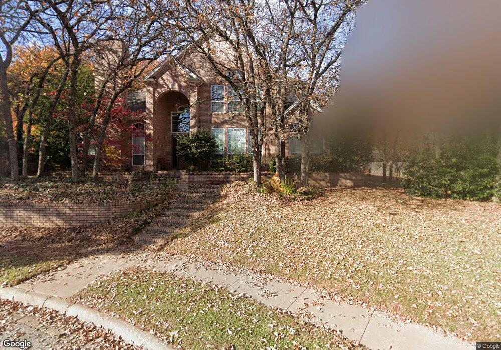
3050 Sentinal Butte Grapevine, TX 76051
Estimated Value: $1,013,068 - $1,076,000
4
Beds
4
Baths
4,125
Sq Ft
$251/Sq Ft
Est. Value
About This Home
This home is located at 3050 Sentinal Butte, Grapevine, TX 76051 and is currently estimated at $1,035,767, approximately $251 per square foot. 3050 Sentinal Butte is a home located in Tarrant County with nearby schools including O.C. Taylor Elementary School, Cross Timbers Middle School, and Grapevine High School.
Ownership History
Date
Name
Owned For
Owner Type
Purchase Details
Closed on
May 14, 2012
Sold by
Sandow Fred L and Sandow Sharon Y
Bought by
Lowrie Ronald G and Lowrie Cherri L
Current Estimated Value
Home Financials for this Owner
Home Financials are based on the most recent Mortgage that was taken out on this home.
Original Mortgage
$417,000
Outstanding Balance
$59,653
Interest Rate
4.02%
Mortgage Type
New Conventional
Estimated Equity
$976,114
Purchase Details
Closed on
May 15, 2009
Sold by
Tichenor Meredith G
Bought by
Sandow Fred L and Sandow Sharon Y
Home Financials for this Owner
Home Financials are based on the most recent Mortgage that was taken out on this home.
Original Mortgage
$376,000
Interest Rate
4.84%
Mortgage Type
Purchase Money Mortgage
Purchase Details
Closed on
Sep 24, 2007
Sold by
Thomas Anthony Lang and Thomas Lorie
Bought by
Tichenor Meredith C
Home Financials for this Owner
Home Financials are based on the most recent Mortgage that was taken out on this home.
Original Mortgage
$295,000
Interest Rate
6.66%
Mortgage Type
Purchase Money Mortgage
Purchase Details
Closed on
Aug 11, 2006
Sold by
Georg Clinton and Georg Cheryl
Bought by
Thomas Anthony Lang
Home Financials for this Owner
Home Financials are based on the most recent Mortgage that was taken out on this home.
Original Mortgage
$360,000
Interest Rate
6.78%
Mortgage Type
Purchase Money Mortgage
Purchase Details
Closed on
Jan 29, 2004
Sold by
Jones Ronald W and Jones Margaret E
Bought by
Georg Clinton
Home Financials for this Owner
Home Financials are based on the most recent Mortgage that was taken out on this home.
Original Mortgage
$300,000
Interest Rate
5.78%
Mortgage Type
Purchase Money Mortgage
Purchase Details
Closed on
Aug 8, 1997
Sold by
Fuller Michael R and Fuller Lou Jean
Bought by
Jones Ronald W and Jones Margaret E
Home Financials for this Owner
Home Financials are based on the most recent Mortgage that was taken out on this home.
Original Mortgage
$202,500
Interest Rate
7.6%
Create a Home Valuation Report for This Property
The Home Valuation Report is an in-depth analysis detailing your home's value as well as a comparison with similar homes in the area
Home Values in the Area
Average Home Value in this Area
Purchase History
| Date | Buyer | Sale Price | Title Company |
|---|---|---|---|
| Lowrie Ronald G | -- | Natco | |
| Sandow Fred L | -- | Providence Title Company | |
| Tichenor Meredith C | -- | Commonwealth Land | |
| Thomas Anthony Lang | -- | Commonwealth Land | |
| Georg Clinton | -- | Alamo Trin Western Title Co- | |
| Jones Ronald W | -- | First American Title Co |
Source: Public Records
Mortgage History
| Date | Status | Borrower | Loan Amount |
|---|---|---|---|
| Open | Lowrie Ronald G | $417,000 | |
| Previous Owner | Sandow Fred L | $376,000 | |
| Previous Owner | Tichenor Meredith C | $295,000 | |
| Previous Owner | Thomas Anthony Lang | $360,000 | |
| Previous Owner | Georg Clinton | $300,000 | |
| Previous Owner | Jones Ronald W | $202,500 | |
| Closed | Georg Clinton | $37,500 |
Source: Public Records
Tax History Compared to Growth
Tax History
| Year | Tax Paid | Tax Assessment Tax Assessment Total Assessment is a certain percentage of the fair market value that is determined by local assessors to be the total taxable value of land and additions on the property. | Land | Improvement |
|---|---|---|---|---|
| 2025 | $2,834 | $776,571 | $248,000 | $528,571 |
| 2024 | $2,834 | $866,873 | $248,000 | $618,873 |
| 2023 | $7,393 | $777,092 | $248,000 | $529,092 |
| 2022 | $13,082 | $696,190 | $248,000 | $448,190 |
| 2021 | $13,052 | $600,295 | $148,800 | $451,495 |
| 2020 | $13,931 | $633,357 | $148,800 | $484,557 |
| 2019 | $13,279 | $582,301 | $148,800 | $433,501 |
| 2018 | $2,949 | $557,998 | $148,800 | $409,198 |
| 2017 | $13,205 | $570,984 | $148,800 | $422,184 |
| 2016 | $12,399 | $569,223 | $145,800 | $423,423 |
| 2015 | $11,181 | $487,400 | $50,000 | $437,400 |
| 2014 | $11,181 | $487,400 | $50,000 | $437,400 |
Source: Public Records
Map
Nearby Homes
- 3828 Kelsey Ct
- 3530 Quail Crest St
- 2704 Yorkshire Ct
- 3223 Wintergreen Terrace
- 4157 Heartstone Dr
- 3826 Shady Meadow Dr
- 2849 Timber Hill Dr
- 3329 Moss Creek Dr
- 4105 Williams Ct
- 2805 Pine View Dr
- 3107 Wintergreen Terrace
- 3206 Wintergreen Terrace
- 3278 Birch Ave
- 3321 Circlewood Ct
- 3801 Hillside Trail
- 3110 Fox Run Dr
- 3200 Magnolia Ct
- 4213 Hearthside Dr
- 4214 Hearthside Dr
- 2906 Cottonwood Ln
- 3046 Sentinal Butte
- 3054 Sentinal Butte
- 3049 Monument Butte
- 3053 Monument Butte
- 3045 Monument Butte
- 3049 Sentinal Butte
- 3053 Sentinal Butte
- 3045 Sentinal Butte
- 3208 Walker Place
- 3056 High Cliff Dr
- 3204 Walker Place
- 3212 Walker Place
- 3048 High Cliff Dr
- 3052 High Cliff Dr
- 3044 High Cliff Dr
- 3060 High Cliff Dr
- 3054 Monument Butte
- 3200 Walker Place
- 3046 Monument Butte
- 3040 High Cliff Dr