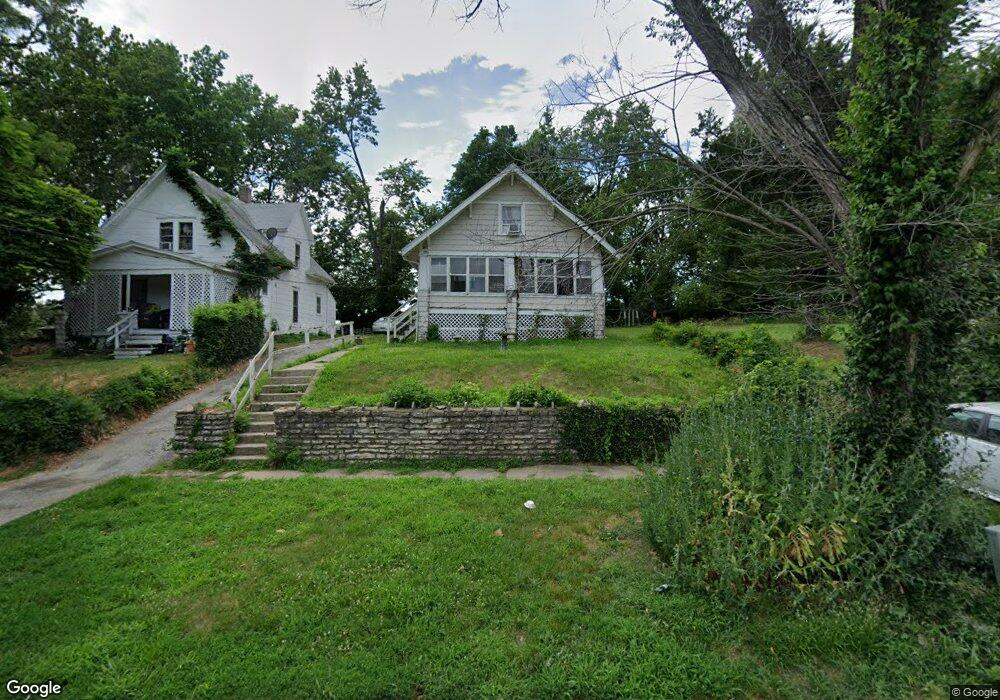
3076 N 21st St Kansas City, KS 66104
Northwest Kansas City NeighborhoodEstimated Value: $140,420 - $184,000
3
Beds
2
Baths
1,340
Sq Ft
$121/Sq Ft
Est. Value
About This Home
This home is located at 3076 N 21st St, Kansas City, KS 66104 and is currently estimated at $161,605, approximately $120 per square foot. 3076 N 21st St is a home located in Wyandotte County with nearby schools including Quindaro Elementary School, Carl B. Bruce Middle School, and Wyandotte High School.
Ownership History
Date
Name
Owned For
Owner Type
Purchase Details
Closed on
Dec 29, 2000
Sold by
Caldwell Delbert
Bought by
Gutto Sheila D
Current Estimated Value
Purchase Details
Closed on
Dec 8, 2000
Sold by
Anderson Jennifer S and Anderson Melvin W
Bought by
Gutto Sheila D
Purchase Details
Closed on
Dec 7, 2000
Sold by
Favors Joe Ann and Favors Adolphus C
Bought by
Gutto Sheila D
Purchase Details
Closed on
Dec 1, 2000
Sold by
Bess Barbara G and Bess Lemeul L
Bought by
Gutto Sheila D
Create a Home Valuation Report for This Property
The Home Valuation Report is an in-depth analysis detailing your home's value as well as a comparison with similar homes in the area
Home Values in the Area
Average Home Value in this Area
Purchase History
| Date | Buyer | Sale Price | Title Company |
|---|---|---|---|
| Gutto Sheila D | -- | -- | |
| Gutto Sheila D | -- | -- | |
| Gutto Sheila D | -- | -- | |
| Gutto Sheila D | -- | -- | |
| Gutto Sheila D | -- | -- | |
| Gutto Sheila D | -- | -- |
Source: Public Records
Tax History Compared to Growth
Tax History
| Year | Tax Paid | Tax Assessment Tax Assessment Total Assessment is a certain percentage of the fair market value that is determined by local assessors to be the total taxable value of land and additions on the property. | Land | Improvement |
|---|---|---|---|---|
| 2024 | $1,050 | $7,763 | $2,024 | $5,739 |
| 2023 | $964 | $6,451 | $1,657 | $4,794 |
| 2022 | $606 | $4,165 | $1,272 | $2,893 |
| 2021 | $495 | $3,229 | $382 | $2,847 |
| 2020 | $405 | $2,692 | $311 | $2,381 |
| 2019 | $370 | $2,483 | $311 | $2,172 |
| 2018 | $352 | $2,388 | $328 | $2,060 |
| 2017 | $320 | $2,162 | $201 | $1,961 |
| 2016 | $326 | $2,176 | $201 | $1,975 |
| 2015 | $330 | $2,176 | $201 | $1,975 |
| 2014 | $562 | $3,048 | $201 | $2,847 |
Source: Public Records
Map
Nearby Homes
- 3038 N 20th St
- 2310 Delavan Ave
- 2933 N Getty St
- 3046 N 27th St
- 3034 N 27th St
- 1811 Kimball Ave
- 2721 N 21st St
- 2725 N 20th St
- 2649 N 20th St
- 2602 N 18th St
- 3218 Lathrop Ave
- 3210 Farrow Ave
- 1342 Georgia Ave
- 2928 Roosevelt St
- 1336 Rowland Ave
- 1341 Rowland Ave
- 3321 Delavan Ave
- 2401 Haskell Ave
- 3049 N 34th St
- 1527 Haskell Ave