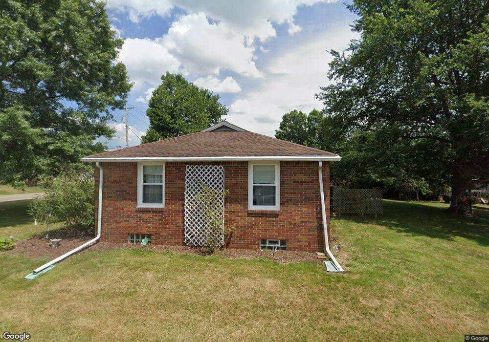
308 Reno Dr Louisville, OH 44641
Estimated Value: $186,738 - $226,000
3
Beds
1
Bath
1,294
Sq Ft
$162/Sq Ft
Est. Value
About This Home
This home is located at 308 Reno Dr, Louisville, OH 44641 and is currently estimated at $209,435, approximately $161 per square foot. 308 Reno Dr is a home located in Stark County with nearby schools including Louisville High School and St. Thomas Aquinas High School & Middle School.
Ownership History
Date
Name
Owned For
Owner Type
Purchase Details
Closed on
Sep 5, 2001
Sold by
Pawley Robert L and Pawley Sherry L
Bought by
Lasure Keith and Lasure Judy
Current Estimated Value
Purchase Details
Closed on
Jul 15, 1999
Sold by
Barr Melvin W
Bought by
Pawley Robert and Pawley Sherry L
Create a Home Valuation Report for This Property
The Home Valuation Report is an in-depth analysis detailing your home's value as well as a comparison with similar homes in the area
Home Values in the Area
Average Home Value in this Area
Purchase History
| Date | Buyer | Sale Price | Title Company |
|---|---|---|---|
| Lasure Keith | $90,000 | -- | |
| Pawley Robert | $90,000 | -- |
Source: Public Records
Mortgage History
| Date | Status | Borrower | Loan Amount |
|---|---|---|---|
| Closed | Lasure Keith | $0 |
Source: Public Records
Tax History Compared to Growth
Tax History
| Year | Tax Paid | Tax Assessment Tax Assessment Total Assessment is a certain percentage of the fair market value that is determined by local assessors to be the total taxable value of land and additions on the property. | Land | Improvement |
|---|---|---|---|---|
| 2025 | -- | $56,600 | $15,120 | $41,480 |
| 2024 | -- | $56,600 | $15,120 | $41,480 |
| 2023 | $1,456 | $43,020 | $12,500 | $30,520 |
| 2022 | $739 | $43,020 | $12,500 | $30,520 |
| 2021 | $1,483 | $43,020 | $12,500 | $30,520 |
| 2020 | $1,180 | $38,360 | $11,270 | $27,090 |
| 2019 | $1,185 | $34,310 | $11,270 | $23,040 |
| 2018 | $1,022 | $34,310 | $11,270 | $23,040 |
| 2017 | $895 | $30,320 | $9,420 | $20,900 |
| 2016 | $913 | $30,320 | $9,420 | $20,900 |
| 2015 | $916 | $30,320 | $9,420 | $20,900 |
| 2014 | $828 | $26,860 | $8,370 | $18,490 |
| 2013 | $417 | $26,860 | $8,370 | $18,490 |
Source: Public Records
Map
Nearby Homes
- 524 Glenbar St
- 5474 Ravenna Ave
- 614 Reno Dr
- 0 Glenbar St
- 316 E Reno Dr
- 428 Honeycrisp Dr NE
- 3047 Mcintosh Dr NE
- 432 Honeycrisp Dr NE
- 2962 Mcintosh Dr NE
- 2963 Mcintosh Dr NE
- 430 Honeycrisp Dr NE
- 2957 Mcintosh Dr NE
- 0 Brookridge Ave
- 3580 Brookridge Ave Lot 15
- 300 Kennedy St
- 910 Crosswyck Cir
- 1170 Winding Ridge Ave
- 1175 Sturbridge Dr
- 1149 Sturbridge Dr
- 325 Lincoln Ave