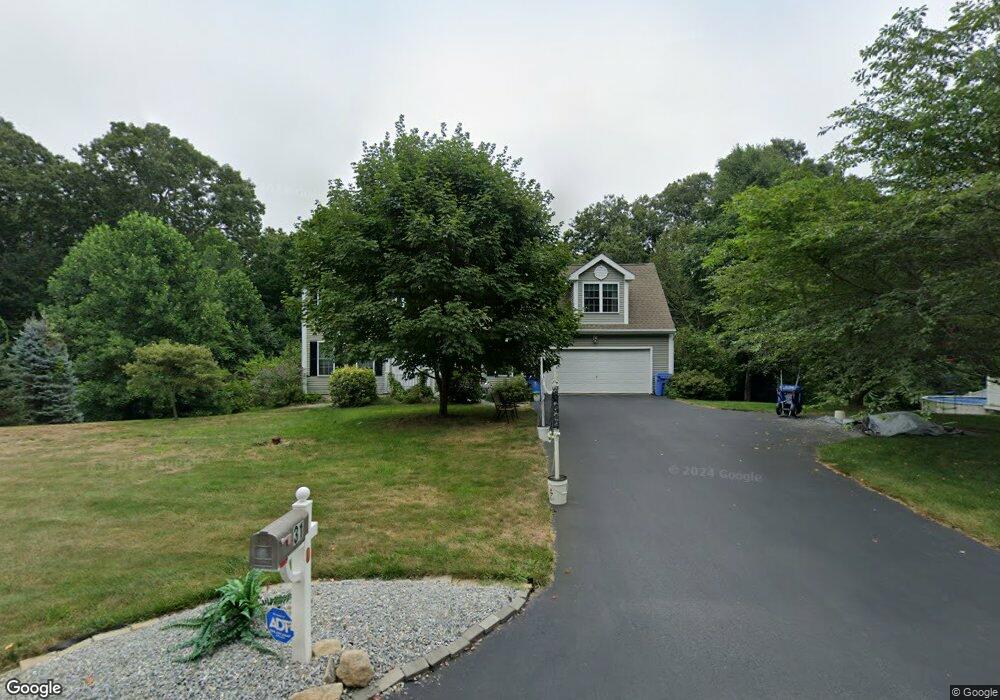
31 Brookside Dr Norwich, CT 06360
Yantic NeighborhoodEstimated Value: $466,000 - $548,000
4
Beds
3
Baths
2,210
Sq Ft
$227/Sq Ft
Est. Value
About This Home
This home is located at 31 Brookside Dr, Norwich, CT 06360 and is currently estimated at $501,506, approximately $226 per square foot. 31 Brookside Dr is a home located in New London County with nearby schools including Kelly STEAM Magnet Middle School, Stoneview Children's University, and St. Patrick Cathedral School.
Ownership History
Date
Name
Owned For
Owner Type
Purchase Details
Closed on
Jan 4, 2007
Sold by
Belmont Homes Ests Llc
Bought by
Loomis Kyle and Loomis Katherine
Current Estimated Value
Create a Home Valuation Report for This Property
The Home Valuation Report is an in-depth analysis detailing your home's value as well as a comparison with similar homes in the area
Home Values in the Area
Average Home Value in this Area
Purchase History
| Date | Buyer | Sale Price | Title Company |
|---|---|---|---|
| Loomis Kyle | $357,500 | -- | |
| Loomis Kyle | $357,500 | -- |
Source: Public Records
Mortgage History
| Date | Status | Borrower | Loan Amount |
|---|---|---|---|
| Open | Loomis Kyle | $24,950 | |
| Open | Loomis Kyle | $232,000 | |
| Closed | Loomis Kyle | $275,500 |
Source: Public Records
Tax History Compared to Growth
Tax History
| Year | Tax Paid | Tax Assessment Tax Assessment Total Assessment is a certain percentage of the fair market value that is determined by local assessors to be the total taxable value of land and additions on the property. | Land | Improvement |
|---|---|---|---|---|
| 2025 | $10,053 | $288,800 | $56,400 | $232,400 |
| 2024 | $9,603 | $288,800 | $56,400 | $232,400 |
| 2023 | $7,880 | $188,300 | $49,100 | $139,200 |
| 2022 | $7,942 | $188,300 | $49,100 | $139,200 |
| 2021 | $7,975 | $188,300 | $49,100 | $139,200 |
| 2020 | $7,980 | $188,300 | $49,100 | $139,200 |
| 2019 | $7,653 | $188,300 | $49,100 | $139,200 |
| 2018 | $7,641 | $184,300 | $56,100 | $128,200 |
| 2017 | $7,495 | $184,300 | $56,100 | $128,200 |
| 2016 | $7,683 | $184,300 | $56,100 | $128,200 |
| 2015 | $7,363 | $177,900 | $56,100 | $121,800 |
| 2014 | $6,945 | $177,900 | $56,100 | $121,800 |
Source: Public Records
Map
Nearby Homes
- 230 Vergason Ave
- 47 Huntington Ave
- 60 Connecticut Ave
- 8 Vergason Ave
- 00 Plain Hill Rd
- 0 Myrtle Dr
- 6 Lee Ave
- 114 Yantic Rd
- 81 W Town St
- 64 Woodrow Ave
- 18 Huntington Ln
- 153 Otrobando Ave
- 134 Otrobando Ave
- 36 Scotland Rd
- 63 Route 32
- 26 Canterbury Turnpike
- 28 Otrobando Ave
- 14 Otrobando Ave
- 89 Canterbury Turnpike
- 13 Town St
- 36 Brookside Dr
- 38 Brookside Dr
- 37 Brookside Dr
- 27 Brookside Dr
- 12 Brookside Dr
- 21 Brookside Dr
- 10 Brookside Dr
- 0 Brookside Dr
- 0 Brookside Dr
- 11 Brookside Dr
- 19 Brookside Dr
- 97 Vergason Ave
- 9 Brookside Dr
- 140 Vergason Ave
- 130 Vergason Ave
- 135 Vergason Ave
- 122 Vergason Ave
- 214 Vergason Ave
- 15 Brookside Dr
- 00 Vergason Ave