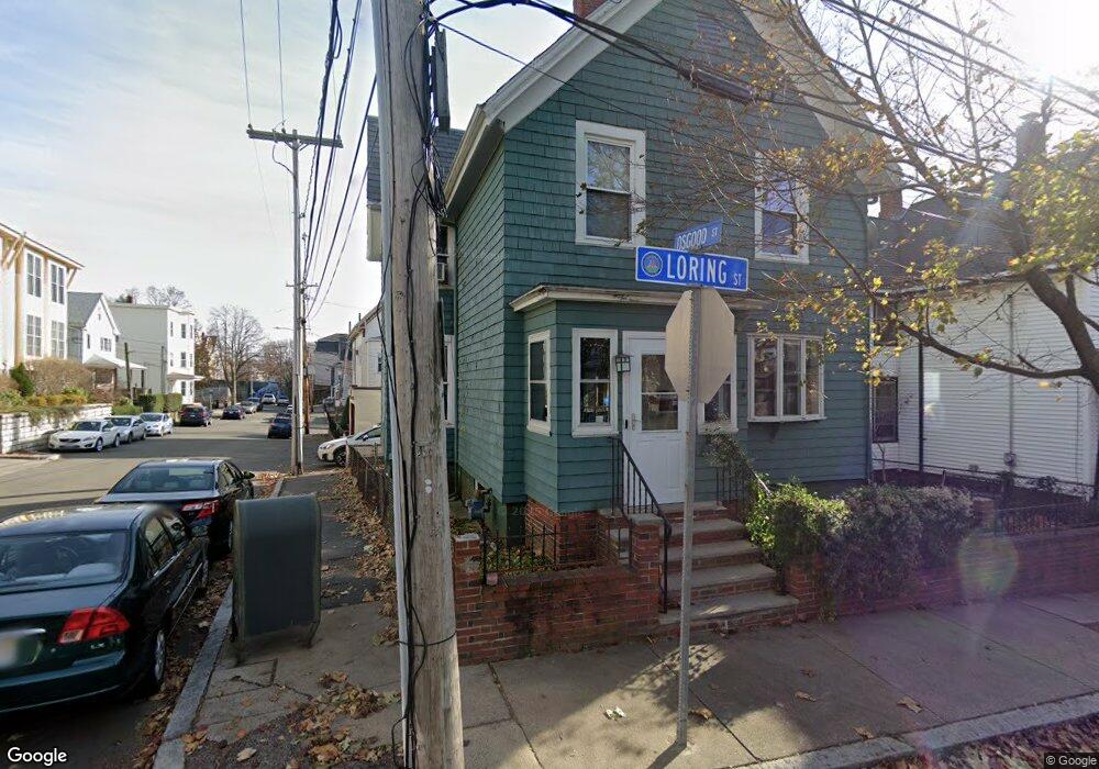
31 Loring St Somerville, MA 02143
Spring Hill NeighborhoodEstimated Value: $1,033,000 - $1,929,000
4
Beds
2
Baths
1,968
Sq Ft
$791/Sq Ft
Est. Value
About This Home
This home is located at 31 Loring St, Somerville, MA 02143 and is currently estimated at $1,556,713, approximately $791 per square foot. 31 Loring St is a home located in Middlesex County with nearby schools including Somerville High School and Saint Theresa School.
Ownership History
Date
Name
Owned For
Owner Type
Purchase Details
Closed on
May 24, 1999
Sold by
Munro Colin C and Munro Margaret A
Bought by
Ricker Randy
Current Estimated Value
Home Financials for this Owner
Home Financials are based on the most recent Mortgage that was taken out on this home.
Original Mortgage
$239,875
Outstanding Balance
$61,158
Interest Rate
6.88%
Mortgage Type
Purchase Money Mortgage
Estimated Equity
$1,495,555
Purchase Details
Closed on
Dec 3, 1997
Sold by
Jones Neal D and Jones Jeanne C
Bought by
Munro Colin C and Munro Margaret A
Home Financials for this Owner
Home Financials are based on the most recent Mortgage that was taken out on this home.
Original Mortgage
$144,000
Interest Rate
7.28%
Mortgage Type
Purchase Money Mortgage
Purchase Details
Closed on
Feb 26, 1993
Sold by
Pickett Robert L and Pickett Elizabeth
Bought by
Jones Jeanne C
Home Financials for this Owner
Home Financials are based on the most recent Mortgage that was taken out on this home.
Original Mortgage
$116,100
Interest Rate
8.03%
Mortgage Type
Purchase Money Mortgage
Create a Home Valuation Report for This Property
The Home Valuation Report is an in-depth analysis detailing your home's value as well as a comparison with similar homes in the area
Home Values in the Area
Average Home Value in this Area
Purchase History
| Date | Buyer | Sale Price | Title Company |
|---|---|---|---|
| Ricker Randy | $252,500 | -- | |
| Munro Colin C | $160,000 | -- | |
| Jones Jeanne C | $129,000 | -- |
Source: Public Records
Mortgage History
| Date | Status | Borrower | Loan Amount |
|---|---|---|---|
| Open | Jones Jeanne C | $239,875 | |
| Previous Owner | Jones Jeanne C | $144,000 | |
| Previous Owner | Jones Jeanne C | $116,100 | |
| Previous Owner | Jones Jeanne C | $100,000 |
Source: Public Records
Tax History Compared to Growth
Tax History
| Year | Tax Paid | Tax Assessment Tax Assessment Total Assessment is a certain percentage of the fair market value that is determined by local assessors to be the total taxable value of land and additions on the property. | Land | Improvement |
|---|---|---|---|---|
| 2025 | $12,600 | $1,154,900 | $536,300 | $618,600 |
| 2024 | $11,785 | $1,120,200 | $536,300 | $583,900 |
| 2023 | $11,034 | $1,067,100 | $536,300 | $530,800 |
| 2022 | $10,230 | $1,004,900 | $510,700 | $494,200 |
| 2021 | $9,600 | $942,100 | $486,400 | $455,700 |
| 2020 | $9,003 | $892,300 | $467,700 | $424,600 |
| 2019 | $8,866 | $824,000 | $406,700 | $417,300 |
| 2018 | $8,098 | $716,000 | $369,700 | $346,300 |
| 2017 | $7,612 | $652,300 | $348,800 | $303,500 |
| 2016 | $6,592 | $526,100 | $255,200 | $270,900 |
| 2015 | $6,508 | $516,100 | $253,800 | $262,300 |
Source: Public Records
Map
Nearby Homes
- 22 Knapp St
- 60 Avon St
- 25 Avon St
- 17 Monmouth St
- 75 School St
- 25 Atherton St Unit 11
- 555 Somerville Ave Unit 3
- 379 Somerville Ave
- 124 Highland Ave Unit 204
- 124 Highland Ave Unit 404
- 144 Highland Ave Unit 1
- 43 Park St Unit 18
- 18 Spring St Unit 18A
- 115 Highland Ave Unit 21
- 400 Possum Run
- 89 Central St
- 170 Highland Ave Unit 4
- 20 Lake St Unit 2
- 42 Belmont St
- 30 Walnut St
- 27 Loring St
- 30 Granite St
- 25 Loring St
- 25 Loring St Unit 3
- 23 Loring St
- 23 Loring St Unit 1
- 26 Granite St
- 25 Osgood St Unit 9
- 25 Osgood St Unit 8
- 25 Osgood St Unit 14
- 25 Osgood St Unit 13
- 25 Osgood St Unit 12
- 25 Osgood St Unit 11
- 25 Osgood St Unit 10
- 25 Osgood St Unit 3
- 32 Loring St
- 29 Osgood St
- 27 Osgood St Unit 7
- 27 Osgood St Unit 5
- 27 Osgood St Unit 4