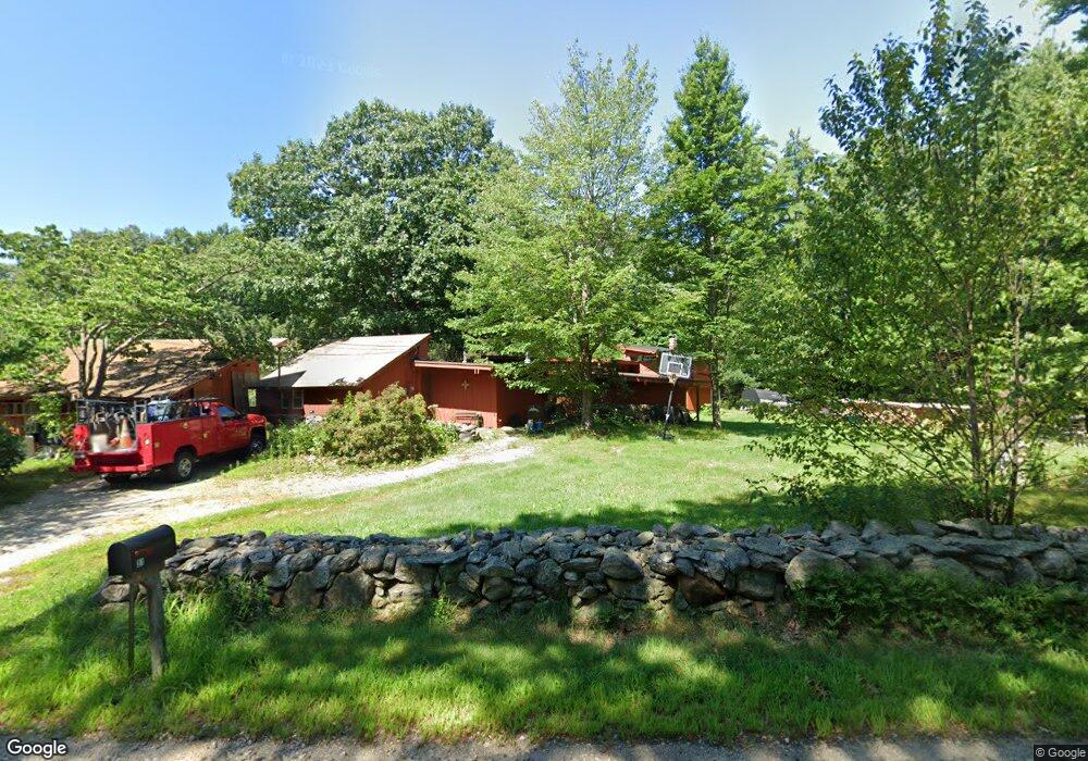
31 Snow Rd Goffstown, NH 03045
Estimated Value: $429,011 - $592,000
3
Beds
2
Baths
2,061
Sq Ft
$251/Sq Ft
Est. Value
About This Home
This home is located at 31 Snow Rd, Goffstown, NH 03045 and is currently estimated at $517,253, approximately $250 per square foot. 31 Snow Rd is a home with nearby schools including Mountain View Middle School and Goffstown High School.
Ownership History
Date
Name
Owned For
Owner Type
Purchase Details
Closed on
Oct 29, 1999
Sold by
Prieo Thomas D
Bought by
Beliveau David A and Beliveau Judy A
Current Estimated Value
Home Financials for this Owner
Home Financials are based on the most recent Mortgage that was taken out on this home.
Original Mortgage
$100,102
Outstanding Balance
$30,630
Interest Rate
7.78%
Estimated Equity
$486,623
Purchase Details
Closed on
Jun 8, 1999
Sold by
Prieto Joseph J
Bought by
Prieto Thomas D
Purchase Details
Closed on
Aug 2, 1996
Sold by
Prieto Thomas D
Bought by
Prieto Joseph J
Create a Home Valuation Report for This Property
The Home Valuation Report is an in-depth analysis detailing your home's value as well as a comparison with similar homes in the area
Home Values in the Area
Average Home Value in this Area
Purchase History
| Date | Buyer | Sale Price | Title Company |
|---|---|---|---|
| Beliveau David A | $112,900 | -- | |
| Prieto Thomas D | $10,000 | -- | |
| Prieto Joseph J | $18,800 | -- |
Source: Public Records
Mortgage History
| Date | Status | Borrower | Loan Amount |
|---|---|---|---|
| Open | Prieto Joseph J | $100,102 |
Source: Public Records
Tax History Compared to Growth
Tax History
| Year | Tax Paid | Tax Assessment Tax Assessment Total Assessment is a certain percentage of the fair market value that is determined by local assessors to be the total taxable value of land and additions on the property. | Land | Improvement |
|---|---|---|---|---|
| 2024 | $6,762 | $330,800 | $178,200 | $152,600 |
| 2023 | $6,239 | $330,800 | $178,200 | $152,600 |
| 2022 | $5,738 | $218,100 | $116,100 | $102,000 |
| 2021 | $5,413 | $218,100 | $116,100 | $102,000 |
| 2020 | $5,413 | $218,100 | $116,100 | $102,000 |
| 2019 | $5,361 | $218,100 | $116,100 | $102,000 |
| 2018 | $4,057 | $218,100 | $116,100 | $102,000 |
| 2017 | $5,226 | $190,600 | $96,100 | $94,500 |
| 2016 | $5,038 | $190,600 | $96,100 | $94,500 |
| 2015 | $4,990 | $177,200 | $82,100 | $95,100 |
| 2014 | $4,784 | $177,200 | $82,100 | $95,100 |
Source: Public Records
Map
Nearby Homes
- 602 Black Brook Rd
- 45 Range Rd
- 0 Fairway Dr Unit 11
- 22 Fairway Dr
- 10 Serenitas Ln
- 22 Peppermint St
- 22 Winter Hill Rd
- 78 Rangeway Rd
- 227 Twist Hill Rd
- 500 E Dunbarton Rd
- 2 Larch St Unit 1
- 12 Maplewood Ave
- 137 Elm St
- 88 Saunders Rd
- 99 Elm St
- 328 E Dunbarton Rd
- 501 E Dunbarton Rd
- 3 Stephanie Rd
- 152 S Mast St
- 163 Woodview Way Unit 2
- 28 Snow Rd
- 36 Snow Rd
- 43 Snow Rd
- 641 Black Brook Rd
- 17 Snow Rd
- 18 Snow Rd
- 7 Snow Rd
- 673 Black Brook Rd
- 490 Tibbetts Hill Rd
- 637 Black Brook Rd
- 488 Tibbetts Hill Rd
- 650 Black Brook Rd
- 12 Snow Rd
- 674 Black Brook Rd
- 625 Black Brook Rd
- 57 Snow Rd
- 679 Black Brook Rd
- 676 Black Brook Rd
- 465 Tibbetts Hill Rd
- 469 Tibbetts Hill Rd