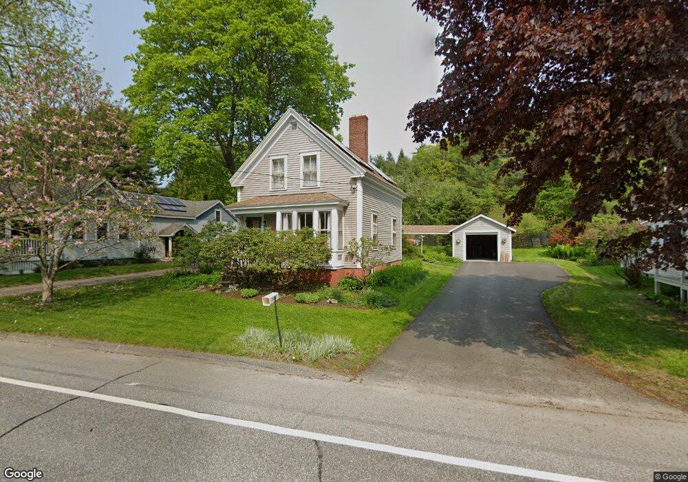
31 South St Freeport, ME 04032
Estimated Value: $561,292 - $633,000
3
Beds
2
Baths
1,760
Sq Ft
$339/Sq Ft
Est. Value
About This Home
This home is located at 31 South St, Freeport, ME 04032 and is currently estimated at $596,323, approximately $338 per square foot. 31 South St is a home located in Cumberland County with nearby schools including Morse Street School, Mast Landing School, and Freeport Middle School.
Create a Home Valuation Report for This Property
The Home Valuation Report is an in-depth analysis detailing your home's value as well as a comparison with similar homes in the area
Home Values in the Area
Average Home Value in this Area
Tax History Compared to Growth
Tax History
| Year | Tax Paid | Tax Assessment Tax Assessment Total Assessment is a certain percentage of the fair market value that is determined by local assessors to be the total taxable value of land and additions on the property. | Land | Improvement |
|---|---|---|---|---|
| 2024 | $4,930 | $369,300 | $167,500 | $201,800 |
| 2023 | $4,514 | $328,300 | $152,200 | $176,100 |
| 2022 | $4,259 | $312,000 | $135,900 | $176,100 |
| 2021 | $3,725 | $312,000 | $135,900 | $176,100 |
| 2020 | $3,585 | $281,100 | $125,900 | $155,200 |
| 2019 | $3,765 | $263,300 | $118,700 | $144,600 |
| 2018 | $3,601 | $239,300 | $105,400 | $133,900 |
| 2017 | $3,456 | $231,200 | $103,300 | $127,900 |
| 2016 | $2,210 | $211,700 | $93,300 | $118,400 |
| 2015 | $3,185 | $189,600 | $85,100 | $104,500 |
| 2014 | $2,996 | $189,600 | $85,100 | $104,500 |
| 2013 | $3,156 | $199,100 | $85,200 | $113,900 |
Source: Public Records
Map
Nearby Homes
- 1612 U S Route 1
- 212 Main St
- 15 Percy St
- 11 Orchard Hill Rd
- 10 Durham Rd
- 42 Durham Rd
- 26 Harvest Ridge Rd Unit 24
- 1260 Us Route 1
- 15 Tinkers Way
- 304 Pownal Rd
- 8 Statler Ln
- 0 Prout Rd
- 143 Bragdon Rd
- 34 Newfield Rd
- 4 Harper's Trail
- 31 Allen Range Rd
- 137 Durham Rd
- 31 Sequoia Dr
- 15 Sequoia Dr
- 71 Merganser Way