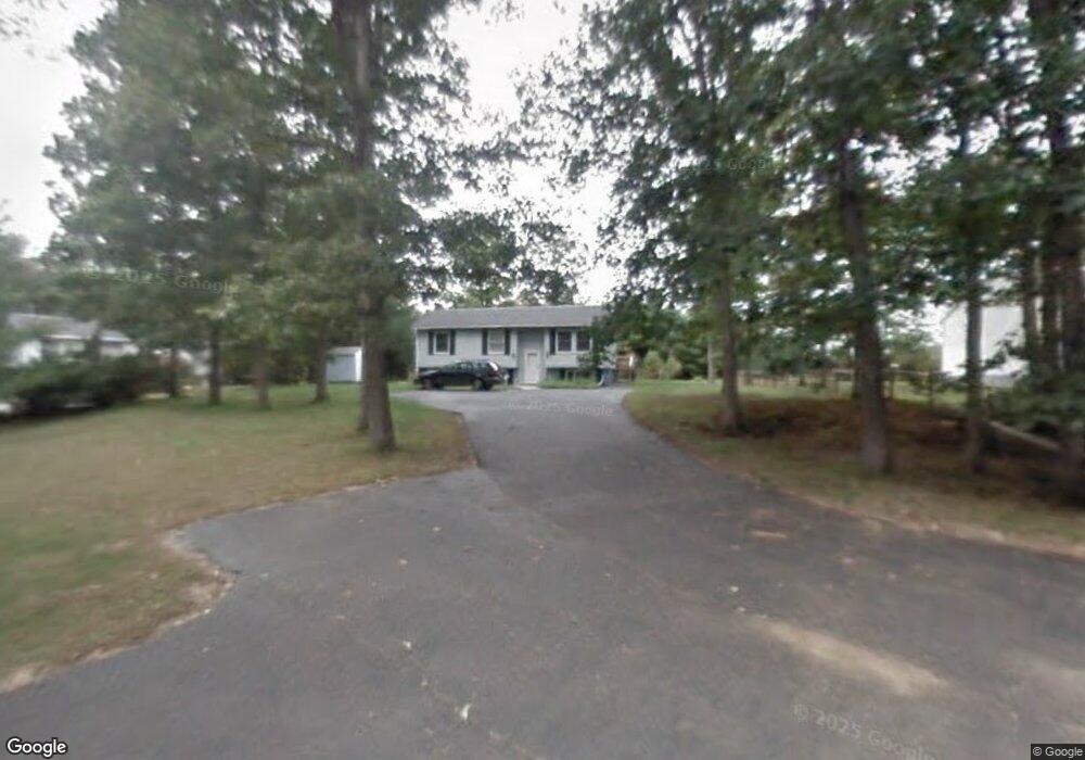
31 Toofs Dr Winchester, NH 03470
Estimated Value: $252,000 - $311,000
3
Beds
1
Bath
1,380
Sq Ft
$206/Sq Ft
Est. Value
About This Home
This home is located at 31 Toofs Dr, Winchester, NH 03470 and is currently estimated at $283,968, approximately $205 per square foot. 31 Toofs Dr is a home located in Cheshire County with nearby schools including Winchester School, Mayland Early College High School, and Keene High School.
Ownership History
Date
Name
Owned For
Owner Type
Purchase Details
Closed on
Jan 8, 2009
Sold by
Wilson Virginia E and Payne Richard D
Bought by
Russell William P
Current Estimated Value
Home Financials for this Owner
Home Financials are based on the most recent Mortgage that was taken out on this home.
Original Mortgage
$151,590
Interest Rate
5.99%
Purchase Details
Closed on
Sep 1, 2004
Sold by
Carpentry Andrew Barry
Bought by
Wilson Virginia E
Home Financials for this Owner
Home Financials are based on the most recent Mortgage that was taken out on this home.
Original Mortgage
$104,400
Interest Rate
6.01%
Mortgage Type
Purchase Money Mortgage
Purchase Details
Closed on
Aug 19, 2003
Sold by
Rhoades Donald R
Bought by
Nh Hsng Finance Author
Purchase Details
Closed on
Dec 2, 1999
Sold by
Black Marjorie
Bought by
Rhoades Donald R and Rhoades Rebecca A
Home Financials for this Owner
Home Financials are based on the most recent Mortgage that was taken out on this home.
Original Mortgage
$77,000
Interest Rate
7.86%
Create a Home Valuation Report for This Property
The Home Valuation Report is an in-depth analysis detailing your home's value as well as a comparison with similar homes in the area
Home Values in the Area
Average Home Value in this Area
Purchase History
| Date | Buyer | Sale Price | Title Company |
|---|---|---|---|
| Russell William P | $148,400 | -- | |
| Wilson Virginia E | $133,500 | -- | |
| Nh Hsng Finance Author | $85,600 | -- | |
| Rhoades Donald R | $77,000 | -- |
Source: Public Records
Mortgage History
| Date | Status | Borrower | Loan Amount |
|---|---|---|---|
| Open | Rhoades Donald R | $147,313 | |
| Closed | Rhoades Donald R | $151,590 | |
| Previous Owner | Rhoades Donald R | $104,400 | |
| Previous Owner | Rhoades Donald R | $77,000 |
Source: Public Records
Tax History Compared to Growth
Tax History
| Year | Tax Paid | Tax Assessment Tax Assessment Total Assessment is a certain percentage of the fair market value that is determined by local assessors to be the total taxable value of land and additions on the property. | Land | Improvement |
|---|---|---|---|---|
| 2024 | $4,569 | $156,200 | $41,300 | $114,900 |
| 2023 | $4,948 | $156,200 | $41,300 | $114,900 |
| 2022 | $4,483 | $156,200 | $41,300 | $114,900 |
| 2021 | $4,966 | $156,200 | $41,300 | $114,900 |
| 2020 | $4,494 | $156,200 | $41,300 | $114,900 |
| 2019 | $4,915 | $137,900 | $36,600 | $101,300 |
| 2018 | $4,789 | $137,900 | $36,600 | $101,300 |
| 2016 | $4,131 | $135,300 | $36,600 | $98,700 |
| 2015 | $4,137 | $135,300 | $36,600 | $98,700 |
| 2014 | $4,284 | $140,100 | $38,000 | $102,100 |
| 2013 | $4,305 | $140,100 | $38,000 | $102,100 |
Source: Public Records
Map
Nearby Homes
- 143 Richmond Rd
- Map 6 Lot 15-1 Off Opportunity Dr Unit 15-1
- Map 6 Lot 15-5 Off Opportunity Dr
- 111 Warwick Rd
- 50 Parker St
- 100 Main St
- 56 Ashuelot St
- 19 Back Ashuelot Rd
- 9 Scotland Rd
- 9 Scotland Rd
- 49 Scotland Rd
- 82 Howard St
- 12 Miner Ct
- 240 Forest Lake Rd
- 21 Clark Rd
- 153 Back Ashuelot Rd
- 7 Lake Shore Dr
- 73 Lake Shore Dr
- 27 Headlands Rd
- 45 Forest Lake Cir