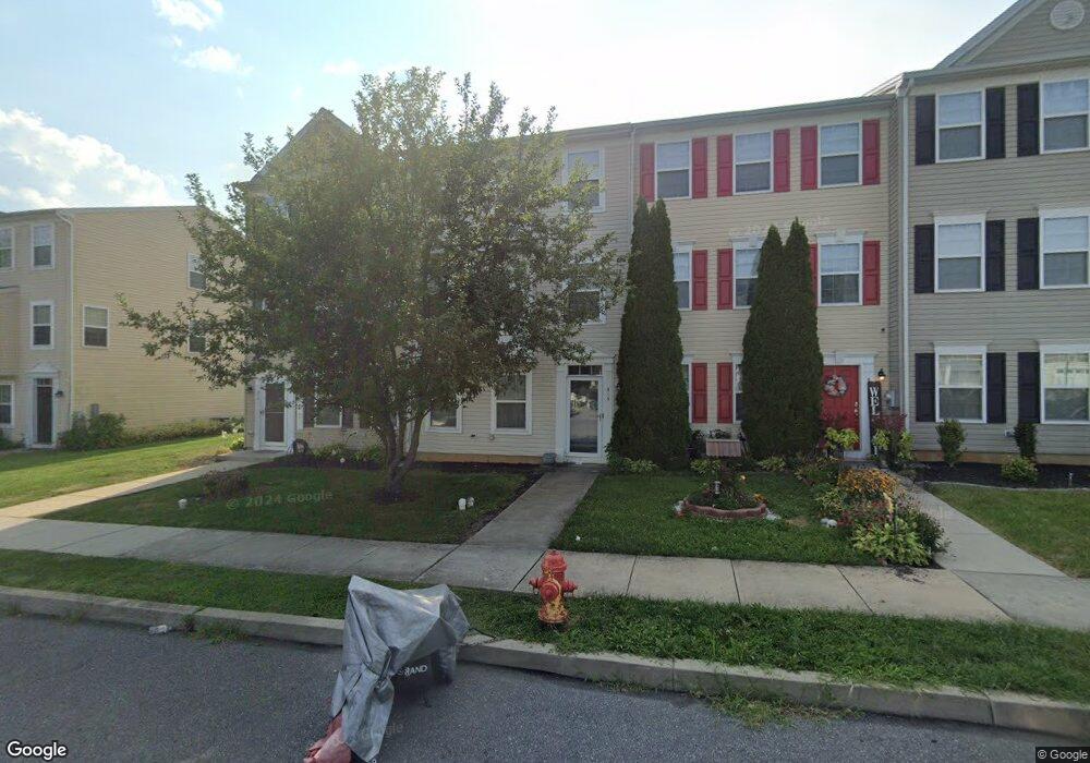
310 Pennshire Dr Lancaster, PA 17603
Meadia Heights NeighborhoodEstimated Value: $293,000 - $331,000
3
Beds
3
Baths
2,100
Sq Ft
$145/Sq Ft
Est. Value
About This Home
This home is located at 310 Pennshire Dr, Lancaster, PA 17603 and is currently estimated at $304,668, approximately $145 per square foot. 310 Pennshire Dr is a home located in Lancaster County with nearby schools including Elizabeth R Martin Elementary School, Wheatland Middle School, and McCaskey High School.
Ownership History
Date
Name
Owned For
Owner Type
Purchase Details
Closed on
Mar 29, 2010
Sold by
Us Home Corporation
Bought by
Grant Rolanda L and Grant Ronalda L
Current Estimated Value
Home Financials for this Owner
Home Financials are based on the most recent Mortgage that was taken out on this home.
Original Mortgage
$124,033
Interest Rate
5.12%
Mortgage Type
FHA
Purchase Details
Closed on
Aug 26, 2009
Sold by
Doa Properties Ix Lots Other Llc
Bought by
Us Homes Corporation
Create a Home Valuation Report for This Property
The Home Valuation Report is an in-depth analysis detailing your home's value as well as a comparison with similar homes in the area
Home Values in the Area
Average Home Value in this Area
Purchase History
| Date | Buyer | Sale Price | Title Company |
|---|---|---|---|
| Grant Rolanda L | $126,490 | North American Title Company | |
| Us Homes Corporation | $660,000 | None Available |
Source: Public Records
Mortgage History
| Date | Status | Borrower | Loan Amount |
|---|---|---|---|
| Previous Owner | Grant Rolanda L | $124,033 |
Source: Public Records
Tax History Compared to Growth
Tax History
| Year | Tax Paid | Tax Assessment Tax Assessment Total Assessment is a certain percentage of the fair market value that is determined by local assessors to be the total taxable value of land and additions on the property. | Land | Improvement |
|---|---|---|---|---|
| 2025 | $4,092 | $141,900 | $23,800 | $118,100 |
| 2024 | $4,092 | $141,900 | $23,800 | $118,100 |
| 2023 | $3,998 | $141,900 | $23,800 | $118,100 |
| 2022 | $3,760 | $141,900 | $23,800 | $118,100 |
| 2021 | $3,646 | $141,900 | $23,800 | $118,100 |
| 2020 | $3,646 | $141,900 | $23,800 | $118,100 |
| 2019 | $3,569 | $141,900 | $23,800 | $118,100 |
| 2018 | $3,026 | $141,900 | $23,800 | $118,100 |
| 2017 | $3,390 | $103,700 | $14,800 | $88,900 |
| 2016 | $3,328 | $103,700 | $14,800 | $88,900 |
| 2015 | $450 | $103,700 | $14,800 | $88,900 |
| 2014 | $2,767 | $103,700 | $14,800 | $88,900 |
Source: Public Records
Map
Nearby Homes
- 204 Pennshire Dr
- 202 Pennshire Dr
- 986 Sterling Place
- 884 Sterling Place
- 11 Clarendon Dr
- 825 S Pearl St
- 1014 Willow Street Pike
- 1014 Willow Street Pike Unit 8
- 112 Hayes & Conestoga Aves
- 122 Hayes Ave
- 1635 Wabank Rd
- 840 Hilton Dr
- 121 Hillard
- 118 Hillard
- 110 Hillard
- 848 Garnet Ave
- 56 Greenwood Ave
- 927 Rolridge Ave
- 828 Highland Ave
- 1052 Union St
- 308 Pennshire Dr
- 312 Pennshire Dr
- 306 Pennshire Dr
- 314 Pennshire Dr
- 304 Pennshire Dr
- 302 Pennshire Dr
- 316 Pennshire Dr
- 318 Pennshire Dr
- 300 Pennshire Dr
- 300 Pennshire Dr Unit 1094
- 320 Pennshire Dr Unit 1084
- 272 Eliot St
- 268 Eliot St
- 274 Eliot St
- 274 Eliot St Unit 1107
- 276 Eliot St
- 278 Eliot St
- 322 Pennshire Dr
- 280 Eliot St