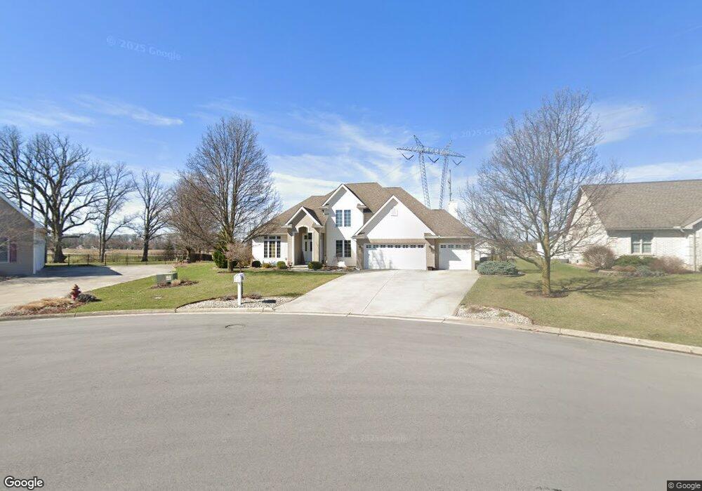
3100 Jacob Dr Findlay, OH 45840
Estimated Value: $392,000 - $477,000
4
Beds
3
Baths
2,111
Sq Ft
$213/Sq Ft
Est. Value
About This Home
This home is located at 3100 Jacob Dr, Findlay, OH 45840 and is currently estimated at $448,745, approximately $212 per square foot. 3100 Jacob Dr is a home located in Hancock County with nearby schools including Liberty-Benton Elementary School, Liberty-Benton Middle School, and Liberty-Benton High School.
Ownership History
Date
Name
Owned For
Owner Type
Purchase Details
Closed on
Feb 28, 2002
Sold by
Siferd Richard L
Bought by
Cramer James R and Cramer Holly A
Current Estimated Value
Home Financials for this Owner
Home Financials are based on the most recent Mortgage that was taken out on this home.
Original Mortgage
$199,400
Outstanding Balance
$82,474
Interest Rate
6.92%
Mortgage Type
New Conventional
Estimated Equity
$366,271
Create a Home Valuation Report for This Property
The Home Valuation Report is an in-depth analysis detailing your home's value as well as a comparison with similar homes in the area
Home Values in the Area
Average Home Value in this Area
Purchase History
| Date | Buyer | Sale Price | Title Company |
|---|---|---|---|
| Cramer James R | $209,900 | -- |
Source: Public Records
Mortgage History
| Date | Status | Borrower | Loan Amount |
|---|---|---|---|
| Open | Cramer James R | $199,400 |
Source: Public Records
Tax History Compared to Growth
Tax History
| Year | Tax Paid | Tax Assessment Tax Assessment Total Assessment is a certain percentage of the fair market value that is determined by local assessors to be the total taxable value of land and additions on the property. | Land | Improvement |
|---|---|---|---|---|
| 2024 | $5,062 | $136,180 | $24,780 | $111,400 |
| 2023 | $4,943 | $136,180 | $24,780 | $111,400 |
| 2022 | $4,894 | $136,180 | $24,780 | $111,400 |
| 2021 | $4,687 | $115,130 | $23,150 | $91,980 |
| 2020 | $4,727 | $115,130 | $23,150 | $91,980 |
| 2019 | $4,536 | $115,130 | $23,150 | $91,980 |
| 2018 | $3,573 | $100,120 | $20,130 | $79,990 |
| 2017 | $3,686 | $100,120 | $20,130 | $79,990 |
| 2016 | $3,572 | $100,120 | $20,130 | $79,990 |
| 2015 | $3,627 | $99,050 | $20,650 | $78,400 |
| 2014 | $3,664 | $99,160 | $20,650 | $78,510 |
| 2012 | $3,779 | $97,920 | $20,650 | $77,270 |
Source: Public Records
Map
Nearby Homes
- 0 County Road 95 Unit 6097574
- 6535 Silver Lake Dr
- 1405 Cypress Lake
- 0 Rock Candy Rd Unit Lot 159
- 0 Rock Candy Rd Unit Lot 170
- 0 Rock Candy Rd Unit Lot 172 206819
- 0 Rock Candy Rd Unit Lot 162
- 0 Rock Candy Rd Unit Lot 171
- 0 Rock Candy Rd Unit Lot 168
- 0 Rock Candy Rd Or Bushwillow Dr Unit Lot 173
- 3106 Saddlebrook
- 0 Bushwillow Dr Or Rock Candy Rd Unit Lot 157
- 0 Bearcat Way Or Rock Candy Rd Unit Lot 167
- 3018 Gleneagle Dr
- 0 County Road 140
- 1310 Muirfield Dr
- 933 Laurel Ln
- 9960 W Us Route 224
- 0 Allen Township 142
- 925 W Melrose Ave
- 2043 Lakeland Dr
- 2029 Lakeland Dr
- 2001 Lakeland Dr
- 3115 Jacob Dr
- 2000 Lakeland Dr
- 3200 Jacob Dr
- Lot 1 Glenmar Pkwy
- 0 Glenmar Pkwy
- 3108 Jurnee Dr
- 3116 Jurnee Dr
- 1935 Lakeland Dr
- 1936 Lakeland Dr
- 9909 Glenmar Pkwy
- 3200 Jurnee Dr
- 3107 Jurnee Dr
- 9991 Smokies Way
- 1923 Lakeland Dr
- 1924 Lakeland Dr
- 6321 County Road 140
- 6093 County Road 140