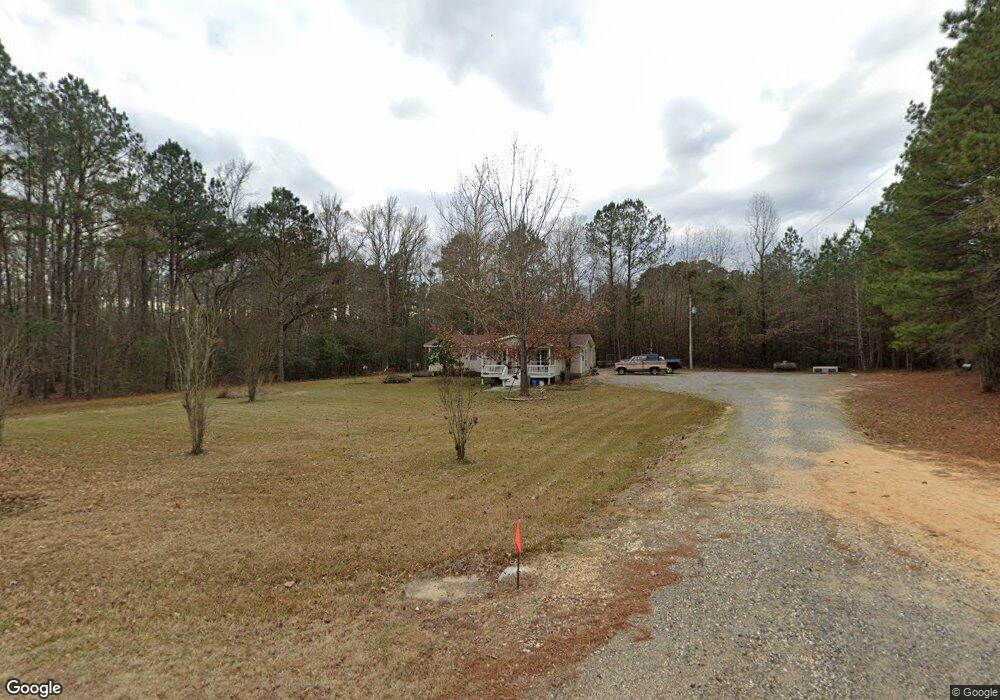
3117 Highway 35 N Sheridan, AR 72150
Estimated Value: $211,000 - $286,000
--
Bed
2
Baths
1,776
Sq Ft
$138/Sq Ft
Est. Value
About This Home
This home is located at 3117 Highway 35 N, Sheridan, AR 72150 and is currently estimated at $244,810, approximately $137 per square foot. 3117 Highway 35 N is a home located in Grant County with nearby schools including Sheridan High School.
Ownership History
Date
Name
Owned For
Owner Type
Purchase Details
Closed on
Oct 11, 2016
Bought by
Cassity William A
Current Estimated Value
Home Financials for this Owner
Home Financials are based on the most recent Mortgage that was taken out on this home.
Original Mortgage
$106,400
Outstanding Balance
$84,961
Interest Rate
3.42%
Estimated Equity
$159,849
Purchase Details
Closed on
Sep 22, 2014
Bought by
Poston Ellen and Poston Robert
Purchase Details
Closed on
May 31, 2005
Sold by
May Nelson Richard Franklin and May Nelson Frances
Bought by
Poston Ellen
Home Financials for this Owner
Home Financials are based on the most recent Mortgage that was taken out on this home.
Original Mortgage
$61,200
Interest Rate
5.78%
Mortgage Type
New Conventional
Purchase Details
Closed on
Jan 29, 2003
Bought by
Nelson
Create a Home Valuation Report for This Property
The Home Valuation Report is an in-depth analysis detailing your home's value as well as a comparison with similar homes in the area
Home Values in the Area
Average Home Value in this Area
Purchase History
| Date | Buyer | Sale Price | Title Company |
|---|---|---|---|
| Cassity William A | -- | -- | |
| Poston Ellen | -- | -- | |
| Poston Ellen | -- | Professional Land Title Coma | |
| Nelson | $31,000 | -- |
Source: Public Records
Mortgage History
| Date | Status | Borrower | Loan Amount |
|---|---|---|---|
| Open | Nelson | $106,400 | |
| Closed | Nelson | -- | |
| Previous Owner | Poston Ellen | $61,200 |
Source: Public Records
Tax History Compared to Growth
Tax History
| Year | Tax Paid | Tax Assessment Tax Assessment Total Assessment is a certain percentage of the fair market value that is determined by local assessors to be the total taxable value of land and additions on the property. | Land | Improvement |
|---|---|---|---|---|
| 2025 | $1,008 | $29,710 | $3,030 | $26,680 |
| 2024 | $1,008 | $27,070 | $2,340 | $24,730 |
| 2023 | $583 | $27,070 | $2,340 | $24,730 |
| 2022 | $633 | $27,070 | $2,340 | $24,730 |
| 2021 | $633 | $27,070 | $2,340 | $24,730 |
| 2020 | $633 | $22,410 | $2,100 | $20,310 |
| 2019 | $633 | $22,410 | $2,100 | $20,310 |
| 2018 | $658 | $22,410 | $2,100 | $20,310 |
| 2017 | $658 | $22,410 | $2,100 | $20,310 |
| 2015 | -- | $12,400 | $2,100 | $10,300 |
| 2014 | -- | $12,400 | $2,100 | $10,300 |
| 2012 | -- | $11,480 | $2,100 | $9,380 |
Source: Public Records
Map
Nearby Homes
- 00 Hwy 35 N
- 2404 N Arch St
- 52 Pinecrest Cir
- Lot 1 & 2 Pinecrest Cir
- 000 Pinecrest Cir
- 64 Horton Hills Dr
- 1400 Skyline Dr
- 1310 Skyline Dr
- 60 Horton Hills Dr
- 7 Emerson Way
- 19 Stephanie Ln
- 1101 N Red St
- 12 Horton Ln
- Lot 3 & 4 Horton Ln
- 1005 N Red St
- 703 N Briarwood Dr
- 1001 N Red St
- 4 Mayce Ln
- 6 Smokey Ridge Ct
- 1207 N Arch St
- 0 Hwy 35 N Unit 16016254
- 3074 Highway 35 N
- 3136 Highway 35 N
- 2979 Highway 35 N
- 3237 Highway 35 N
- 83 Grant 3533
- 000 Grant 3533 Unit LotWP001
- 2825 Highway 35 N
- 3386 Highway 35 N
- 288 Grant 822
- 3569 Highway 35 N
- 0 Grant 3531
- 300 Grant 3531
- 3586 Highway 35 N
- 15 Grant 3531
- 266 Grant 3531
- Lot 15 Grant 84
- Lot 25 Grant 844
- 392 Grant 3531
- 377 Grant 3531