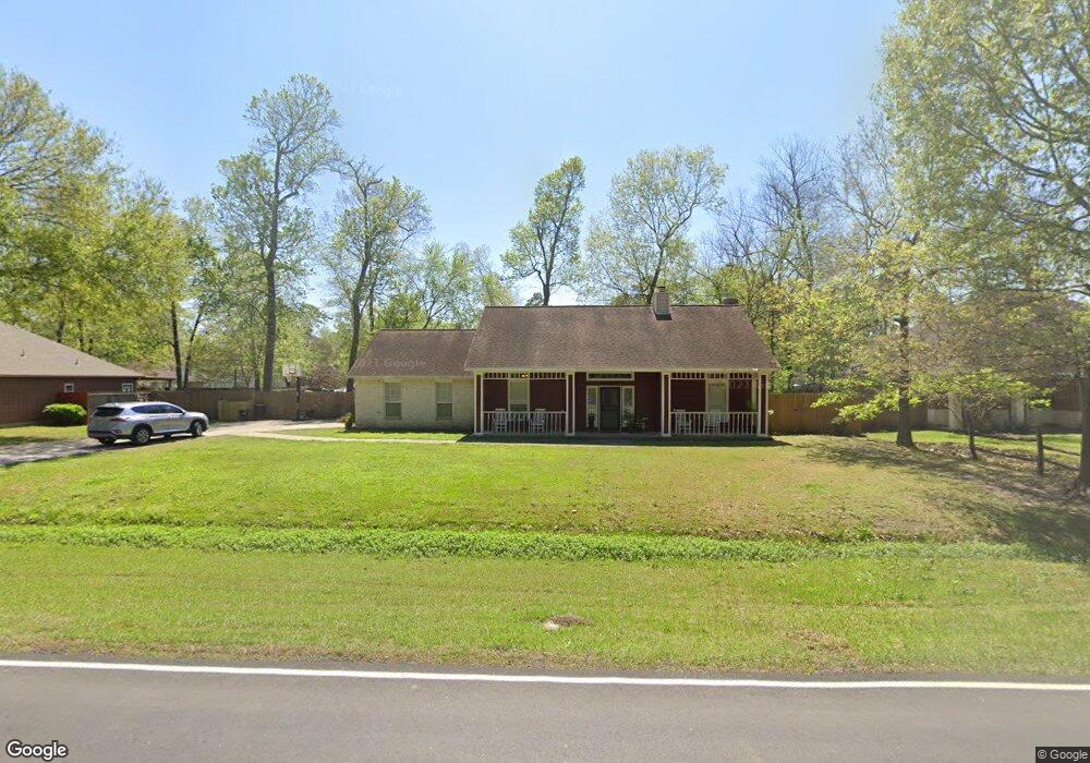
3119 Foley Rd Crosby, TX 77532
Estimated Value: $290,000 - $358,000
3
Beds
2
Baths
1,810
Sq Ft
$181/Sq Ft
Est. Value
About This Home
This home is located at 3119 Foley Rd, Crosby, TX 77532 and is currently estimated at $326,936, approximately $180 per square foot. 3119 Foley Rd is a home located in Harris County with nearby schools including Newport Elementary School, Crosby Middle School, and Crosby High School.
Ownership History
Date
Name
Owned For
Owner Type
Purchase Details
Closed on
Nov 1, 2002
Sold by
Garrett Charles E
Bought by
Newell David C and Newell Lydia
Current Estimated Value
Home Financials for this Owner
Home Financials are based on the most recent Mortgage that was taken out on this home.
Original Mortgage
$128,779
Interest Rate
5.95%
Mortgage Type
FHA
Create a Home Valuation Report for This Property
The Home Valuation Report is an in-depth analysis detailing your home's value as well as a comparison with similar homes in the area
Home Values in the Area
Average Home Value in this Area
Purchase History
| Date | Buyer | Sale Price | Title Company |
|---|---|---|---|
| Newell David C | -- | American Title Co | |
| Newell David C | -- | American Title Co |
Source: Public Records
Mortgage History
| Date | Status | Borrower | Loan Amount |
|---|---|---|---|
| Closed | Newell David C | $128,779 |
Source: Public Records
Tax History Compared to Growth
Tax History
| Year | Tax Paid | Tax Assessment Tax Assessment Total Assessment is a certain percentage of the fair market value that is determined by local assessors to be the total taxable value of land and additions on the property. | Land | Improvement |
|---|---|---|---|---|
| 2025 | $2,314 | $334,013 | $128,857 | $205,156 |
| 2024 | $2,314 | $334,013 | $111,084 | $222,929 |
| 2023 | $2,314 | $353,622 | $102,197 | $251,425 |
| 2022 | $7,271 | $307,824 | $75,537 | $232,287 |
| 2021 | $6,815 | $253,865 | $53,320 | $200,545 |
| 2020 | $7,097 | $249,966 | $53,320 | $196,646 |
| 2019 | $6,801 | $232,652 | $53,320 | $179,332 |
| 2018 | $2,338 | $222,064 | $40,879 | $181,185 |
| 2017 | $5,662 | $190,000 | $34,658 | $155,342 |
| 2016 | $5,364 | $180,000 | $34,658 | $145,342 |
| 2015 | $4,021 | $167,173 | $16,735 | $150,438 |
| 2014 | $4,021 | $152,686 | $16,735 | $135,951 |
Source: Public Records
Map
Nearby Homes
- 3011 Matador Ranch Trail
- 3027 Matador Ranch Trail
- 3015 Foley Rd
- 3007 Matador Ranch Trail
- 3303 Indian Mound Trail
- 3003 Matador Ranch Trail
- 18402 Steele Point Dr
- Julian Plan at Sundance Cove - Paintbrush Collection
- Salinas Plan at Sundance Cove - Paintbrush Collection
- Dawson Plan at Sundance Cove - Paintbrush Collection
- Templeton Plan at Sundance Cove - Paintbrush Collection
- Arpa Plan at Sundance Cove - Paintbrush Collection
- Harding Plan at Sundance Cove - Paintbrush Collection
- 18226 Steele Point Dr
- 2922 Indian Mound Trail
- 18334 Steele Point Dr
- 2731 Rapho St
- 18735 Etta Pines Cir
- 18222 Steele Point Dr
- 2655 Homestead Ranch Ln
- 3123 Foley Rd
- 3115 Foley Rd
- 3127 Foley Rd
- 3126 Deep Anchor Way
- 3118 Deep Anchor Way
- 3114 Deep Anchor Way
- 3110 Deep Anchor Way
- 3203 Foley Rd
- 3107 Foley Rd
- 3202 Deep Anchor Way
- 0 Foley Rd Unit 37991078
- 0 Foley Rd Unit 37991089
- 0 Foley Rd Unit 37991087
- 0 Foley Rd Unit 37991096
- 0 Foley Rd Unit 37991077
- 0 Foley Rd Unit 68090932
- 0 Foley Rd Unit 3239687
- 0 Foley Rd Unit 2644899
- 0 Foley Rd Unit 4031218
- 0 Foley Rd Unit 3835357